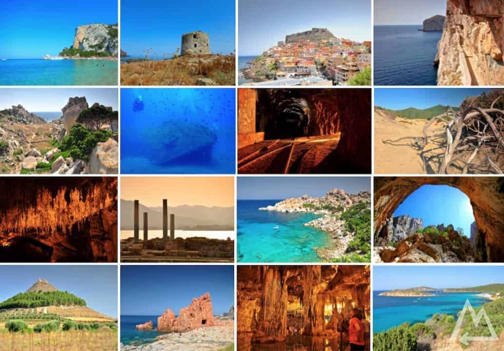
Your master plan for Sardinia
Visit all the awesome spots of Sardinia with this master plan. An old mine, the best turquoise blue lagoons, secret lagoons, sand dunes, awe-inspiring canyons, countless colorful villages, extraordinary caves and ship wrecks are waiting to be discovered. With this plan you won’t miss anything.
Trip overview:
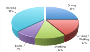
- 1 week
- 1700 km (by car)
- 10 km (by foot)
- 1.5 km (by diving)
- 2 caves to explore
- 1 old mine explored
- 1 world war II ship wreck to dive around
The east coast of Sardinia
We started at the port Golfo Aranci as we came by ferry from Genua. We headed south and passed the first pit stop called Cala Brandinchi (little Tahiti). It’s supposed to be one of the best beached in Sardinia but at the time we were there the weather wasn’t perfect so we continued on further. Next stop we checked out is the nature park Stagno di Bidderosa. It’s quite fun to drive around in the pine forest and check out the hidden lagoons and beaches. If you like snorkelling, you’ll see a lot of fishes there.
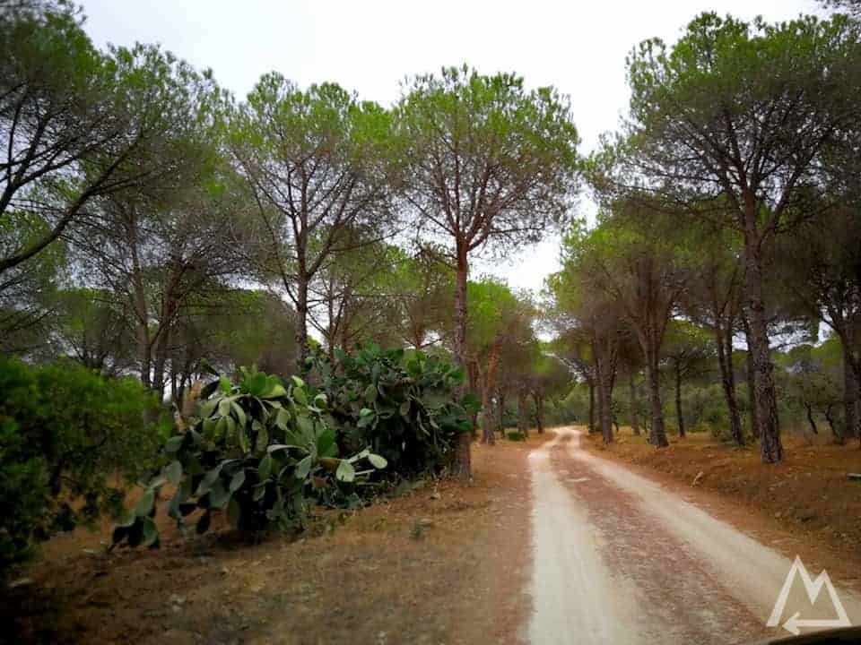
Stagno di Bidderosa – Sardinia
If you’re a diver your next stop is going to be the KT12 wreck near Orosei. We went with the very uncomplicated and superfriendly guys from the Orosei Diving Center.
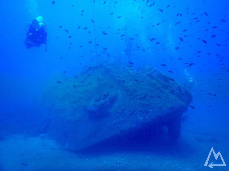
KT12 wreck near Orosei
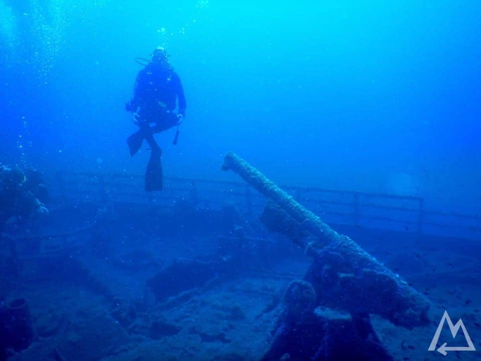
KT12 wreck near Orosei
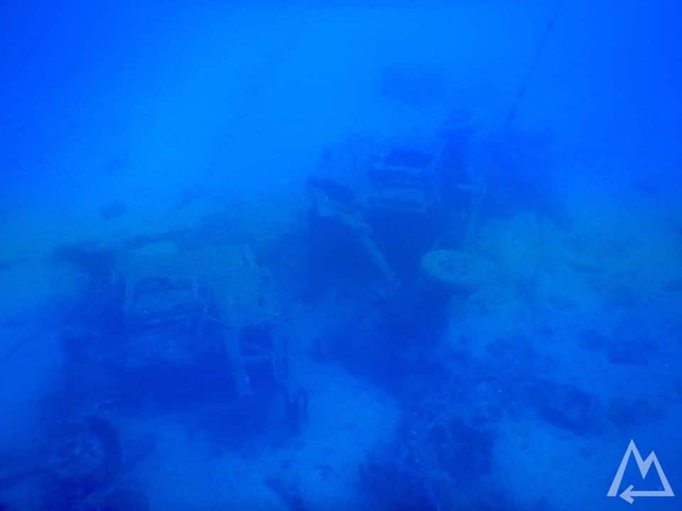
Old sunken cars near the KT12 wreck near Orosei
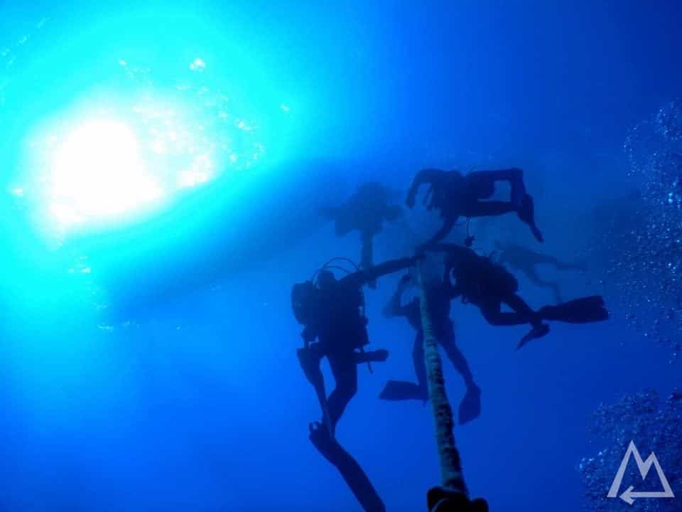
Hanging in the 30m deep sea at the safety stop returning from the KT12 wreck near Orosei
The next stop is Cala Gonone. There are several ferries starting from the harbour that go to the different hidden beaches and caves along the coast there. You can also reach them by hiking but we weren’t so eager to hike at 34°C and due to the fact that you can get there by ferry. So we went by ferry to the places Grotte del Bue Marino and Cala Luna in a half day tour.
Grotte del Bue Marino
Grotte del Bue Marino
Grotte del Bue Marino
Cala Luna
The next stop is called Gola di Gorropu. It’s one of the deepest canyons of Europe and you need to hike there. Plan more than half a day for it. There is a transport service from the visitor center to the bottom of the canyon so you can just follow the river bed up to the canyon and save about 2h of walking total. We decided to walk all the way down to the canyon which is 700m elevation and finally 700m up again, this takes around 6h. To be honest, it was quite a strenuous hike due to the hot temperatures during summer but the breathtaking views on the way to the canyon and then inside the canyon were well worth it.
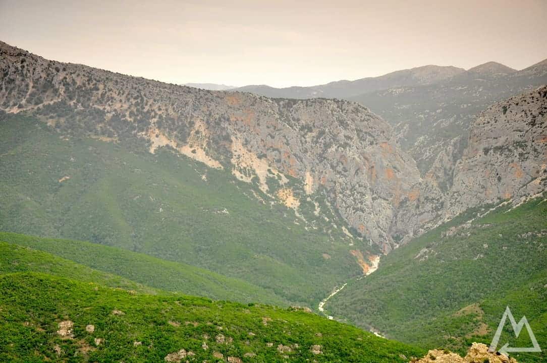
Gola di Gorropu from the street
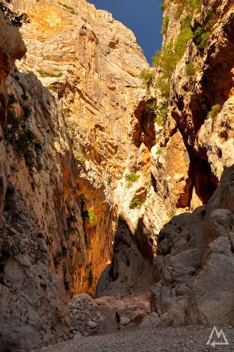
Gola di Gorropu
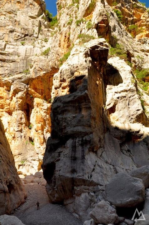
Gola di Gorropu
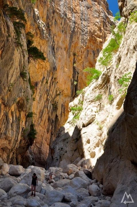
Gola di Gorropu
Gola di Gorropu
After the hike we recommend to check out the town Murals of Orgosolo. The streets are full with wall paintings.
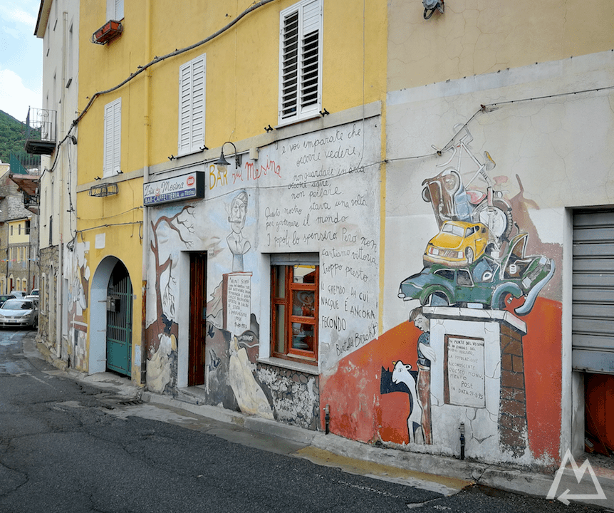
Murals of Orgosolo
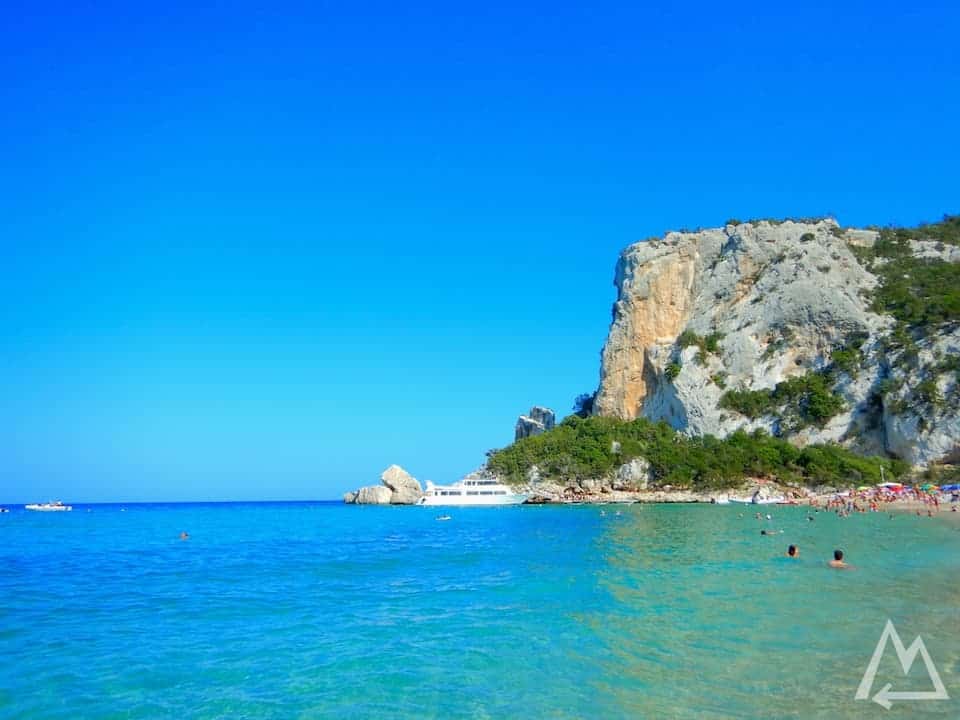
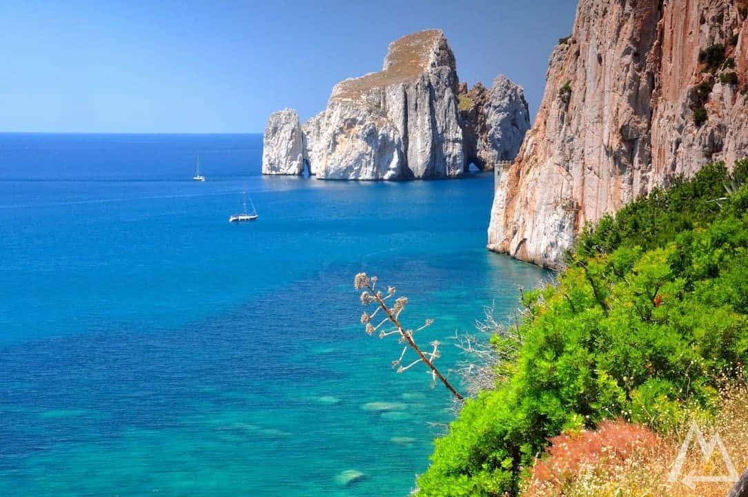
Finally, and best in the evening at sunset is the place called Spiaggia delle Rocce Rosse. The huge red rock in the deep blue sea just seems out of this world and is definitely worth a visit.
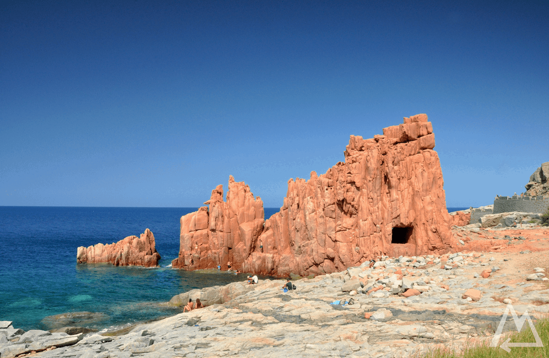
Spiaggia delle Rocce Rosse
The south coast
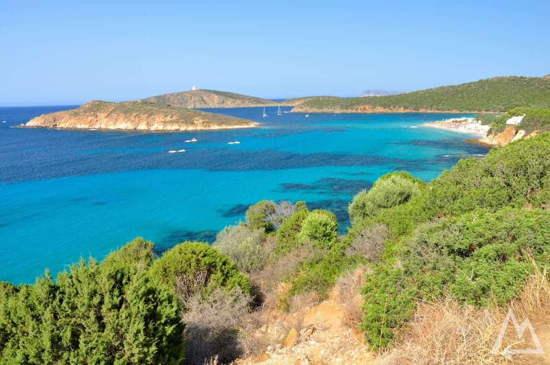
Now heading all the way down to the south of the island to visit the city Nora and its archaeological site.
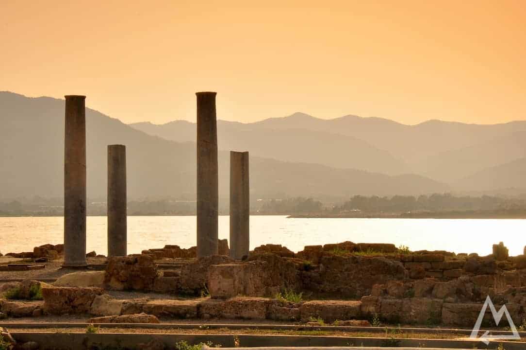
Nora archaeological site
After walking through the relicts of the old romans we head further to Spiaggia di Cala Cipolla, a small beach ideal for snorkelling and relaxing under the sun.
Spiaggia di Cala Cipolla
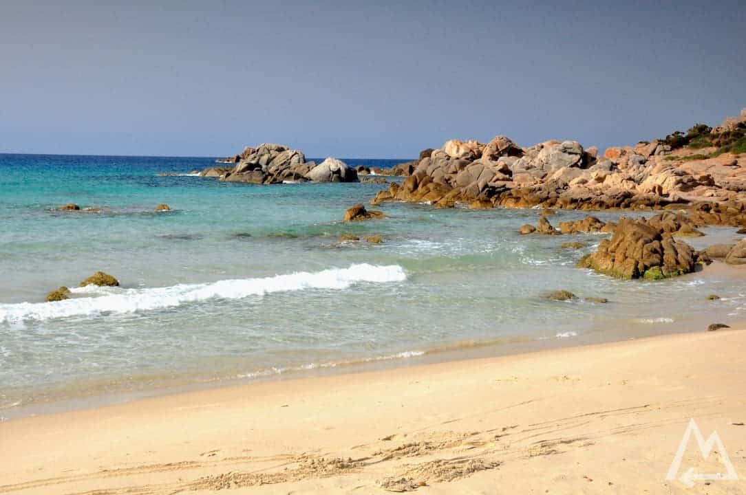
Right next to this beach, about 15min by car, you find the place called Spiaggia di Tuerredda. Here we spent at least 2 hours just for snorkelling. The turquoise water is incredibly clear and offers a lot of marine life to discover.
Spiaggia di Tuerredda
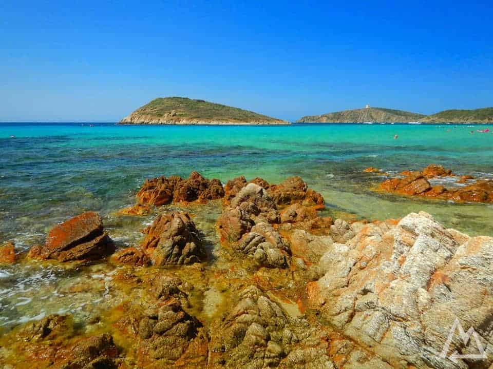
Spiaggia di Tuerredda
The west coast
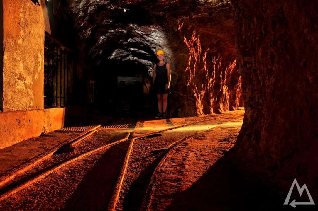
Leaving the south coast and going north we find the special place called Porto Flavia.
Porto Flavia
Take a guided tour through the mine-like tunnels of a special construction which was used to store minerals from mines. It was used to store all the extracted material from the nearby mines and then transport it to the sea where cargo ships picked up the material to bring it to smelters around the globe.
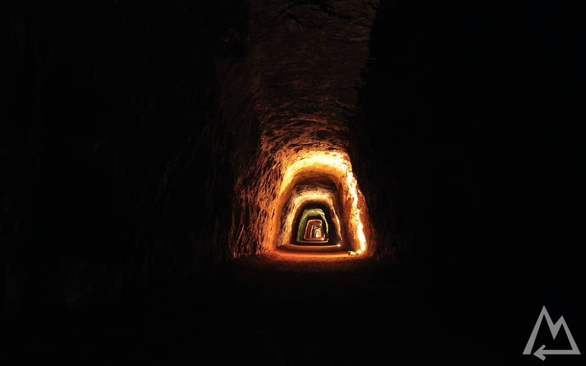
Tunnels in Porto Flavia
Tunnels of Porto Flavia
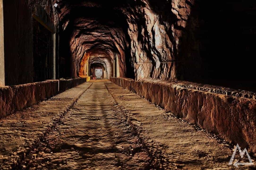
Tunnels of Porto Flavia
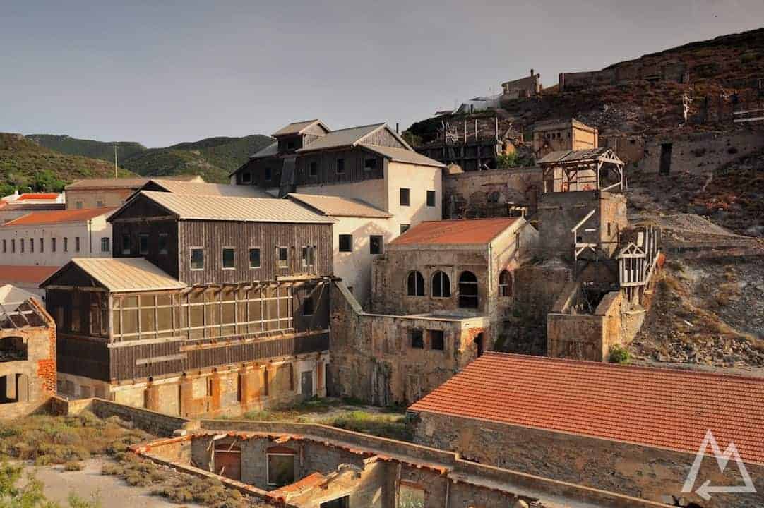
Heading further north we find an abandoned mine called Ingurtosu. Skip the museum that advertises a visitor center at 200m below ground level, it’s fake and totally not worth the money unless you are interested in a bunch of butterflies. Instead just drive downhill and check out all the abandoned leftovers from the ancient lead and zinc mine.
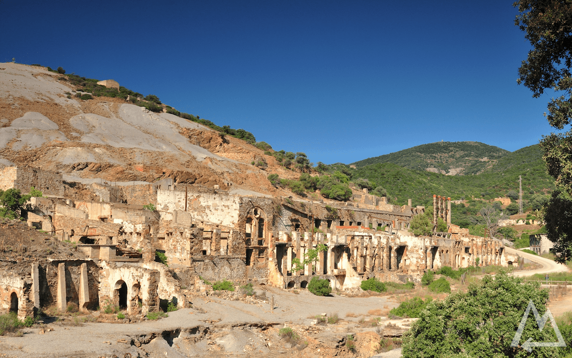
Ingurtosu
If you continue downhill following a long dirt road you’ll reach the place Spiaggia di Piscinas. We spent at least 4h there checking out the huge sand dunes and the nearly endless beach.
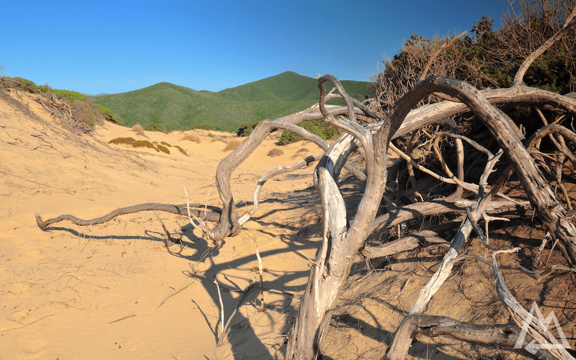
Spiaggia di Piscinas
Heading again into the middle of the island you’ll find the area called “Marmilla”. The whole area is sprinkled with strange looking meadow cones. Some hills have leftovers of ancient buildings on their top.
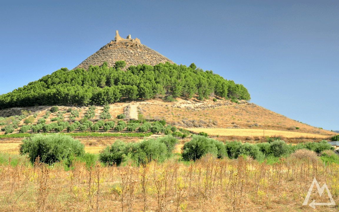
Marmilla
Also you will find several archeological sites in that area with strange architectural shapes. The most famous one is called Nuraghe Su Nuraxi and can be visited with guided tours.
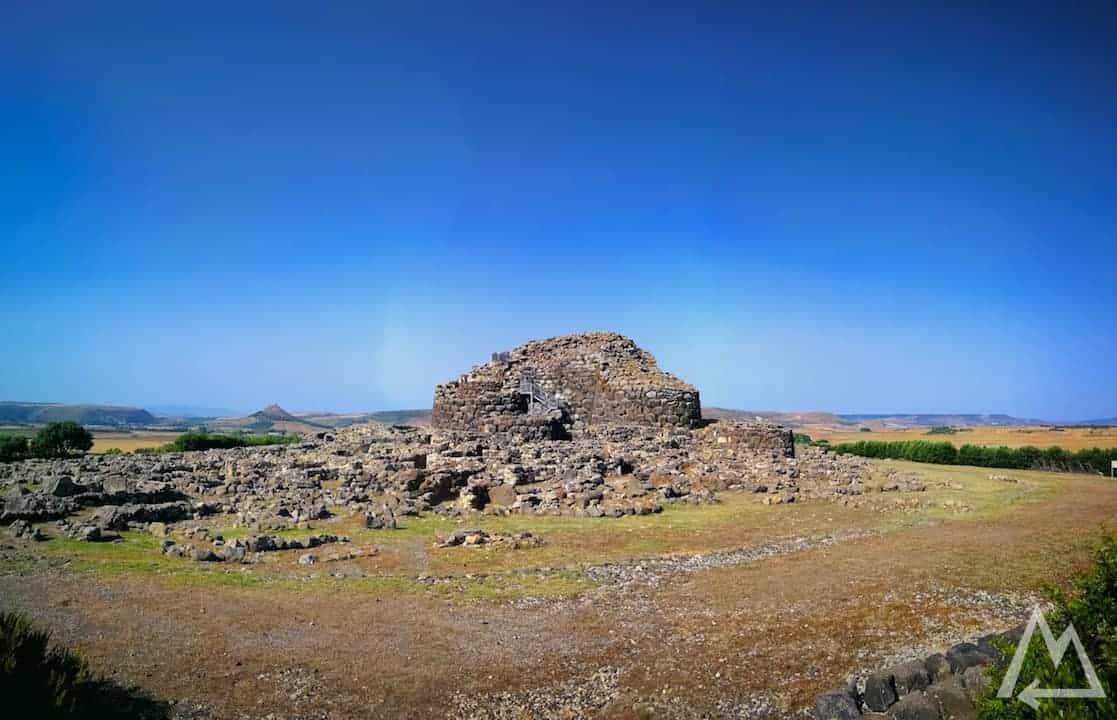
Nuraghe Su Nuraxi
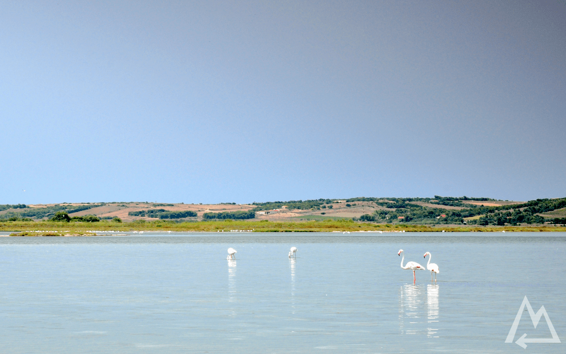
Driving further north towards Oristano, you can find wild flamingos. We asked a local for the best spot to see the most Flamingos and he gave us these coordinates N 39.9126317, E 8.4846935, the link for Google Maps is linked to the description of the picture below. You can also find the point on the map on the top of this post.
Close to this spot you can check out the area archeologica di Tharros. You can save the entry fee if you walk up the mountain a little bit.
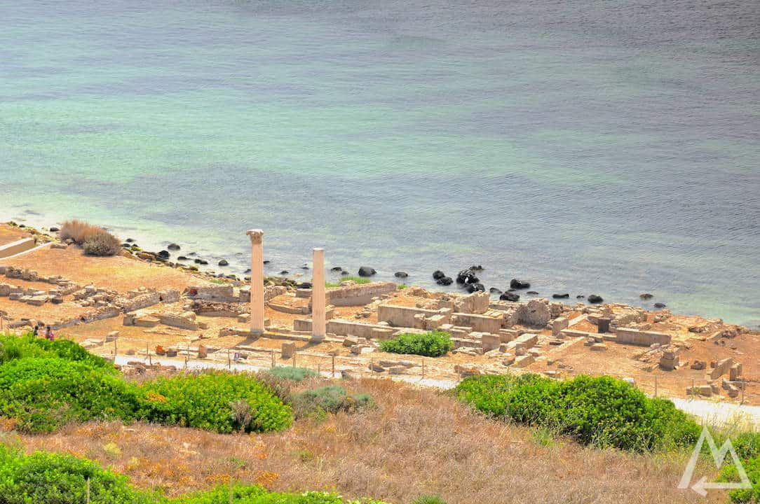
Area archeologica di Tharros
Next stop is the city Bosa and Il Castello Malaspina. You can drive up to the fortress. From there you get a great overview of the city Bosa.
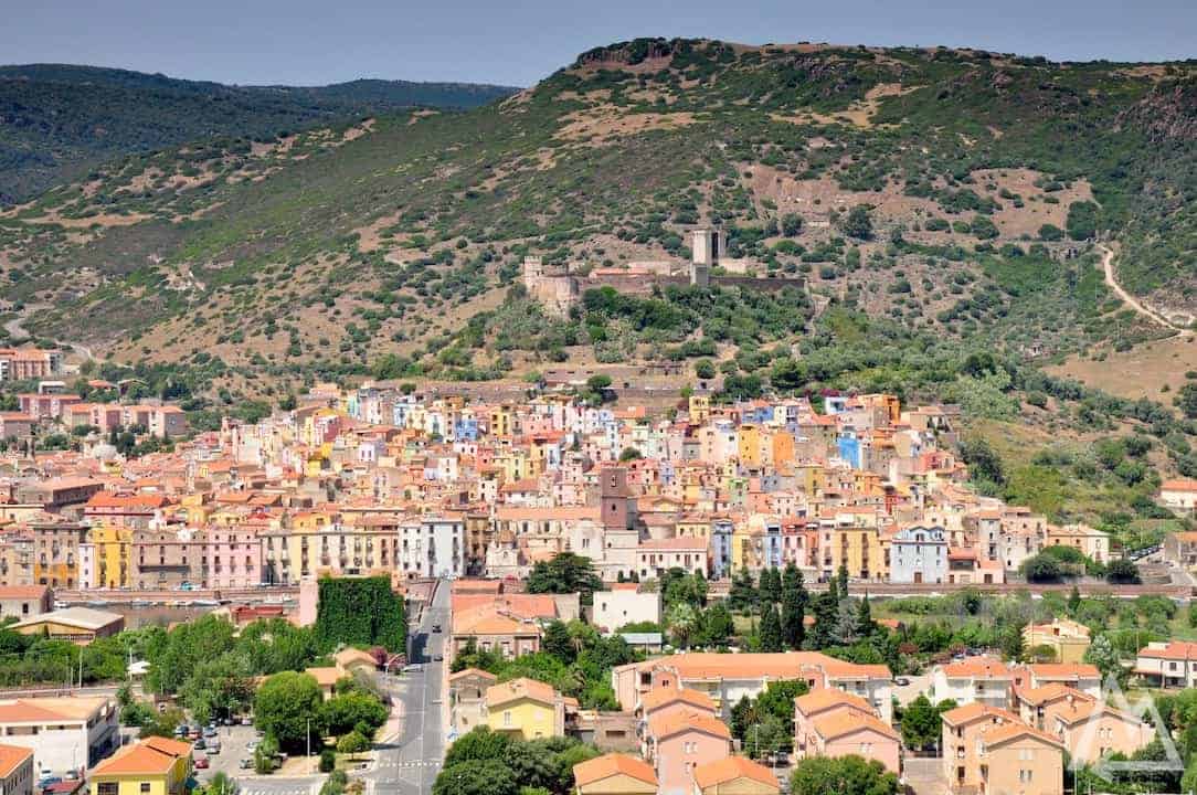
Bosa
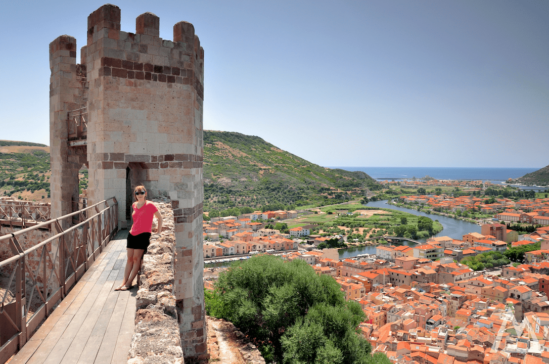
Il Castello Malaspina
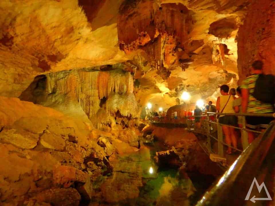
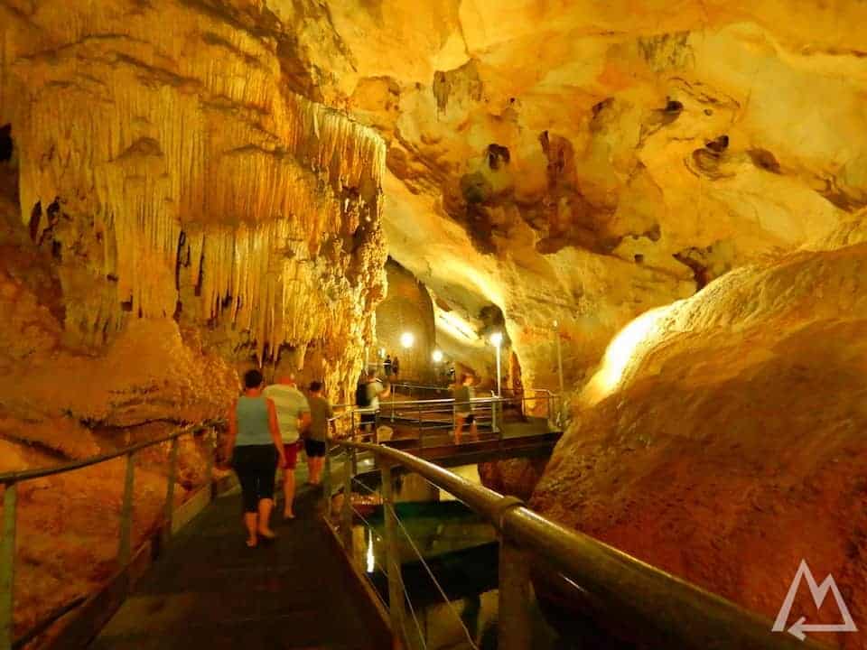
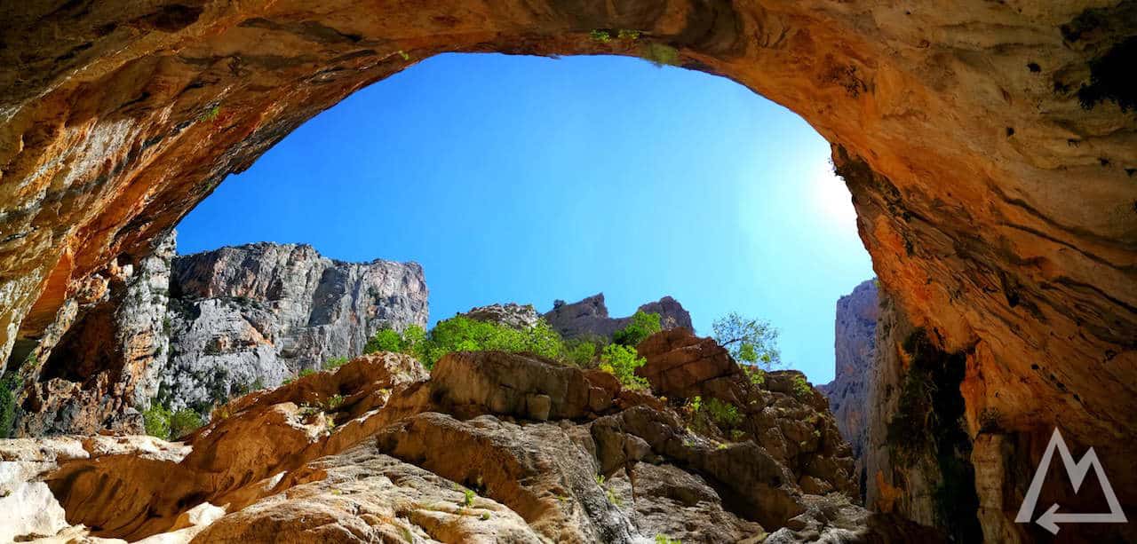
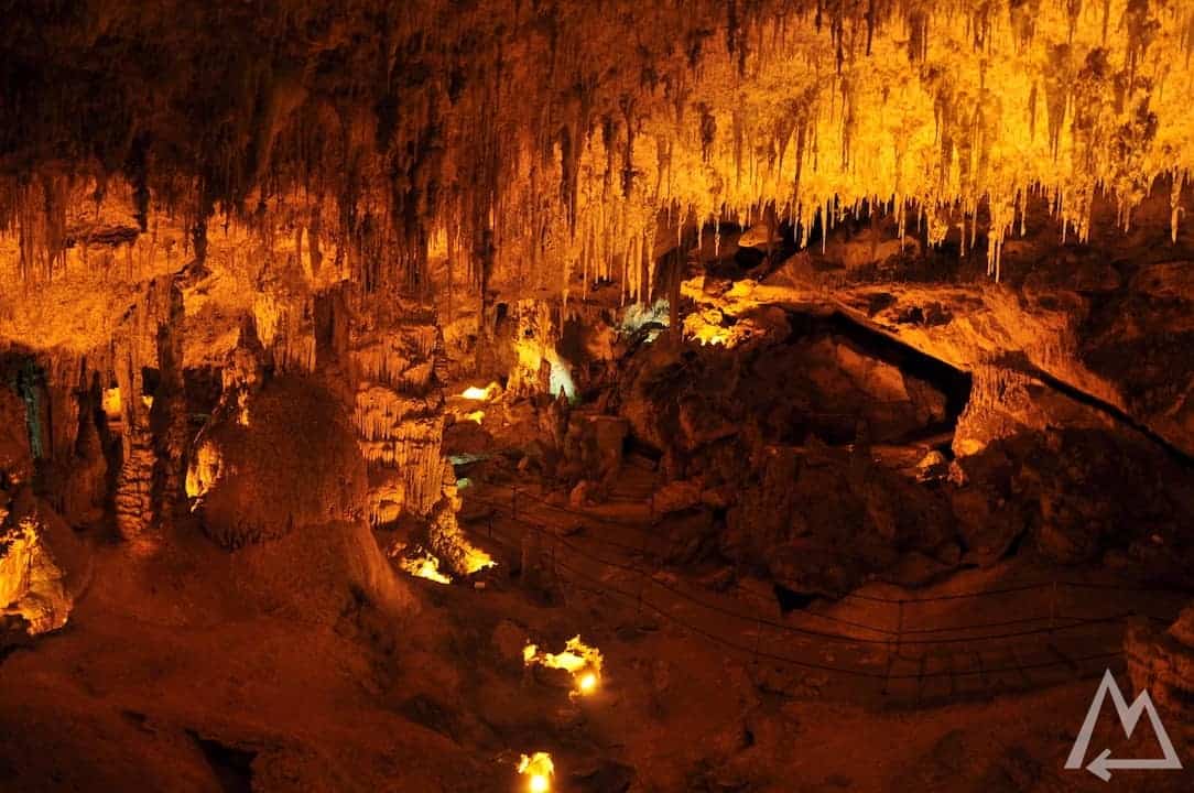
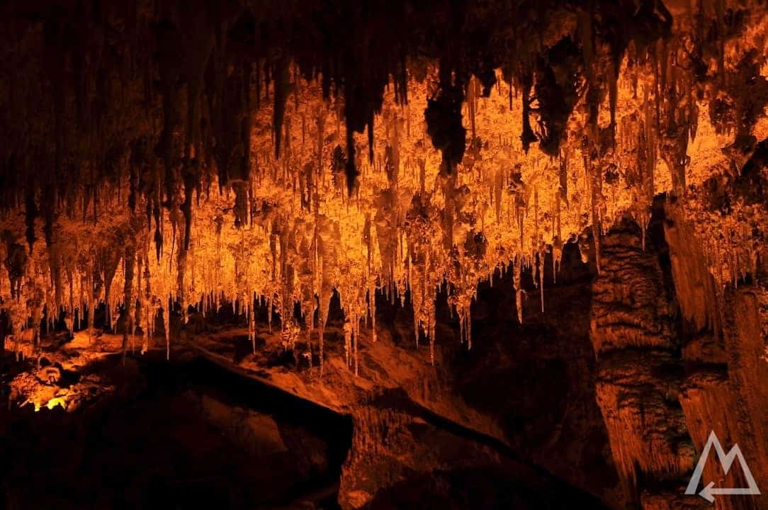
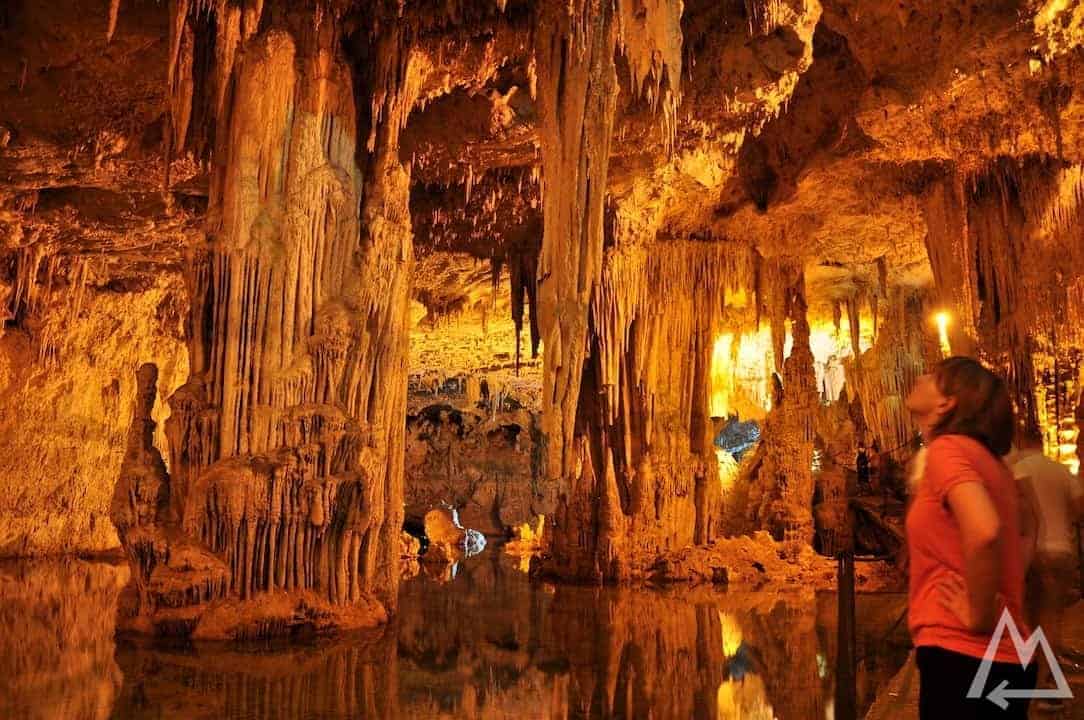
Heading further north you’ll find the great cave Grotta di Nettuno. There is a staircase leading down to the cave which is already quite insane as the cliff in which it was built is nearly vertical.
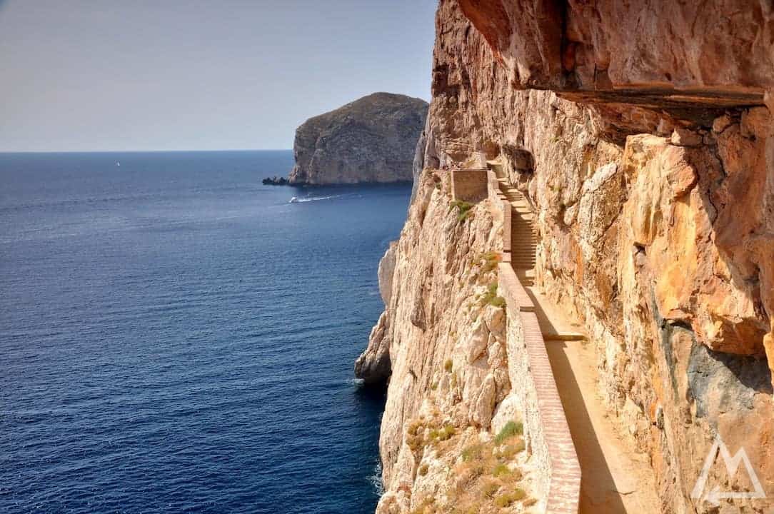
Grotta di Nettuno
Reaching the entry of the cave you’ll get awarded by cool, fresh air. The cave is just incredible. With a guided tour you’ll find huge stalactites and stalagmites, several lakes and some unique lime stone formations on the roof of the cave with horizontal connections between the stalactites..
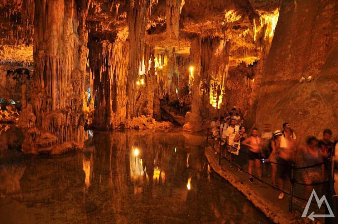
Grotta di Nettuno
Grotta di Nettuno
Grotta di Nettuno
Grotta di Nettuno
The north coast
Further north you can see the abandoned silver mine Argentiera.
Argentiera silver mine
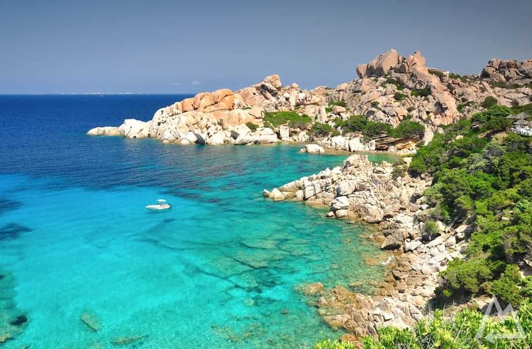
Next stop is Spiaggia della Pelosa.
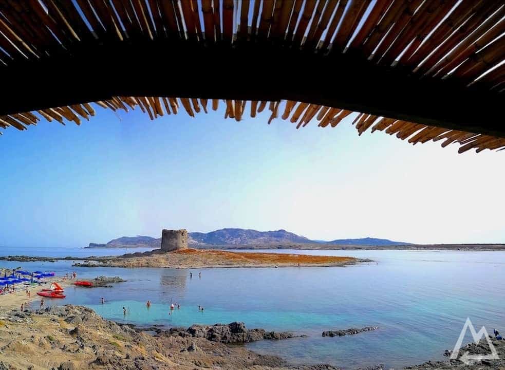
Spiaggia della Pelosa
This place is also awesome for some snorkelling and you can even cross the sea to the little fortress on the island.
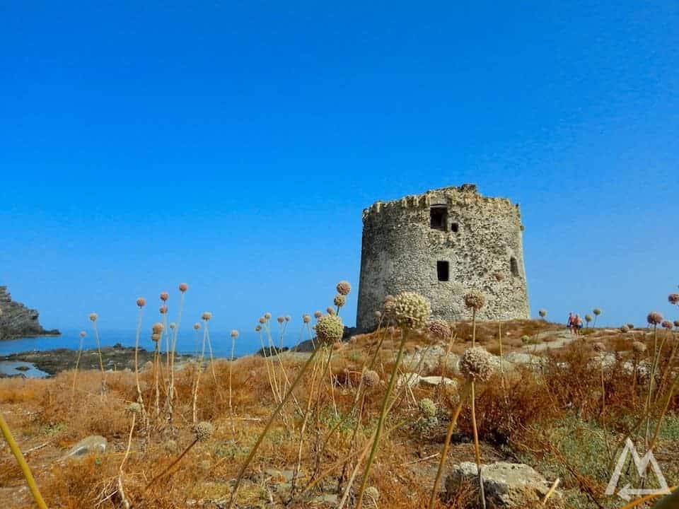
Spiaggia della Pelosa, fortress on the island
Watch out for urchins in the water if you’re walking on the stones.
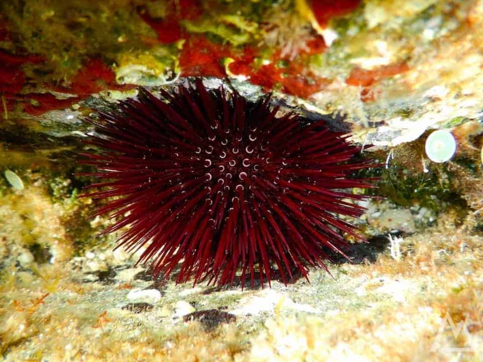
Urchins in Spiaggia della Pelosa
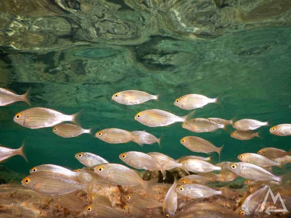
Snorkelling at Spiaggia della Pelosa
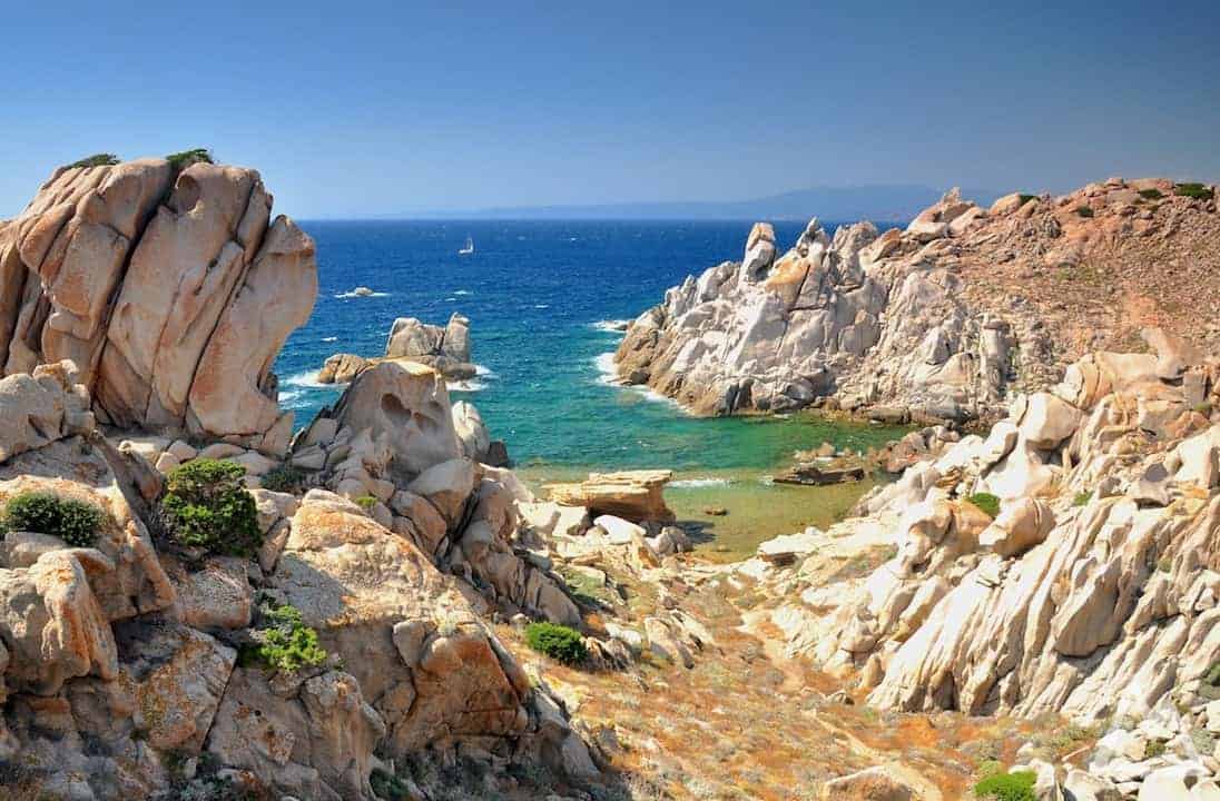
Following the road along the coast we find the charming colorful village Castelsardo.
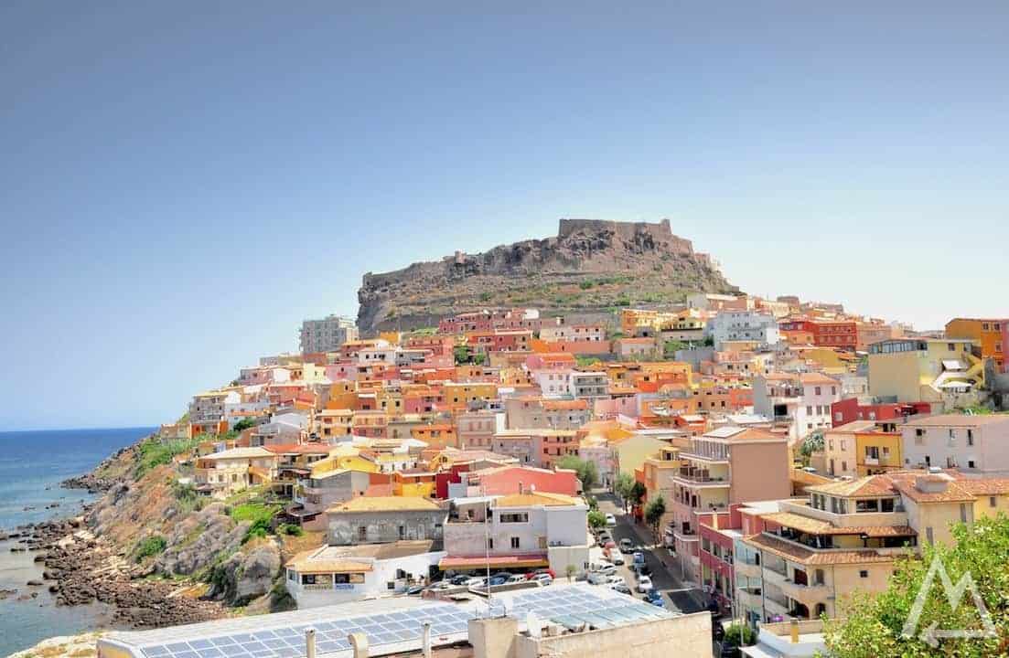
Castelsardo, the charming colorful village
Last stop on the plan is Valle della Luna. This place is incredible and you can spend at least a day here.
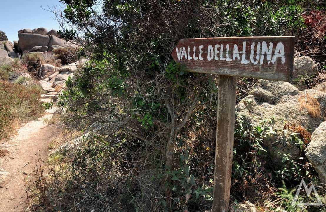
Hike to Valle della Luna
The way to the hidden secret lagoon may be even better than the lagoon itself.
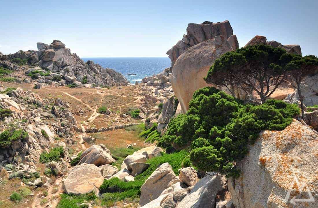
Hike to Valle della Luna
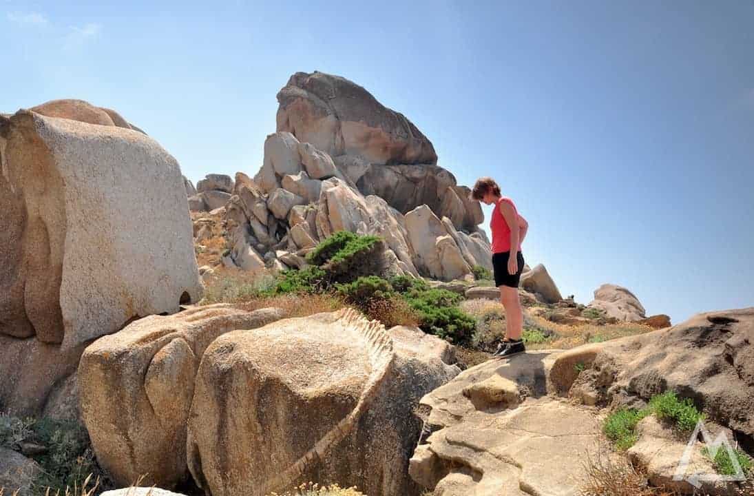
Hike to Valle della Luna
Hike to Valle della Luna
If you want to know how to take such pictures, check out our photography courses
Click here and sign up to get our new eBook for free.

We hope this post is helpful and inspiring.
Please let us know if anything is missing or misleading.