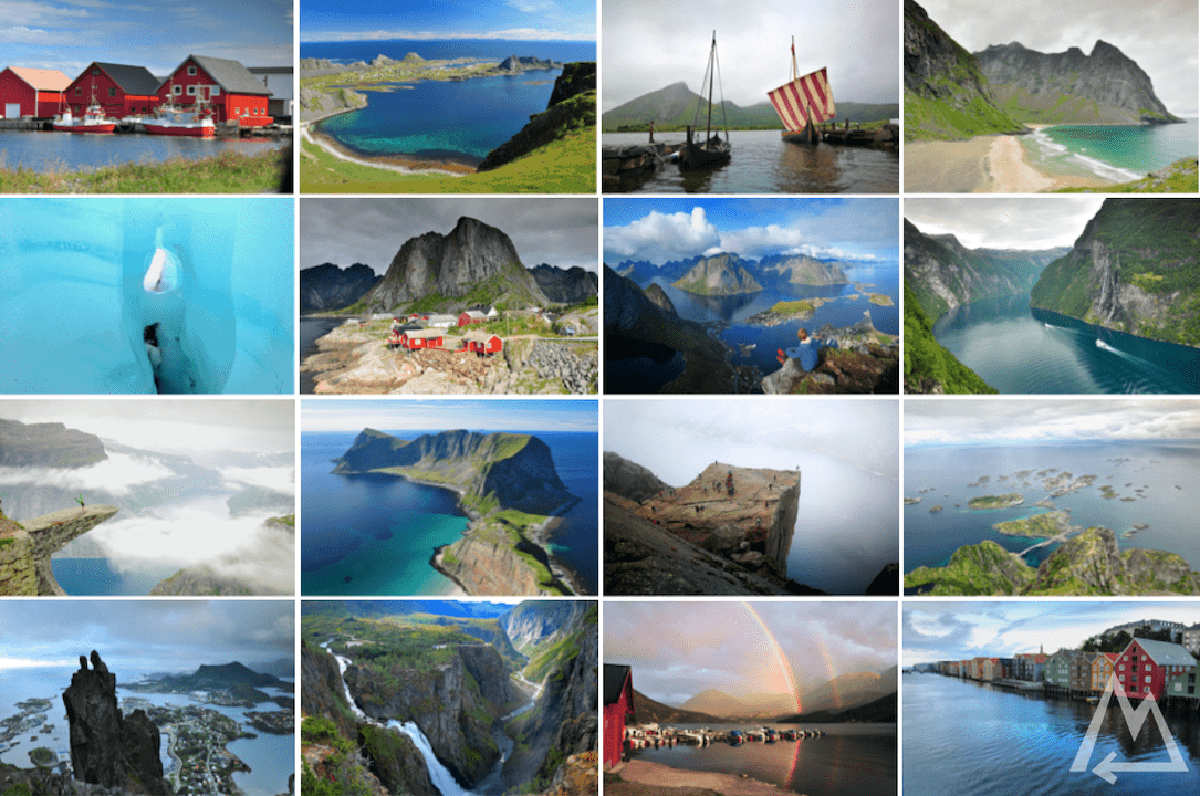
The complete travel guide to Norway
See all the awesome places of Norway with this master plan. Massive overhanging cliffs, turquoise lagoons with sand beaches, a glacier, a natural water slide, countless canyons and fjords, big waterfalls and many more unique places like Lofoten and Værøy are waiting for you to discover. With this plan you won’t miss any great spot and do it all in two weeks.
Trip overview:

- 2 weeks
- 4900 km (by car)
- 105 km (by foot)
- 18 ferries to take
- 10 mountains to mountaineer
- 1 glacier to hike
Exploring Norway
We started in Oslo, picked up our rental car and checked out the first spot on the list Jettegrytene. It’s a dried-out riverbed where you can go for a stroll or a swim. Passing a barrier and following a dirt road for some kilometres you’ll arrive at this magic place.
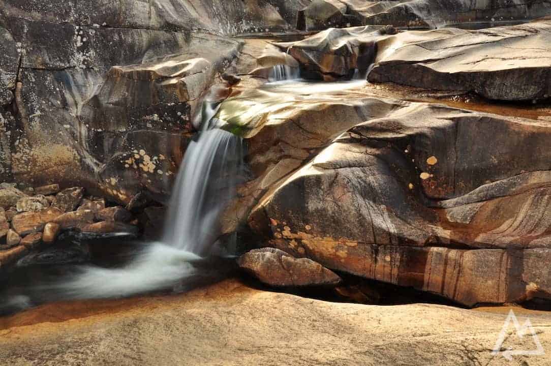
Jettegrytene
Mostly locals hang out here and enjoy the natural water slides and pools, especially cool for the kids. At the end of the canyon is a 20m long water slide that allows you to glide into a lake.
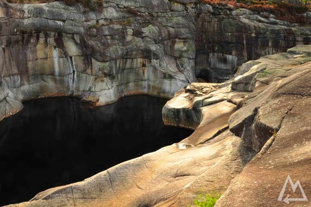
Jettegrytene
Next stop is Kjerag Parking where you can do the Kjeragbolten hike. The hike takes around 6-8h with an elevation gain of 570m and round trip distance of 12km. As we were short in time with two weeks for entire country anyway, we skipped this hike. If you’re interested, you’ll find everything to the hike under this link.
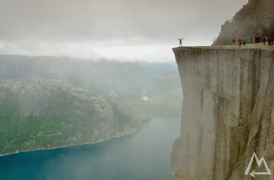
Not far from there and further west you can stop at the Pulpit Rock Parking and hike to the famous Preikestolen (Pulpit rock). The hike is rather moderate with around 4h for the 7.6km round trip with an elevation gain of approximately 330m. The final part of the path follows the edge of the cliff and you see this breathtaking view down to the Lysefjord. You’ll find more information about the hike under this link.
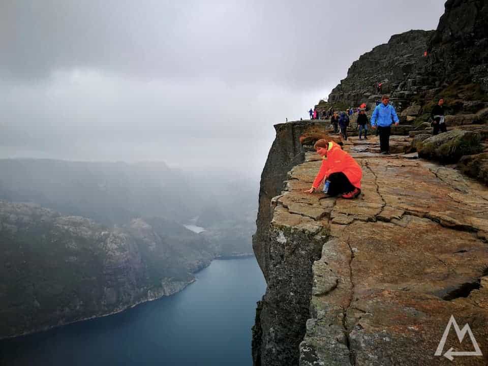
Preikestolen
Reaching the top and checking out the cliff.
Preikestolen
You can walk further up to see the entire rectangular rock from above like that.
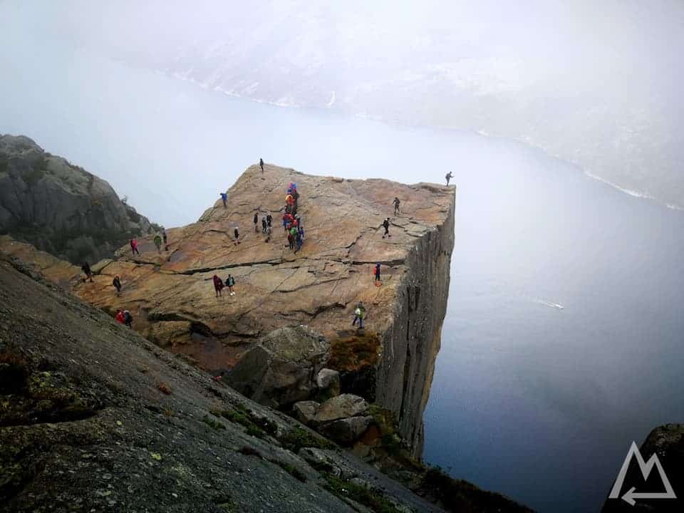
Preikestolen from above
After this hike we recommend to drive to Odda. On the way there, stop at the Låtefossen waterfall it’s quite impressive and worth a stop.
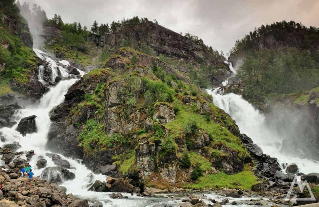
Låtefossen
From Odda you’re within 30min at the parking for the Trolltunga hike. We recommend to check the opening time of the barrier for the upper parking lot the day before and be there 1h earlier when you actually go for the hike. Only 40 cars per day get access to that parking lot. If you’re lucky and get access you can save 400m elevation gain and a few kilometers to walk. There is also a shuttle service to that parking lot for the late arrivers. However, the hike is rather demanding because of it’s length of 23-27km and elevation gain of 500 – 900m, depending if you start at the upper parking lot or at the standard parking. The hike takes about 10-13h. For more information check out this link.
Hike to Trolltunga
On the way to Trolltunga you’ll encounter two emergency cabins in case of fast weather changes or physical emergencies.
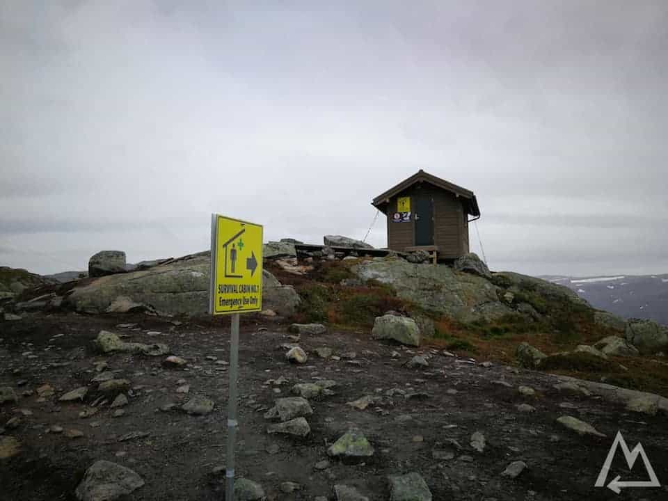
Emergency cabins on the way to Trolltunga
Following the cliff to Trolltunga offers this fantastic view down to the lake Ringedalsvatnet.
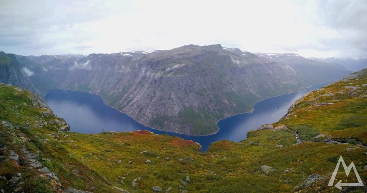
Hike to Trolltunga
Finally, reaching Trolltunga and waiting for the crowd to finish their Instagram shots, I decided to go for a single-arm handstand because why not.
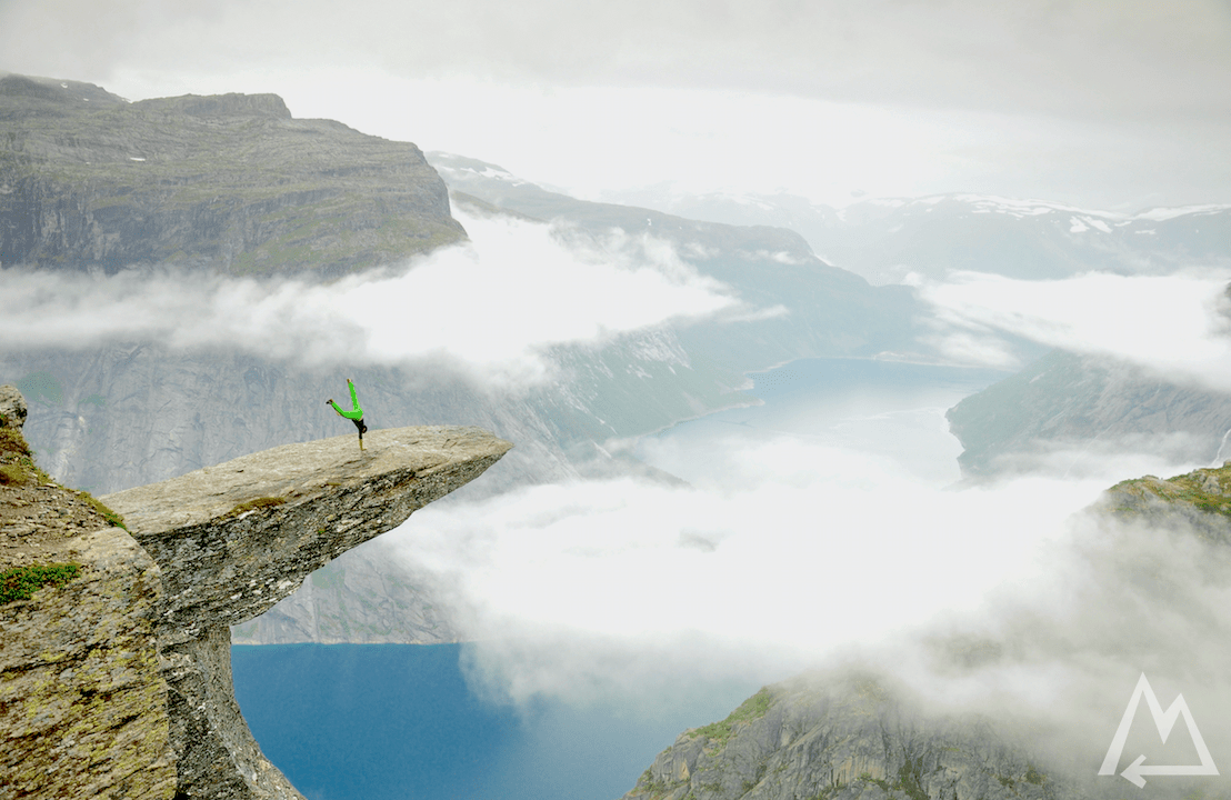
Single-arm handstand on Trolltunga
Driving up north quite a bit you can stop at the FONNA Glacier Ski Resort. Either you book and join a tour in advance or have your gear with you for the glacier walk. As it’s a ski resort you can also go for skiing in summer. We went for a short glacier walk with our own gear. If you don’t have any experience with glaciers we recommend a guided tour as it can be dangerous.
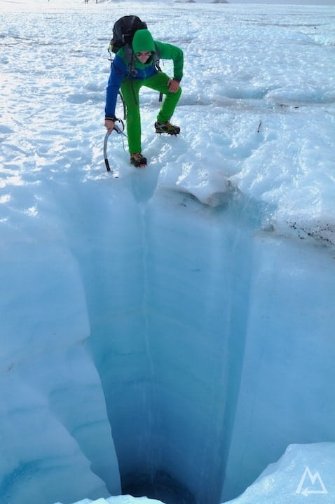
Folgefonna glacier walk
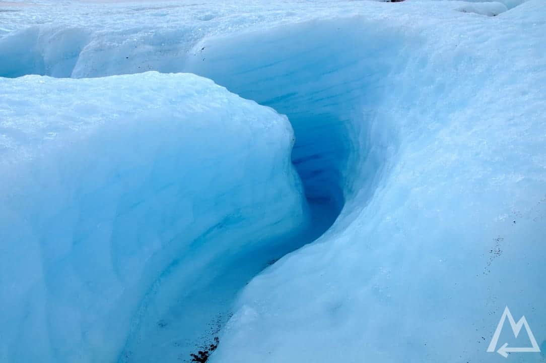
There are several deep water cut holes in the blue ice glacier.
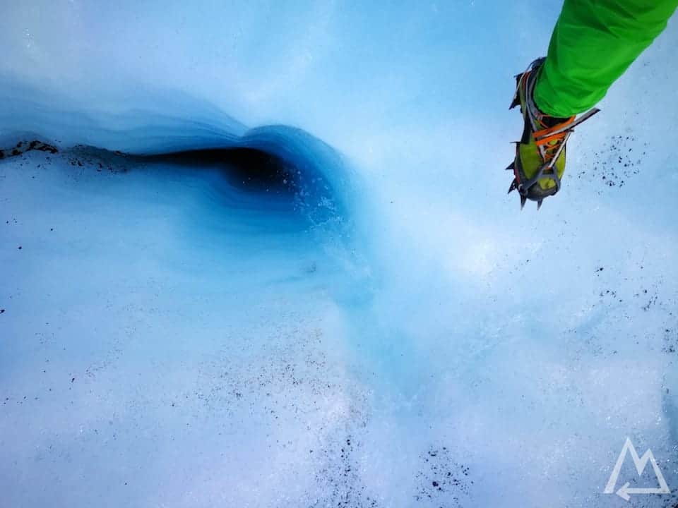
Folgefonna glacier walk
You’ll also find some ice caves and other weird structures along the glacier.
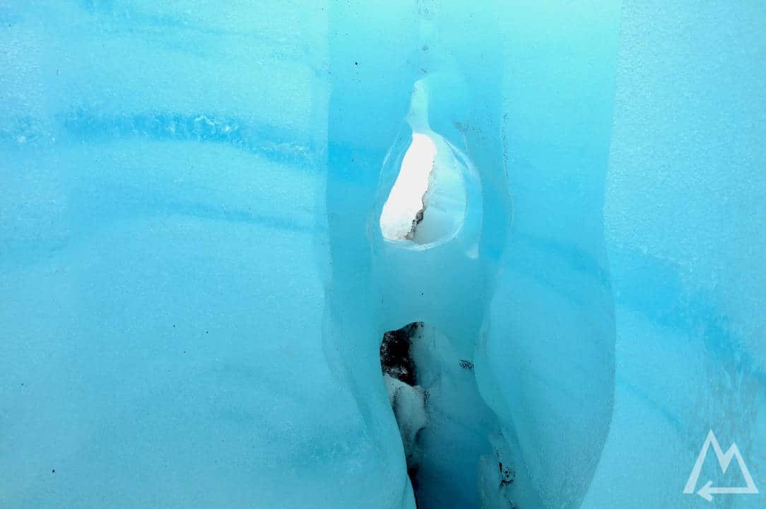
Ice Cave at Folgefonna glacier
Folgefonna glacier
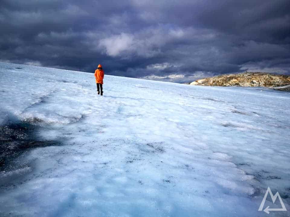
Hike on the Folgefonna glacier
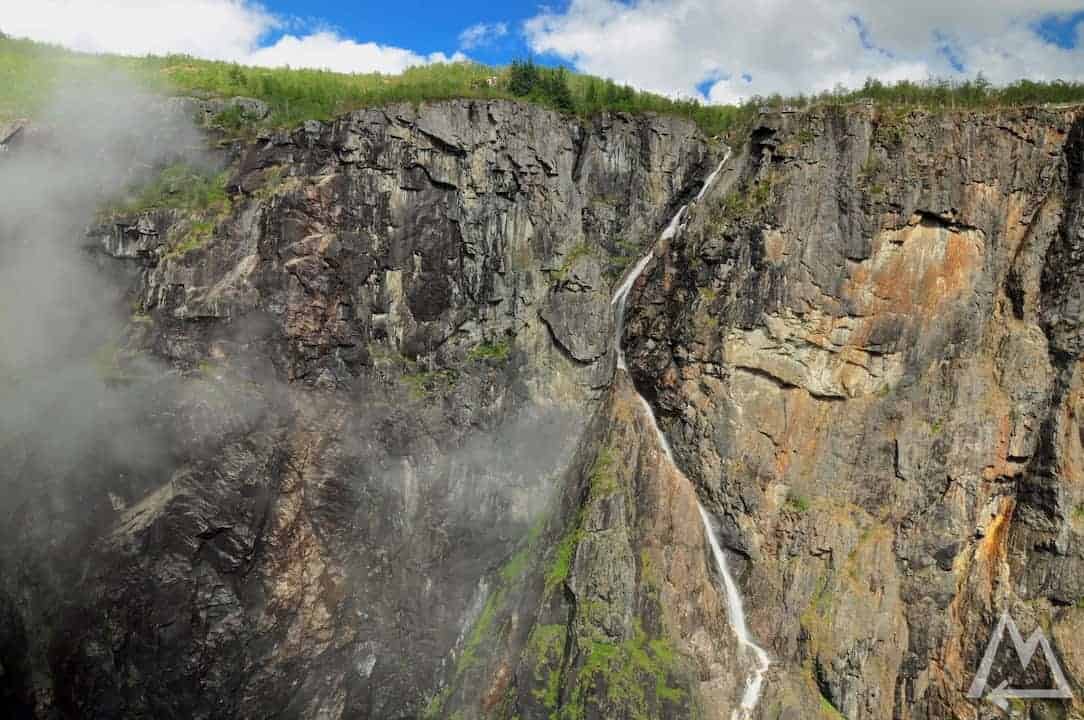
After this you should stop at the Fossli Hotel Vøringfossen Viewpoint.
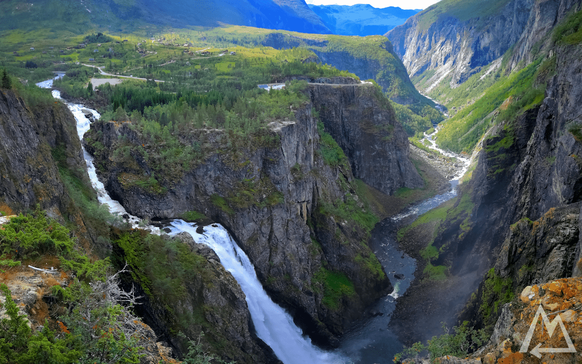
Vøringfossen
There is a smaller waterfall on the right rock wall zigzagging down like this.
Vøringfossen
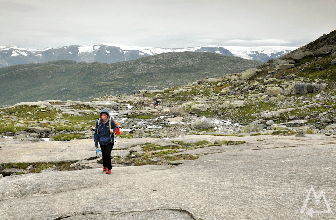
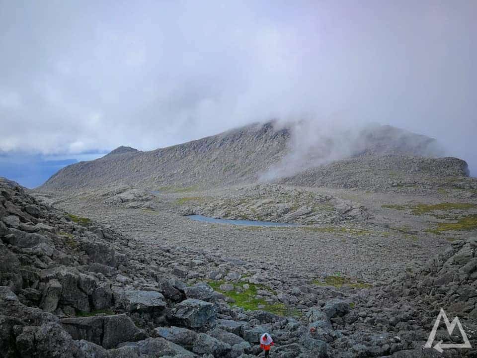
Next stop is another hike to the place Besseggen. It’s said to be one of the best hikes in Norway. We went there but unfortunately, the weather changed overnight and we decided to continue on our tour to visit the entire country. If you’re interested in the hike check out this link. It takes 6-7h for the 900m elevation gain and 14km hike.
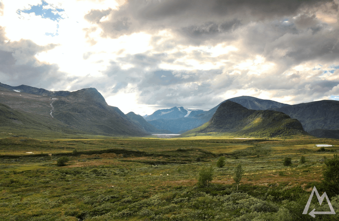
Valley near Besseggen
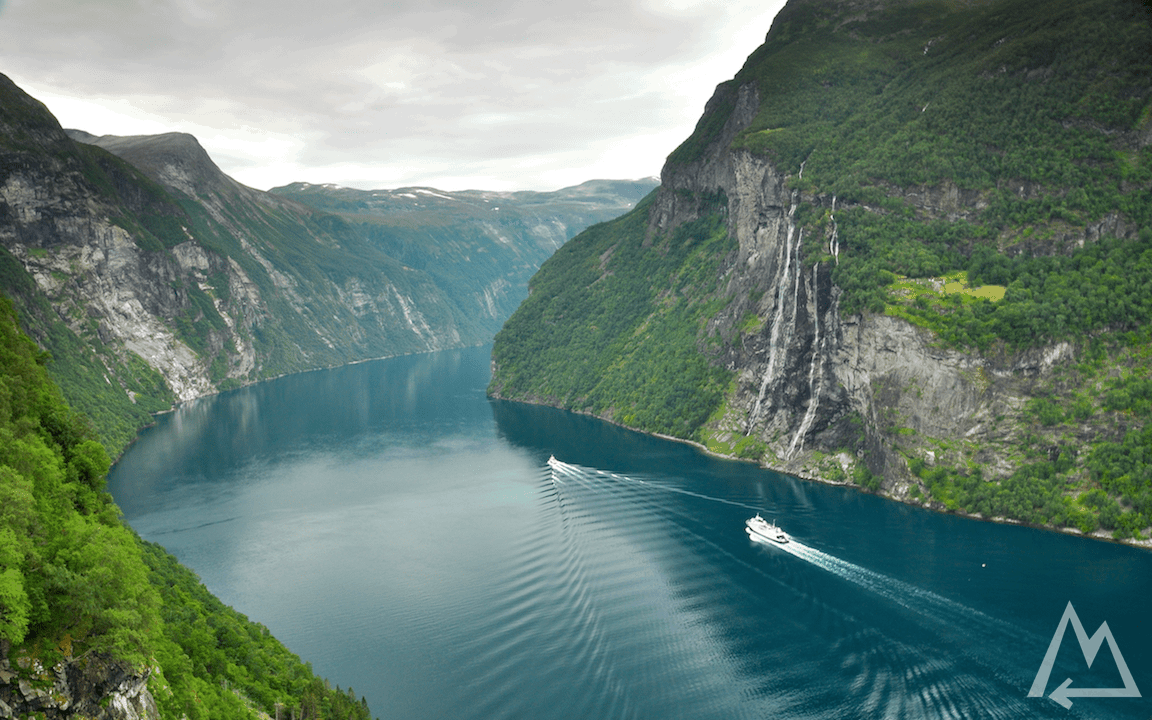
Next on the list is the village Geiranger. Here we took the ferry from Geiranger to discover the fjord. The ferry ride itself is worth the money as it gives you a sense of how huge these fjords are.
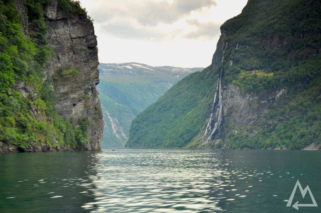
Geiranger fjord from the ferry
We jumped off at the place Skagehola and walked the 250m up to the Skageflå farm where you can enjoy this unique scenery.
Geiranger fjord from Skageflå farm
From there you can either walk all the way back to Geiranger which takes about 4h or just hop on the ferry and ride back. For more informations regarding the hike back check out this link.
At the very west side of Norway you can hike to Hornelen, the highest sea cliff in Europe. We recommend to do this hike only under perfect weather condition as it can change instantly and the wind speed on the summit can be unpredictably high. Be careful if you go. If you start at Hunskår you’ll need around 7-8h for the 860m elevation gain and 12km distance. Check out this link for more information.
Hike to Hornelen, Europe’s highest sea cliff
The hike can be quite demanding at some areas as you will crawl over some big boulders.
Hike to Hornelen, Europe’s highest sea cliff
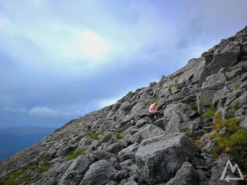
Hike to Hornelen, Europe’s highest sea cliff
At the top of the cliff is a tiny cabin where you can get shelter in case of rain and wind.
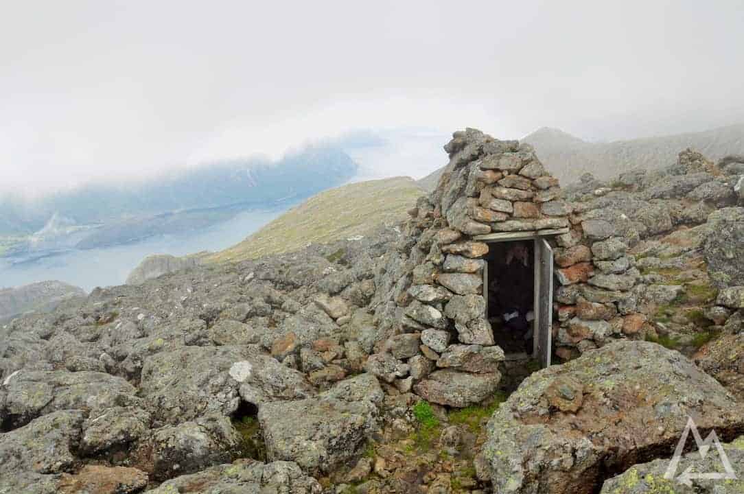
Cabin on top of Hornelen
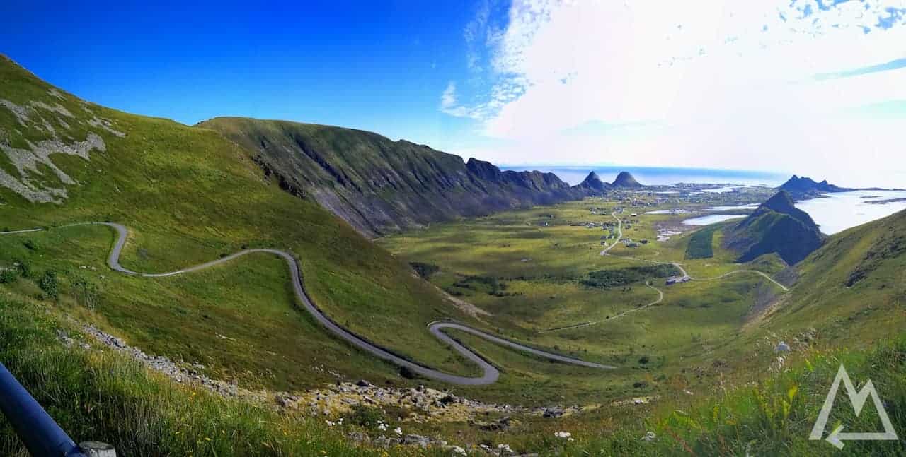
The next two stops are Ålesund and then Trollstigen. We skipped both spots as the weather was still bad and therefore not worth the detour. Ålesund you should definitely visit at night from the Aksla hill at the Fjellstua viewpoint. Trollstigen is best to be seen from the viewpoint Plattingen.
On the road to our next stop we spotted a huge rainbow.
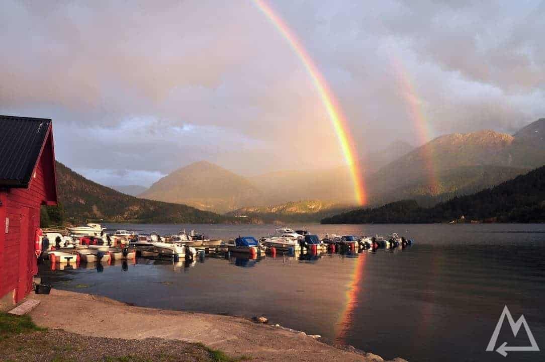
Rainbow at Aurstad Camping
Next stop we checked out is Atlanterhavsveien.
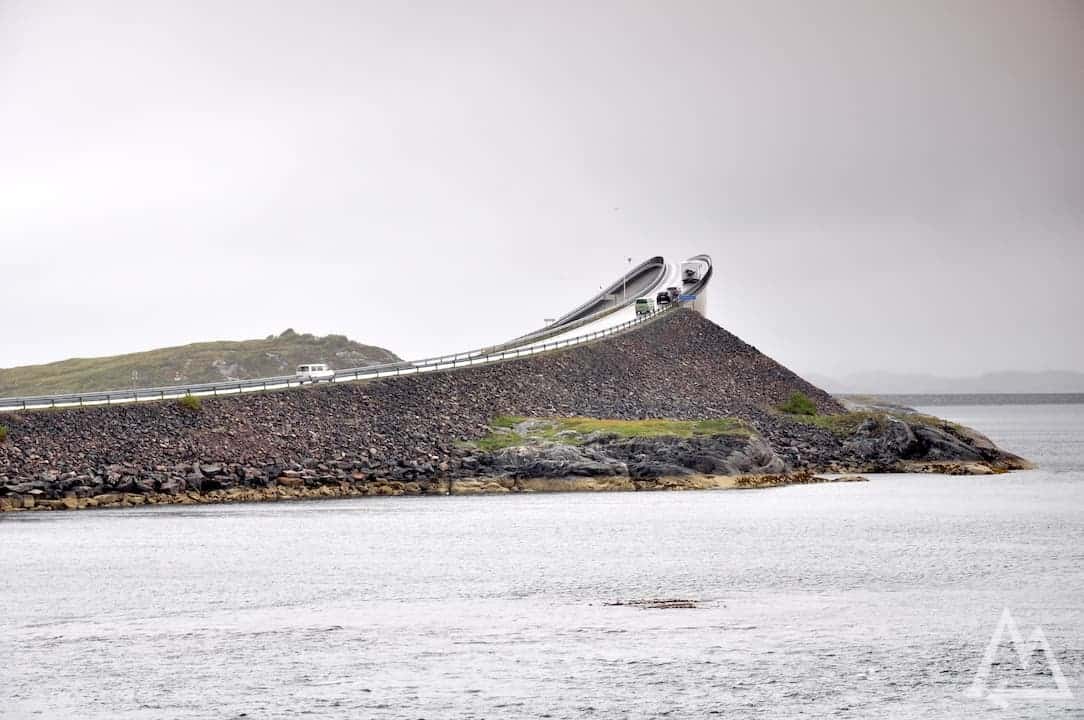
Atlanterhavsveien
Make sure to continue the road and also drive through the Atlanterhavstunnelen, a 6km long tunnel 250m below sea level.
Next pit stop is Trondheim, a colorful city well worth a visit.
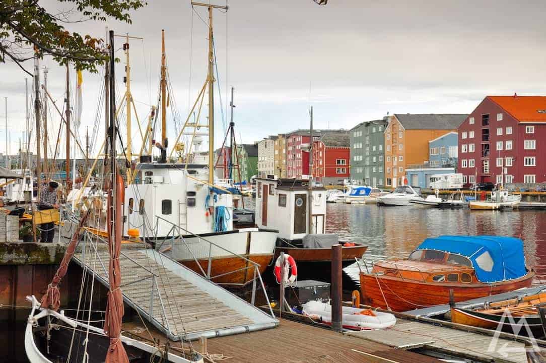
Trondheim
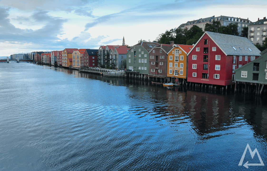
Trondheim
The next day, we combined another bad weather day with an extraordinarily long drive all the way up to the Lofoten. We went to Skutvik and from there took the ferry to Svolvær.
The Lofoten
In Svolvær you can go for the hike to Svolværgeita. Check out this link for detailed informations.
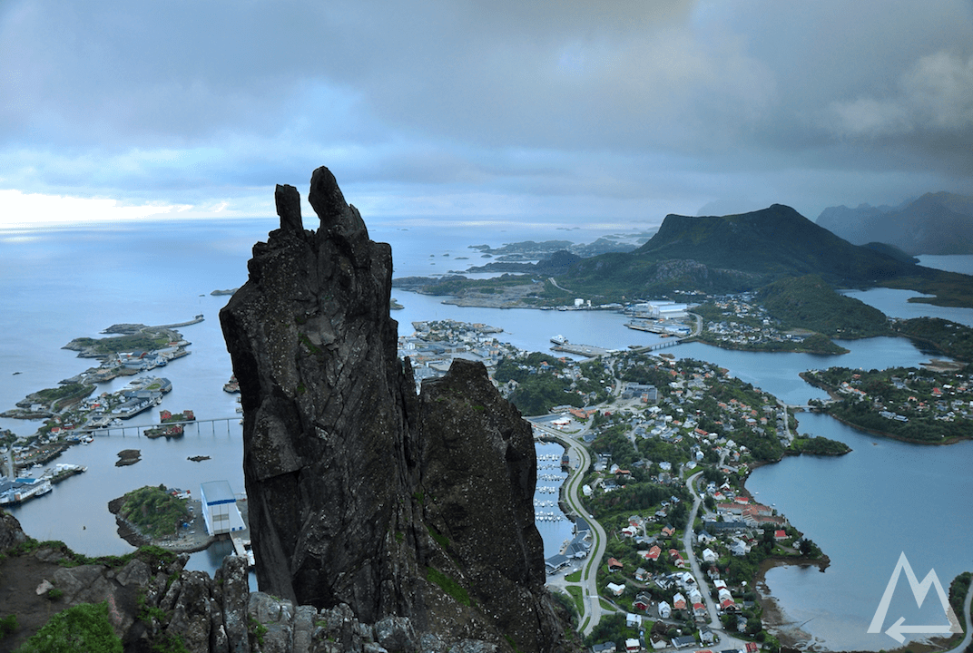
Svolvaergeita
If you have bad weather, which is often the case in the Lofoten, you can visit the war museum in Svolvær. One of the encryption machines Enigma is there.
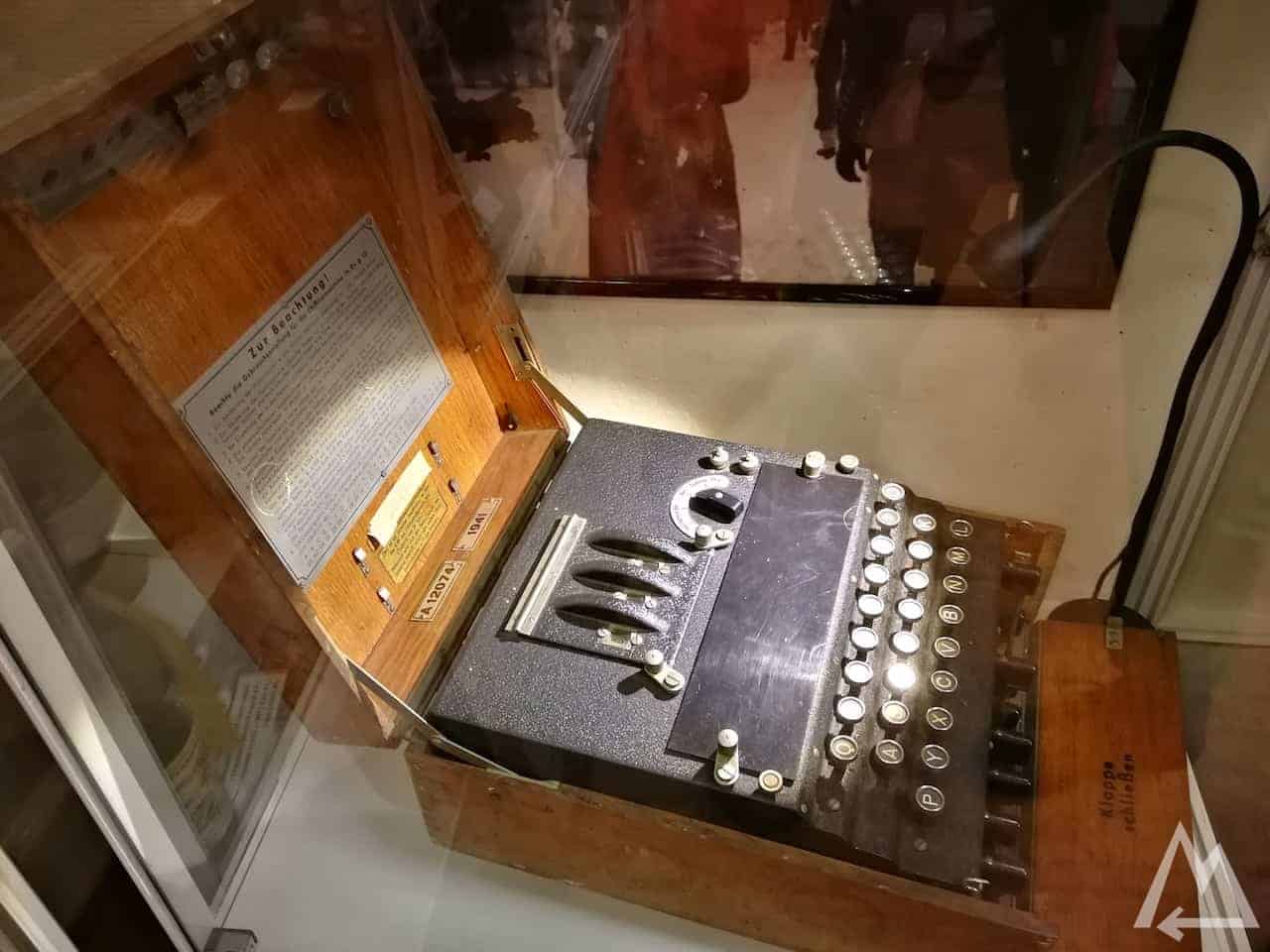
Enigma in Svolvær war museum
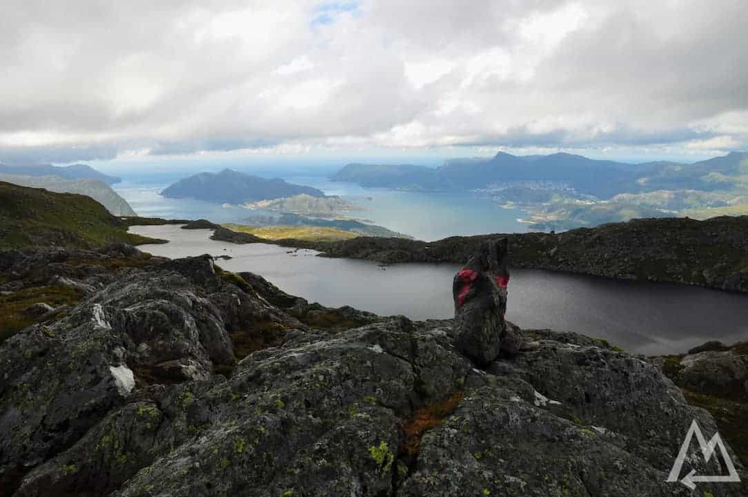
A few kilometers from Svolvær lies the village Henningsvær. We highly recommend to go for the hike to Festvågtinden. Is a rather medium hike, taking only 2-3h for an elevation gain of 541m and a distance of around 1.5km. Check out this link for more details. From the beginning to the top of the path you can enjoy the turquoise lagoons surrounding the mountain.
Hike to Festvågtinden
On the top you’ll get a panorama you’ve never seen before. It’s just insane how far you can see and how blue the water is.
On top of Festvågtinden, looking down to Henningsvær
View from Festvågtinden
The next place we checked out is called Eggum beach. You can walk along the coast and enjoy the mossy green mountains combined with deep blue sea.
Eggum
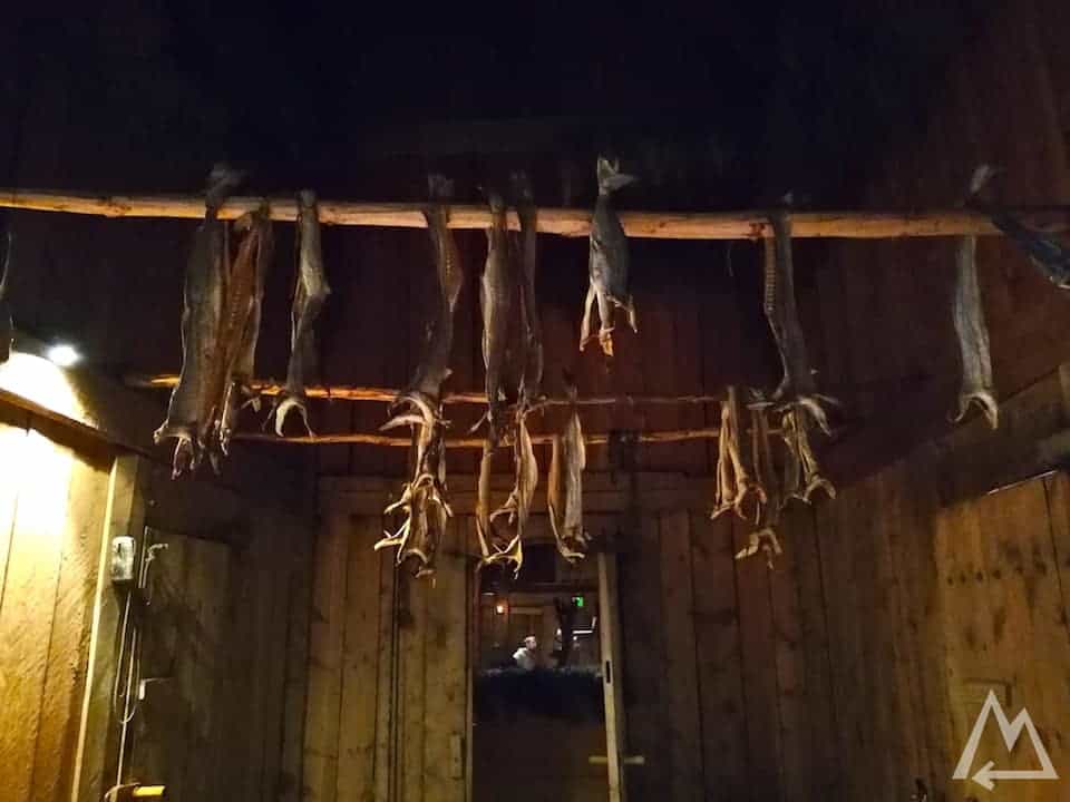
As you can see, the weather turned bad again so we decided to visit the Lofotr Vikingmuseum.
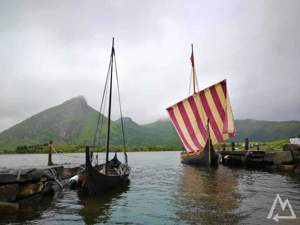
Lofotr Vikingmuseum
You can go for a sail boat tour with one of these recreated Viking ships, see a blacksmith trying to forge some knifes and indulge in the old Viking techniques of clothes production and food preparation.
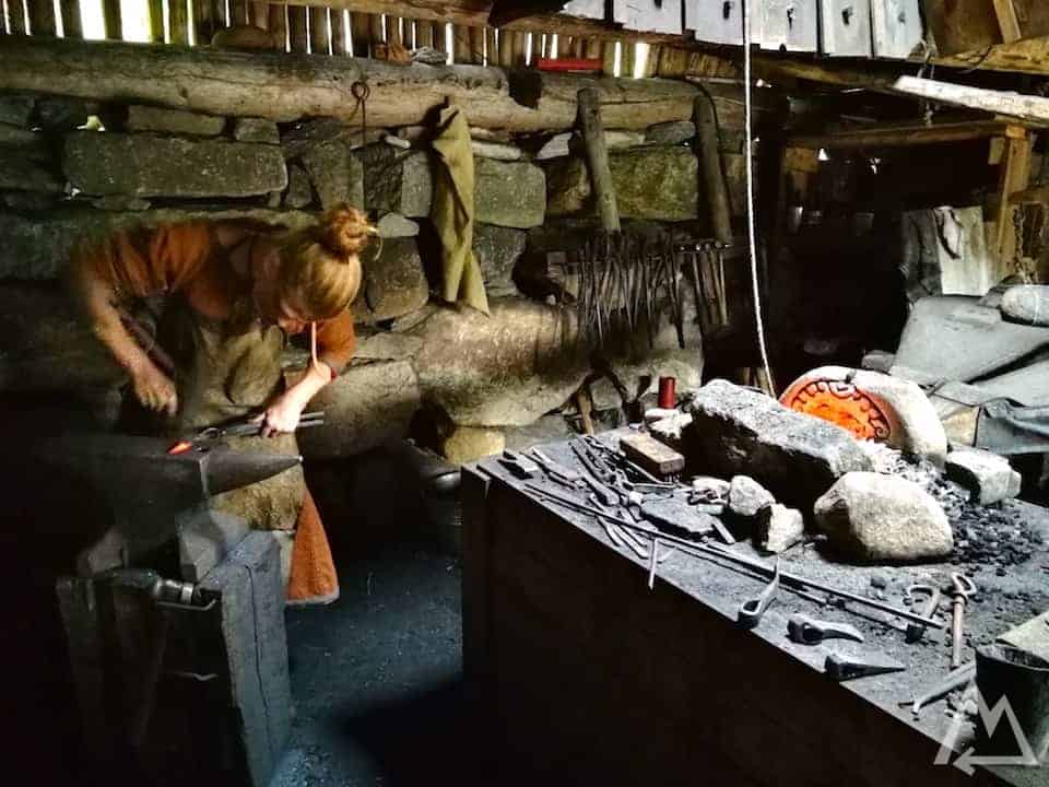
Lofotr Vikingmuseum
Lofotr Vikingmuseum
Another cool place to visit (when it’s good weather) is Kvalvika beach. A very easy hike 200m elevation gain up and down twice, taking around 2h. Check out this link for more infos.
Kvavlika beach
Following the mountain chain of the Lofoten further down towards Reine we stopped at Hamnøy. An old fishing village with the famous red fishermen houses and boats in front of the famous massive cliffs of the Lofoten.
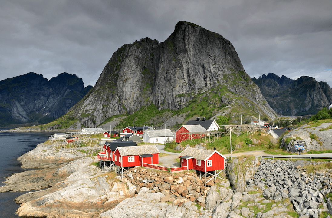
Hamnøy
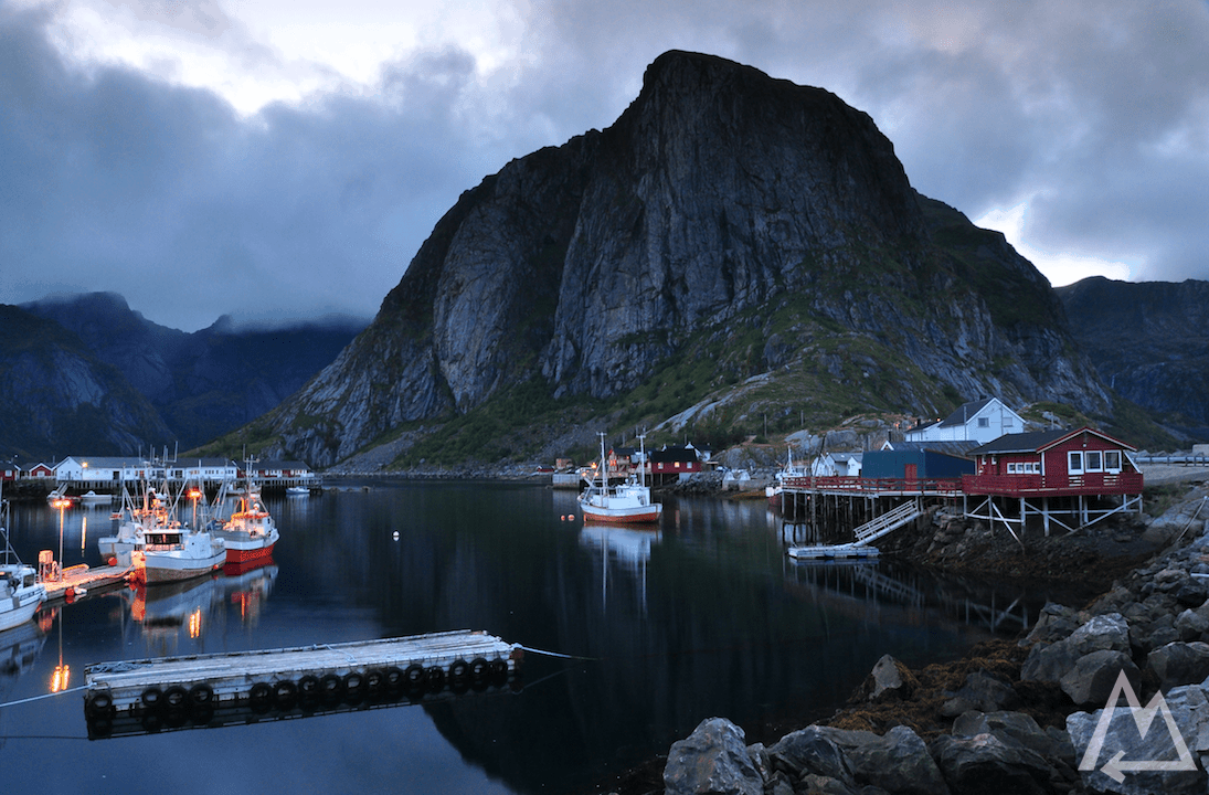
Hamnøy
Following the street to Reine lets you automatically stop for some pictures like this.
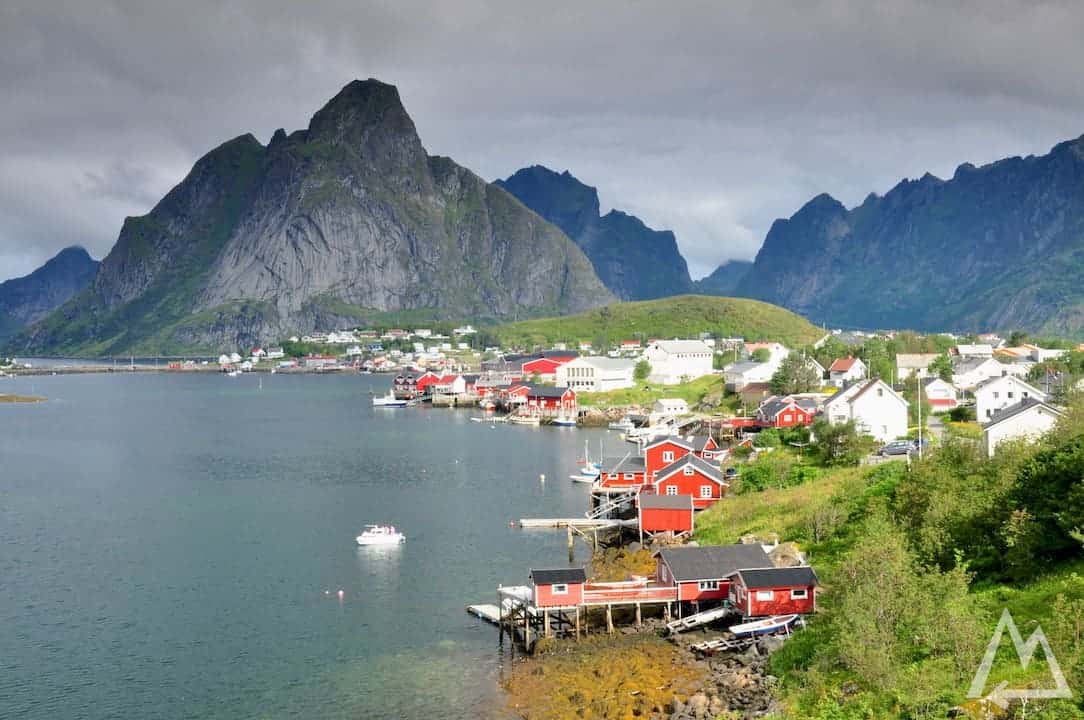
Reine
In Reine you can go for the probably most famous hike of the Lofoten up to Reinebringen. Check out this link for further information regarding trailhead and parking. It’s about 2h to get the 448m up the hill as marked with the red line below.
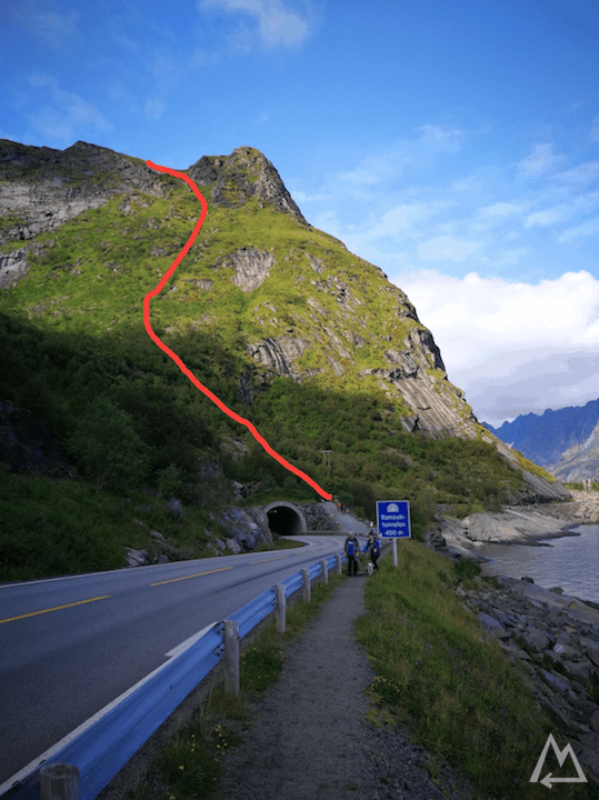
Trail to Reinebringen
It’s well worth crawling up this hill because of this breathtaking view you’ll get.
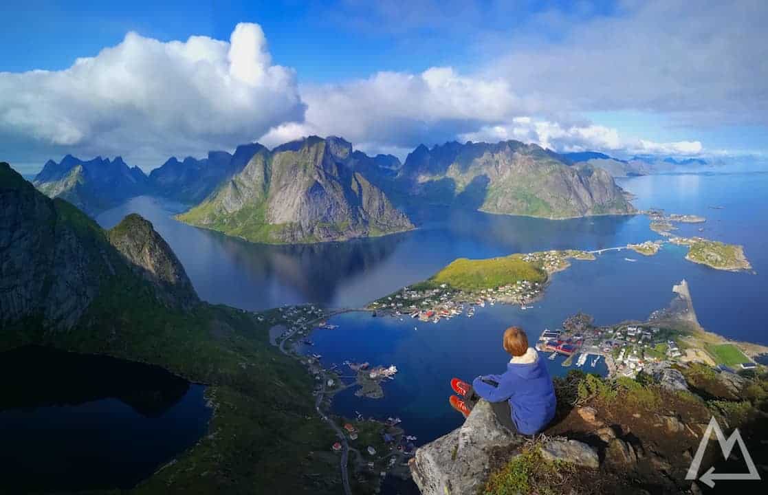
On top of Reinebringen
You can walk along the ridge and see the Lofoten from different angles.
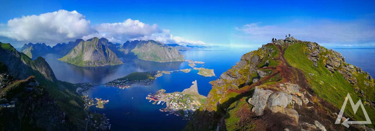
Reinebringen ridge
There is another hike we wanted to go for but didn’t have enough time for anymore. It’s called Helvetestinden and you’ll find all the infos under this link. Some guys we talked to said it might be even better than the Reinebringen hike.
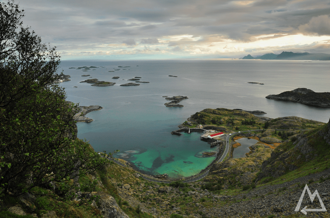
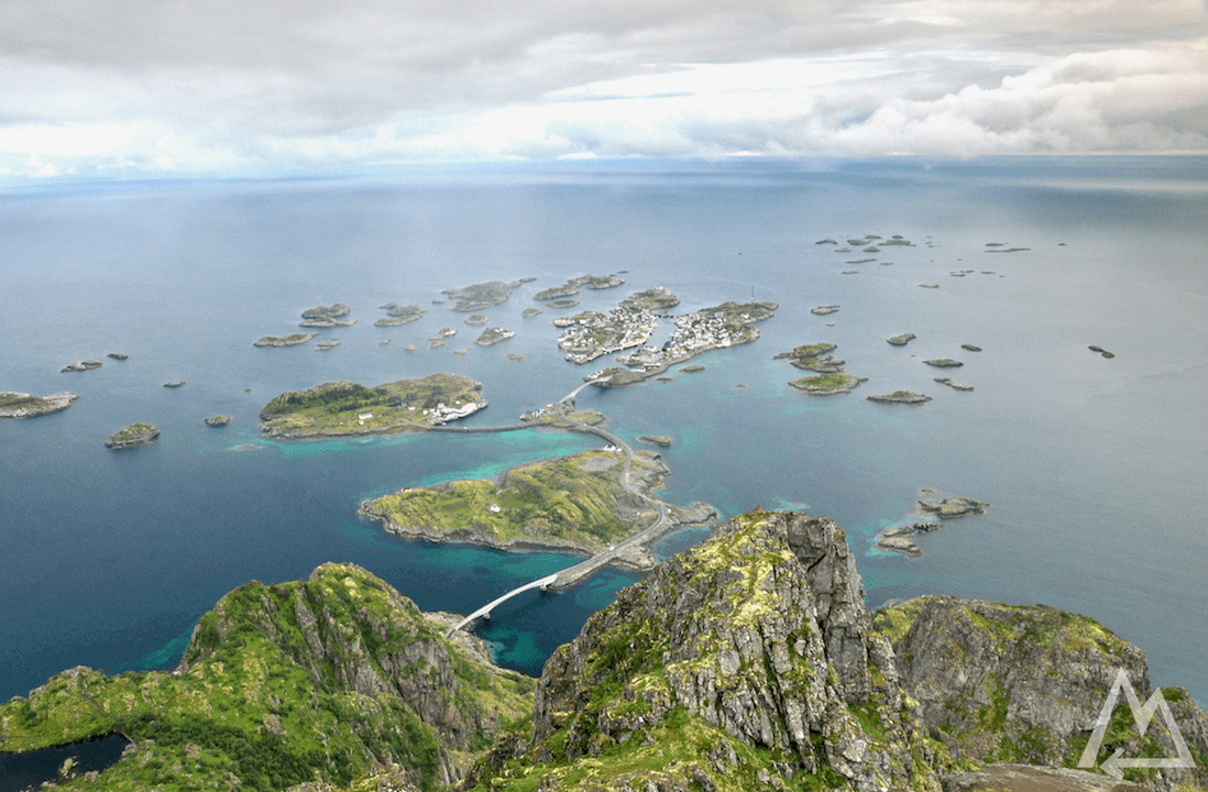
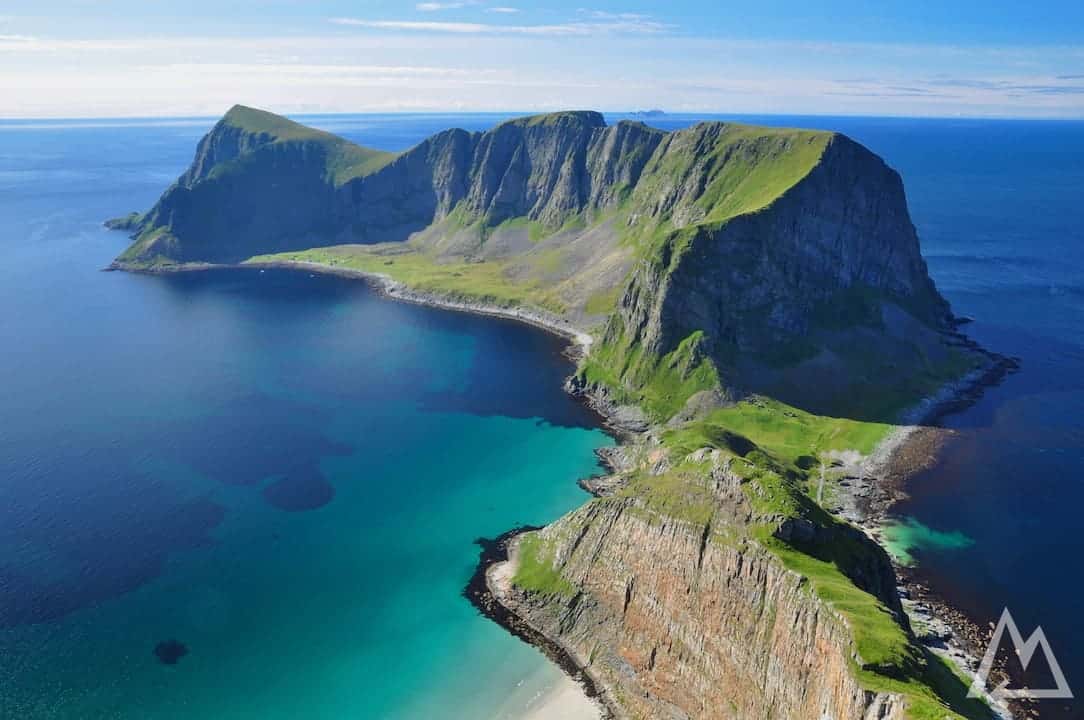
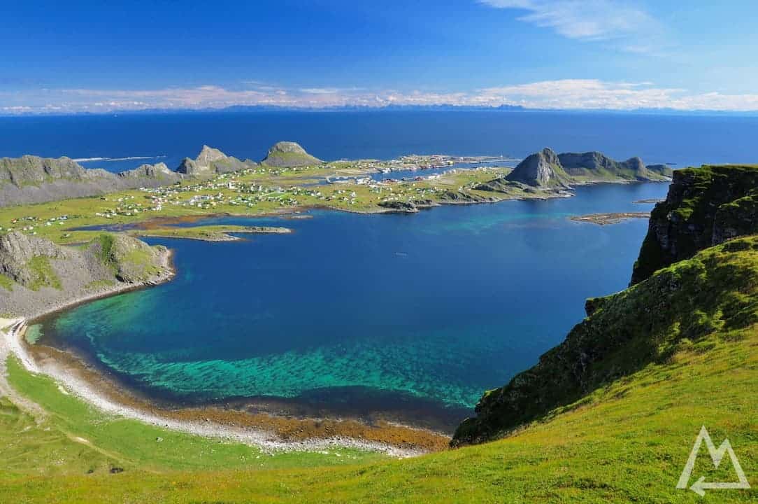
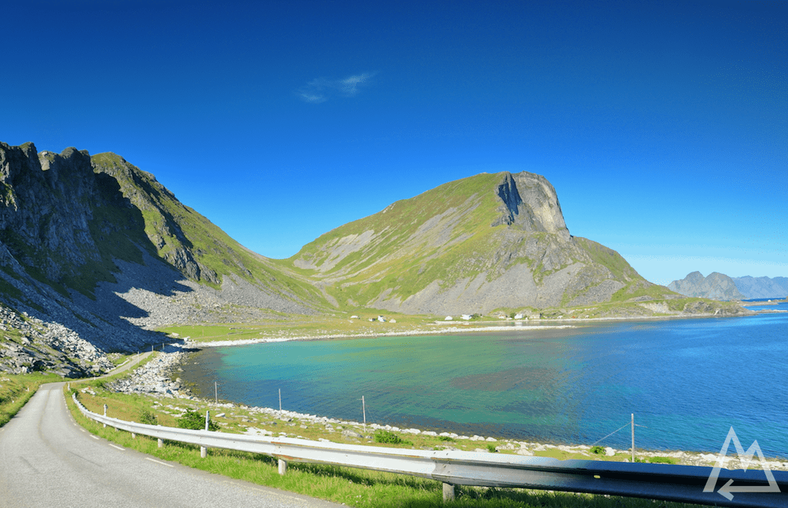
Taking the ferry from Moskenes to Værøy and from there back to Bodo is a great idea. Værøy is so cool that you want to spend a whole day there.
Værøy (island of the Lofoten)
We first went for the hike to the Mastadfjellet viewpoint. On the way up this 438m hill you can already get the Hawaiian island feeling but in the arctic circle.
Hike to Mastadfjellet viewpoint
Hike to Mastadfjellet viewpoint
Mastadfjellet viewpoint
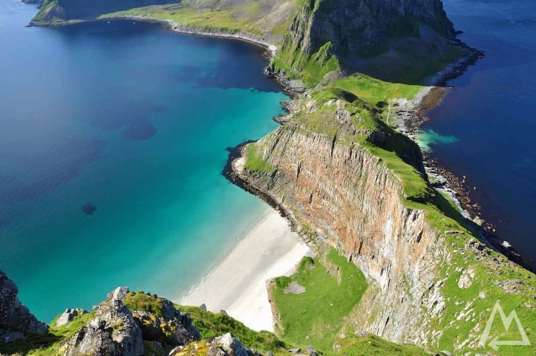
Mastadfjellet viewpoint, Punn Sanden beach
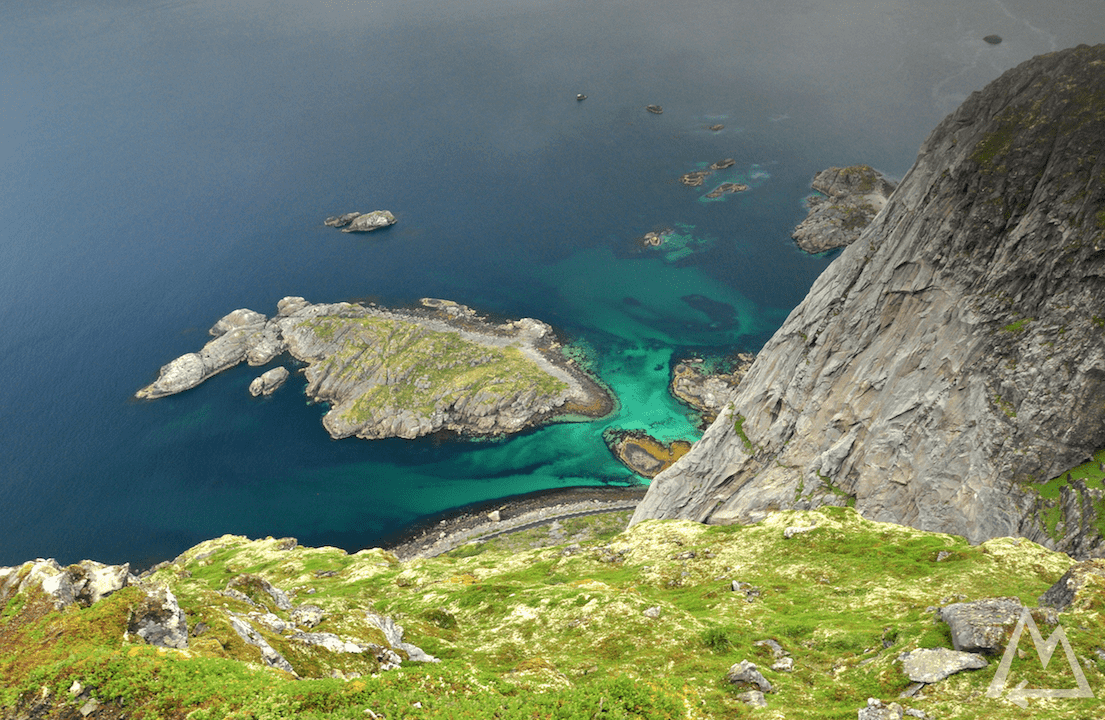
On the way back we followed the edge of the cliff with this gorgeous view down to the village of Vaeroy.
Vaeroy from Sorlandshagen
If you want to know how to take such pictures, check out our photography courses
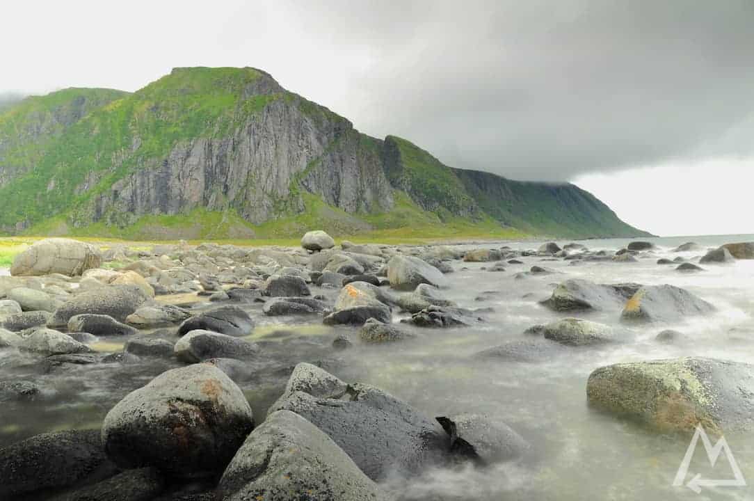
After this hike we checked out the rest of the island. After maybe 10min drive you will find this amazing place called Breivika beach.
Breivika beach
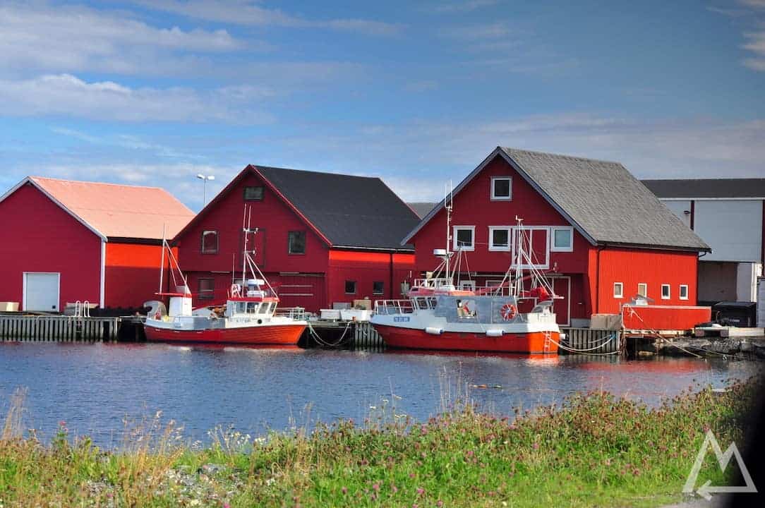
Fishermen houses in Vaeroy village
Nordland, Vaeroy
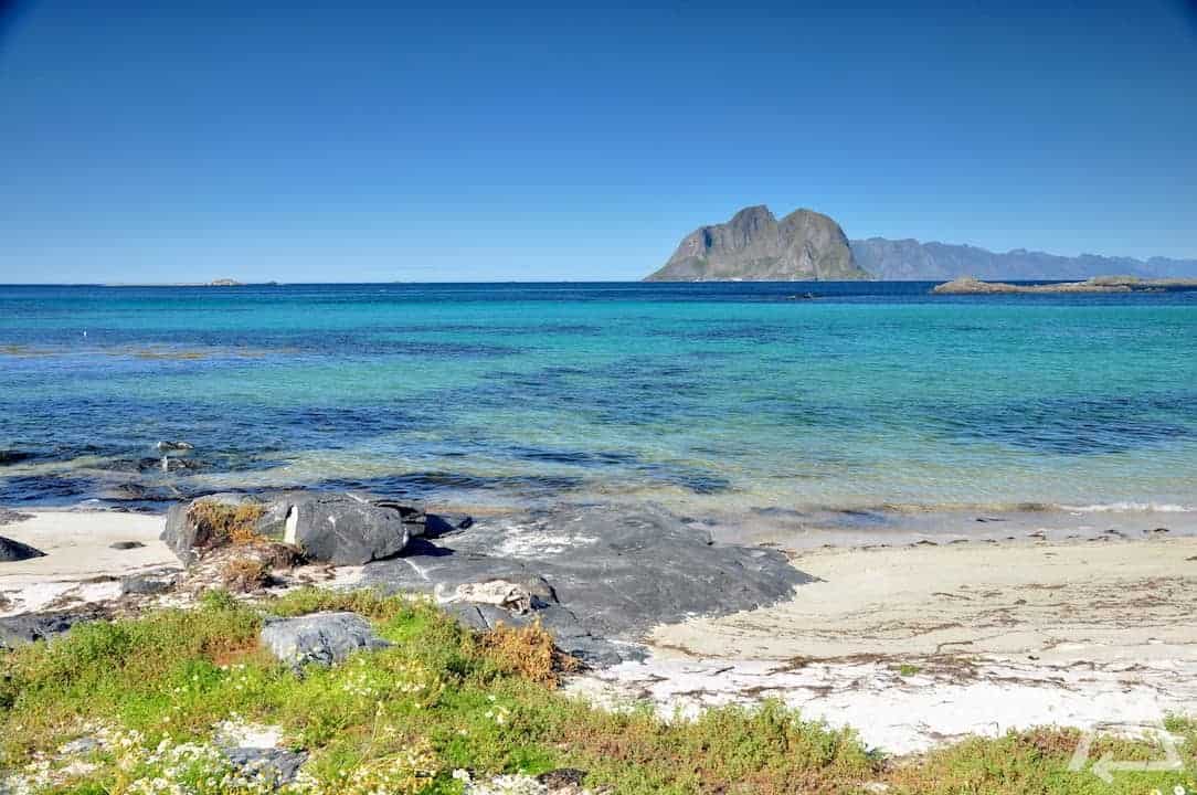
In about half an hour walking you can get to the Kvalneset lighthouse.
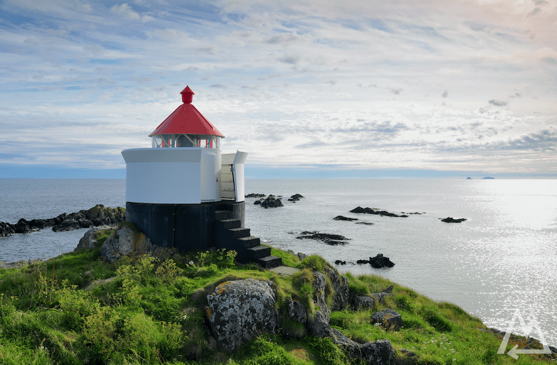
Kvalneset lighthouse in Vaeroy
After this we left this awesome island and headed back to Bodo. From there you can visit the Setergrotta. A guided cave tour where you crawl through narrow cave tunnels and do other crazy stuff await you. Check out this link if you’re interested.
Another place to make a stop is called Torghatten. Open this link for more informations. There’s a 160m long and 35m high natural hole in a mountain. On the way back to Oslo make a stop in Lillehammer and check out the Olympic ski jumping hill, it’s quite impressive.
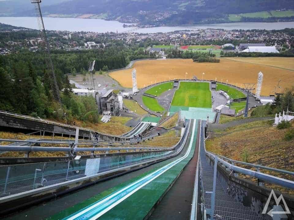
Olympic sky jumping hill in Lillehammer
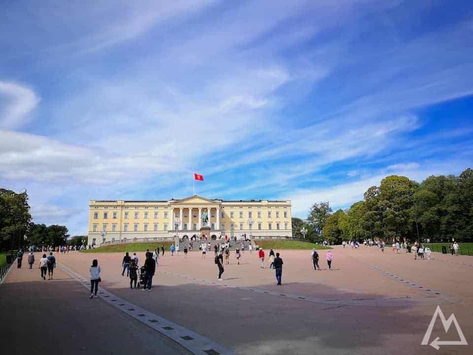
Finally, we headed back to Oslo, did a last sightseeing in the town and prepared for our flight back.
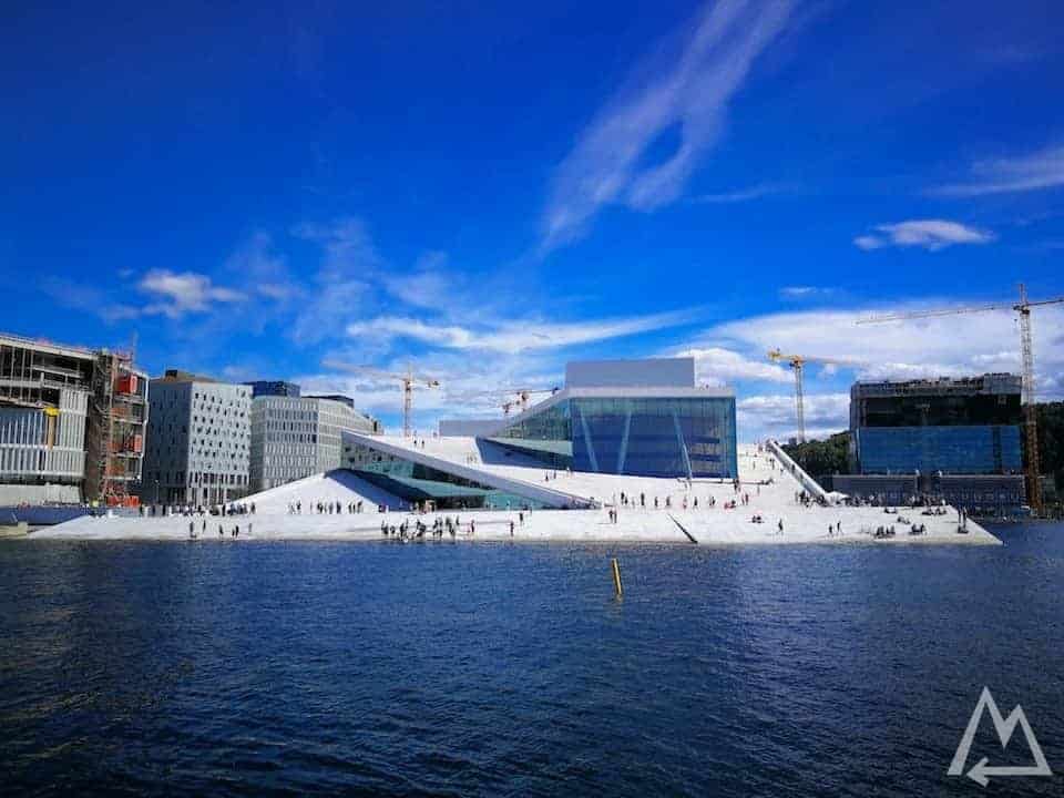
Opera House in Oslo
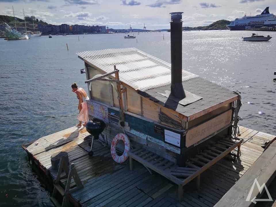
Sauna near the opera house in Oslo
Kingdom of Norway
Click here and sign up to get our new eBook for free.

We hope this post is helpful and inspiring.
Please let us know if anything is missing or misleading.