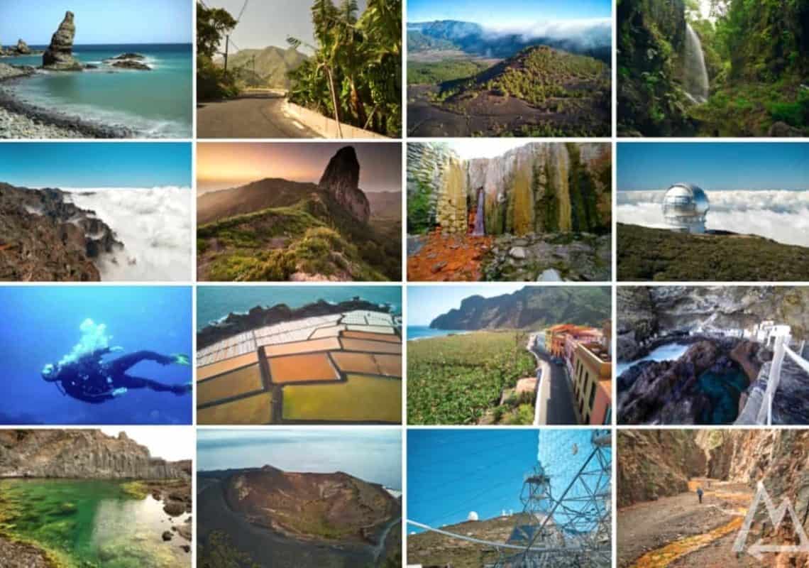
The best places to visit in La Palma & La Gomera, Canary Islands, Spain
See all the awesome places of La Palma & La Gomera with this master plan in just one week. Impressive volcanos, turquoise lagoons, colourful salt pans, laurel forests, impressive waterfalls, a secret smugglers’ cove and tons of banana fields. With this plan you won’t miss any great spots and see it all in one week.
Trip overview:
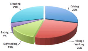
- 1 week
- 1000 km (by car)
- 45 km (by foot)
- 2 ferries to take
- 10 mountains to mountaineer
- 2 volcanos to hike
Exploring La Palma
Day 1 (east & north):
We started in Santa Cruz (Airport) de La Palma, picked up our rental car, quickly visited Santa Cruz and then checked out the first spot on the list Playa de Nogales. An insane coastline with black beaches and huge colourful cliffs welcomes you after a short walk and you can go for a stroll or a swim.
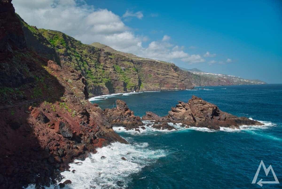
Playa de Nogales
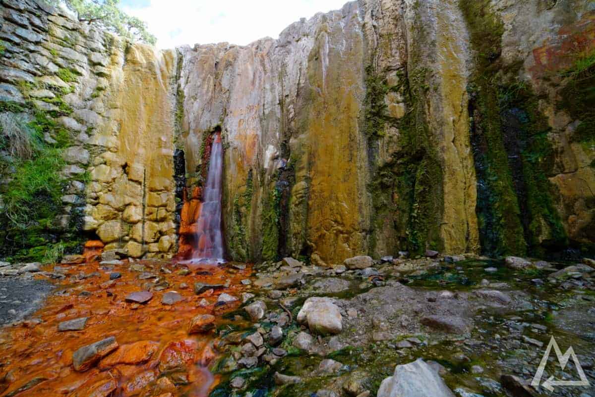
The next place to stop is Cubo De La Galga. It’s a huge laurel forest to spend time in. The most popular hike takes around four hours or 11km. We skipped it due to limited time on the first day. Continuing the road further east you need to stop at the place Cascada de los Tilos. After a 5 min walk you’ll arrive at this awesome spot.
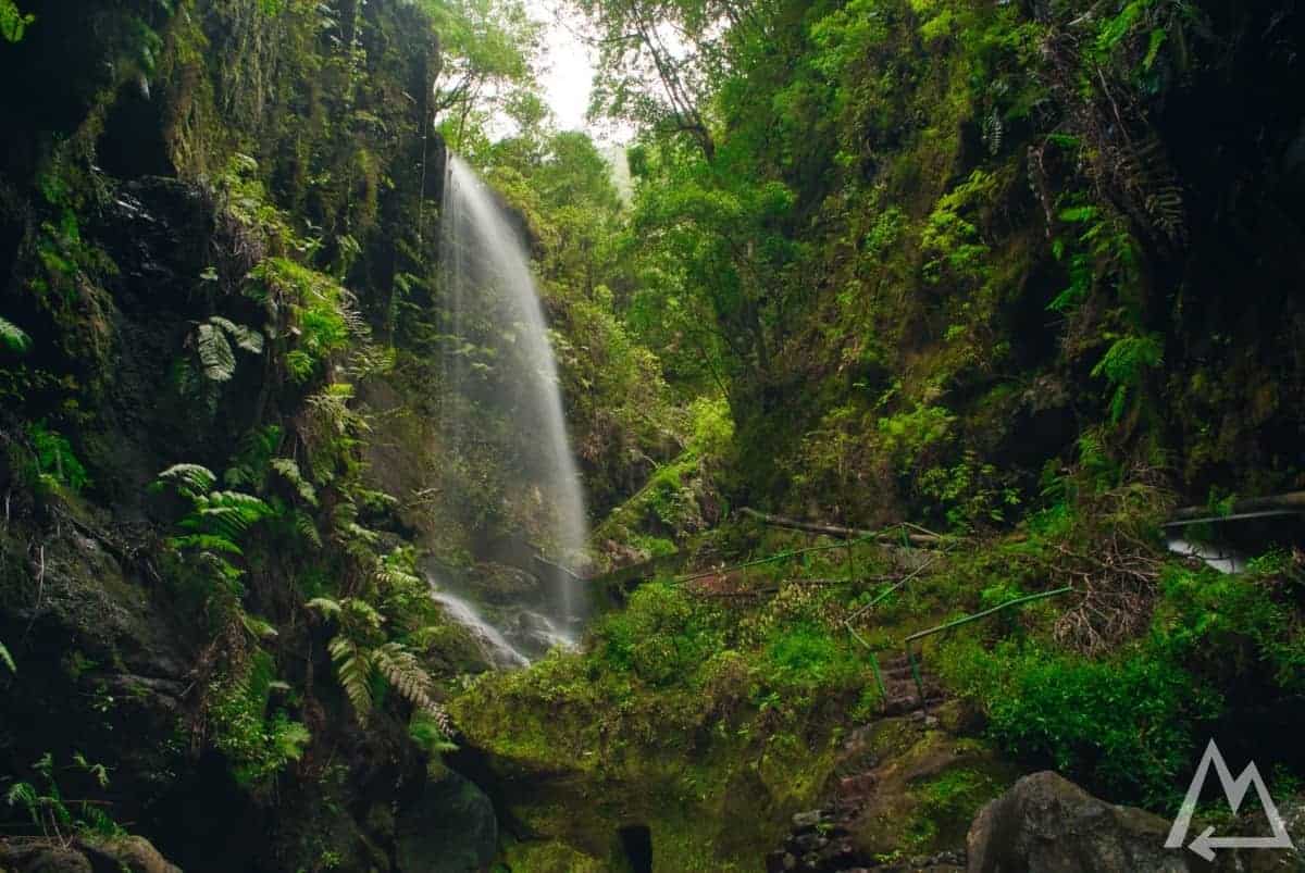
Cascada de los Tilos
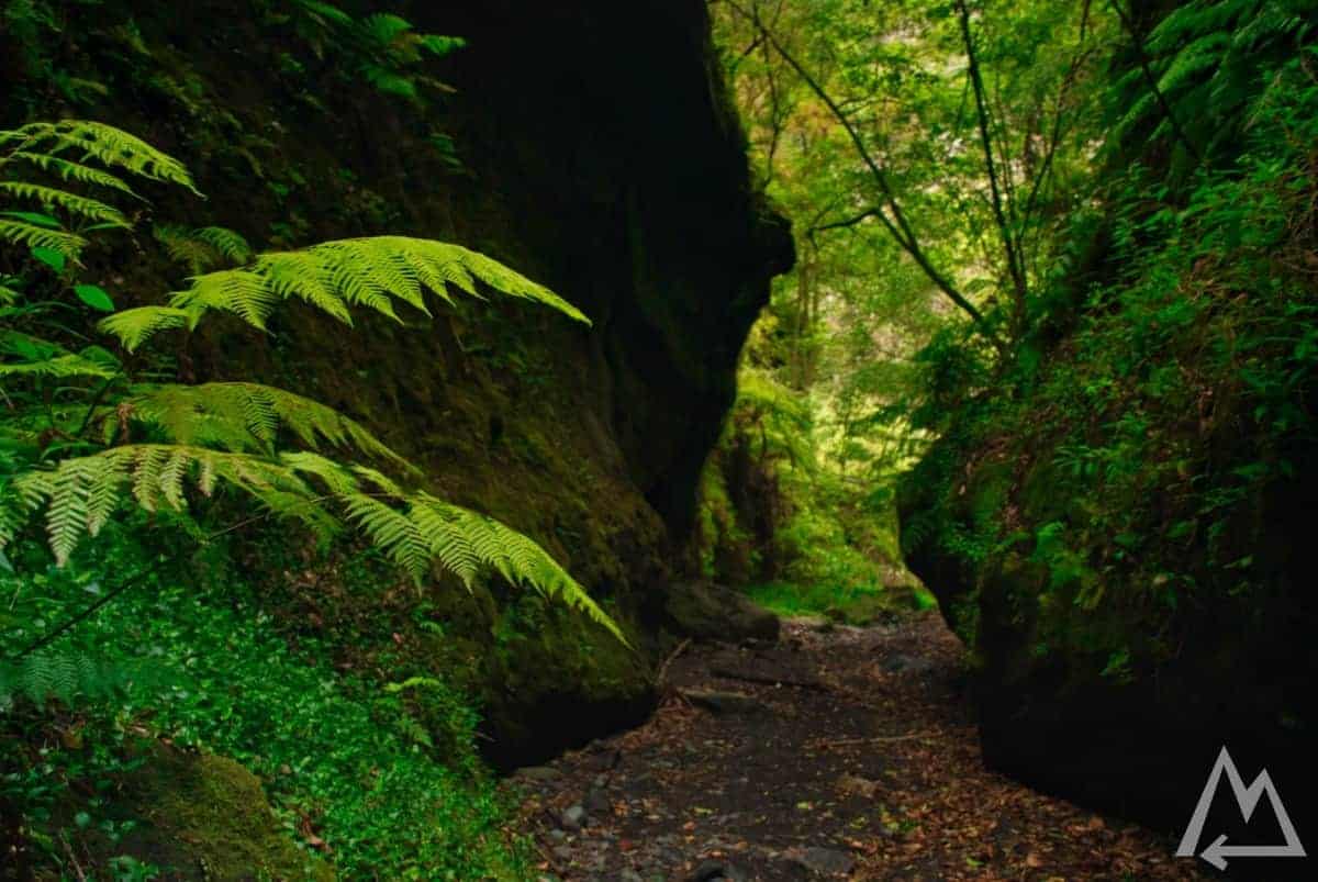
Cascada de los Tilos
If you intend to explore the area a little bit more you can hike up the path from the visitor centre to Mirador de las Barandas. After approx. 30 min you’ll be rewarded with this awesome view.
Mirador de las Barandas
Heading back to the coast further north, you can stop at Charco Azul. The natural pools are inviting for a bath.
Charco Azul
Charco Azul
Charco Azul
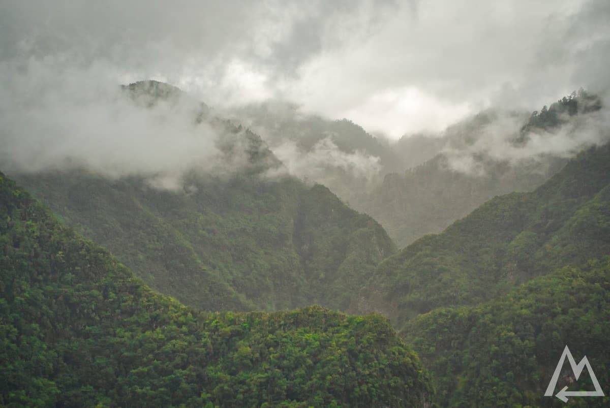
The northern part of the island is usually cloudy, nonetheless it’s a lot of fun to hit the streets there and enjoy the light show of sun, clouds and forest.
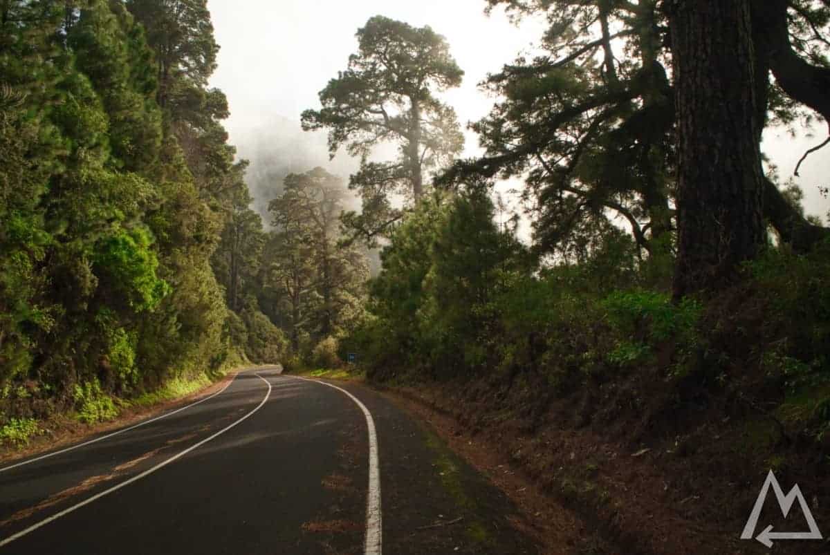
North of La Palma on the road
After this, enjoy some great dinner with fish, mussels and local white wine.
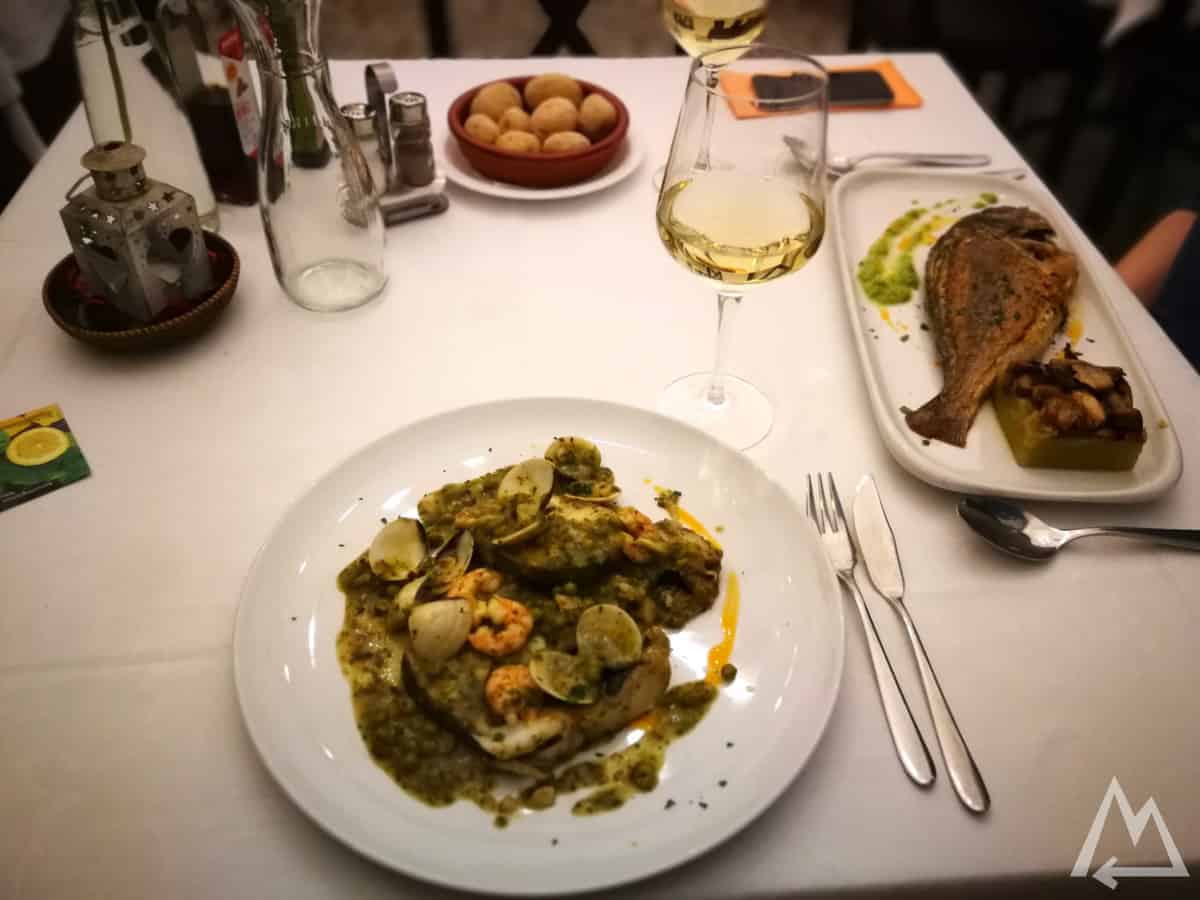
Local fish and mussels in Los Llanos
Day 2 (north & west):
Next stop is Prois Candelaria, an old smugglers’ cove with tiny houses built under the overhanging lava cliff. You will need to walk about 10 minutes on a narrow path along the coast line.
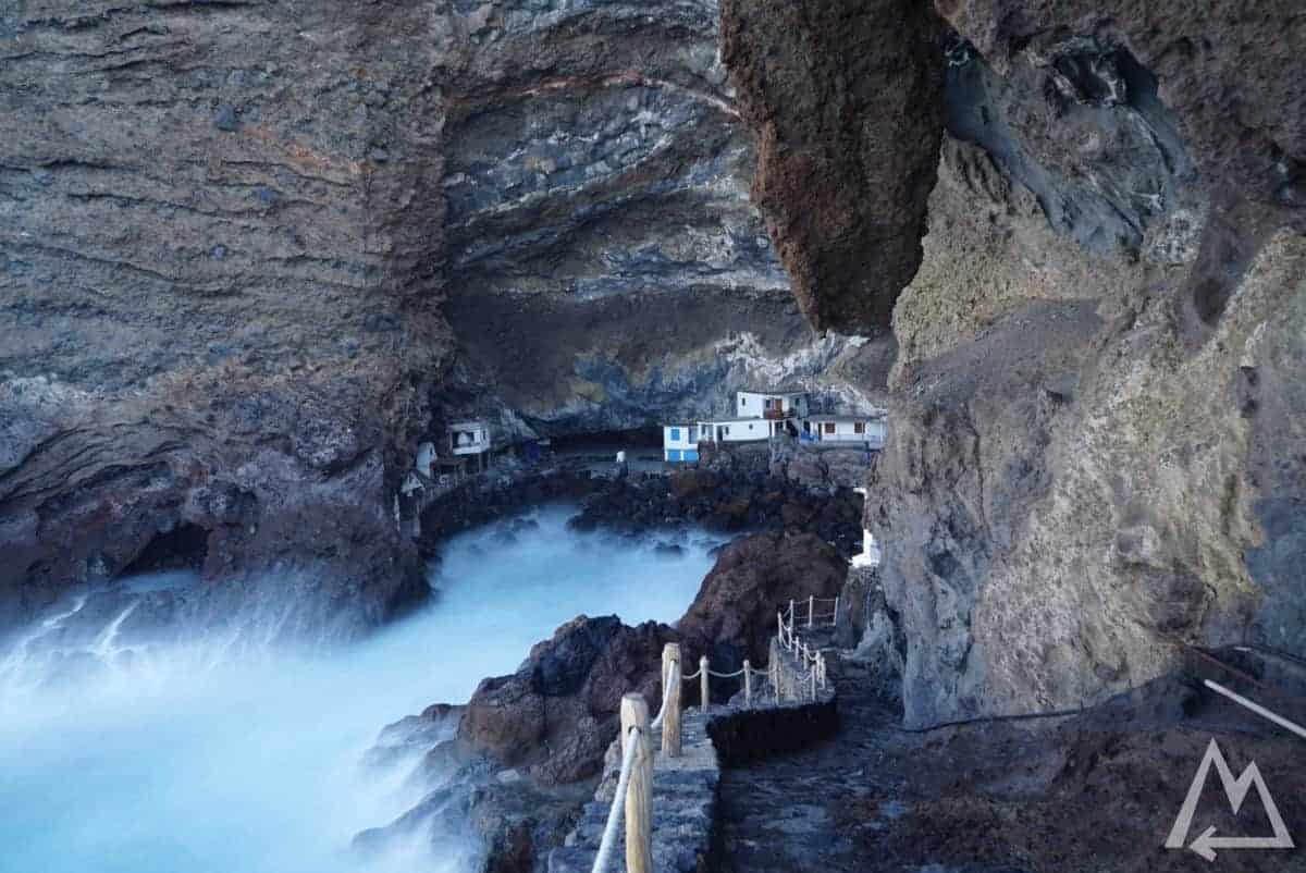
Prois Candelaria

Prois Candelaria
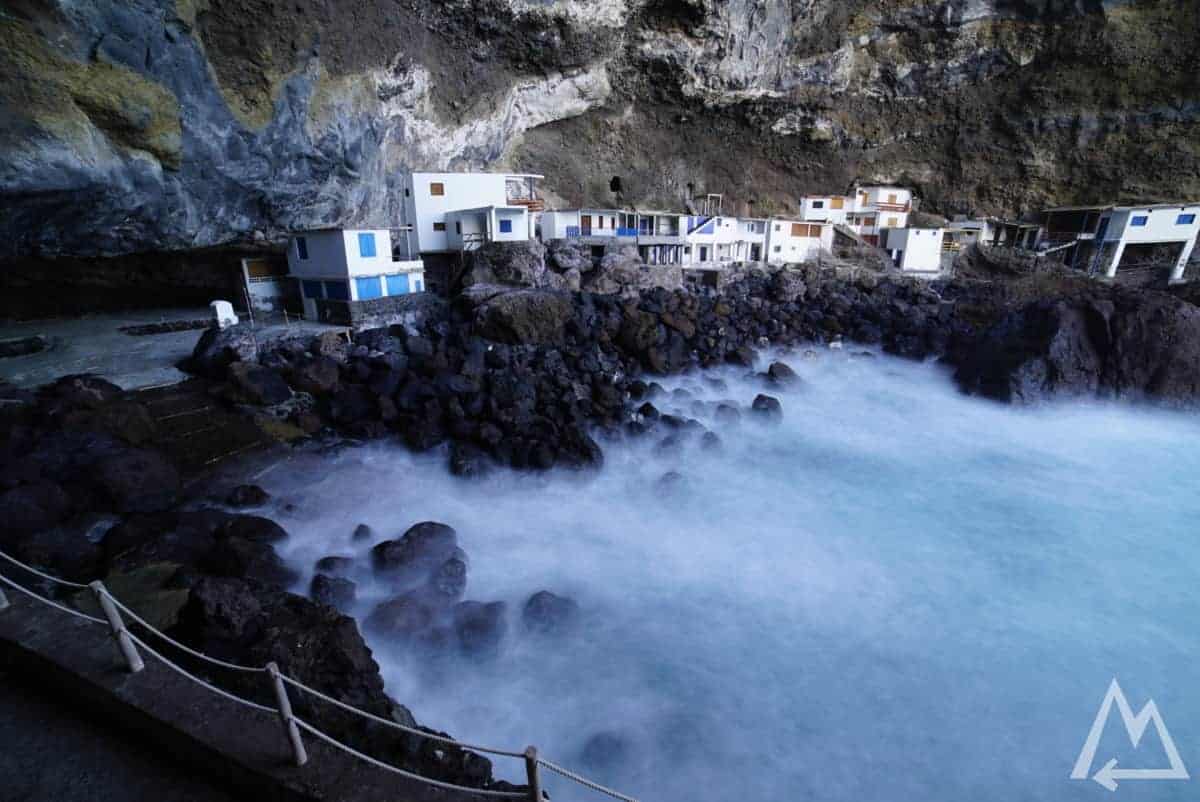
Prois Candelaria
If you want to know how to take such pictures, check out our photography courses
Further north you need to visit the place Roque de Santo Domingo.
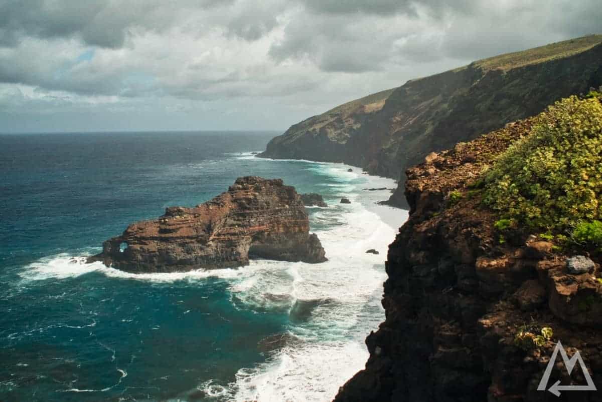
Roque de Santo Domingo
Head up the mountain to stop at Mirador Los Andenes and check out this contrasted view.
Mirador de los Andenes
A little further up you’ll pass the Astrophysical Observatory of the island.
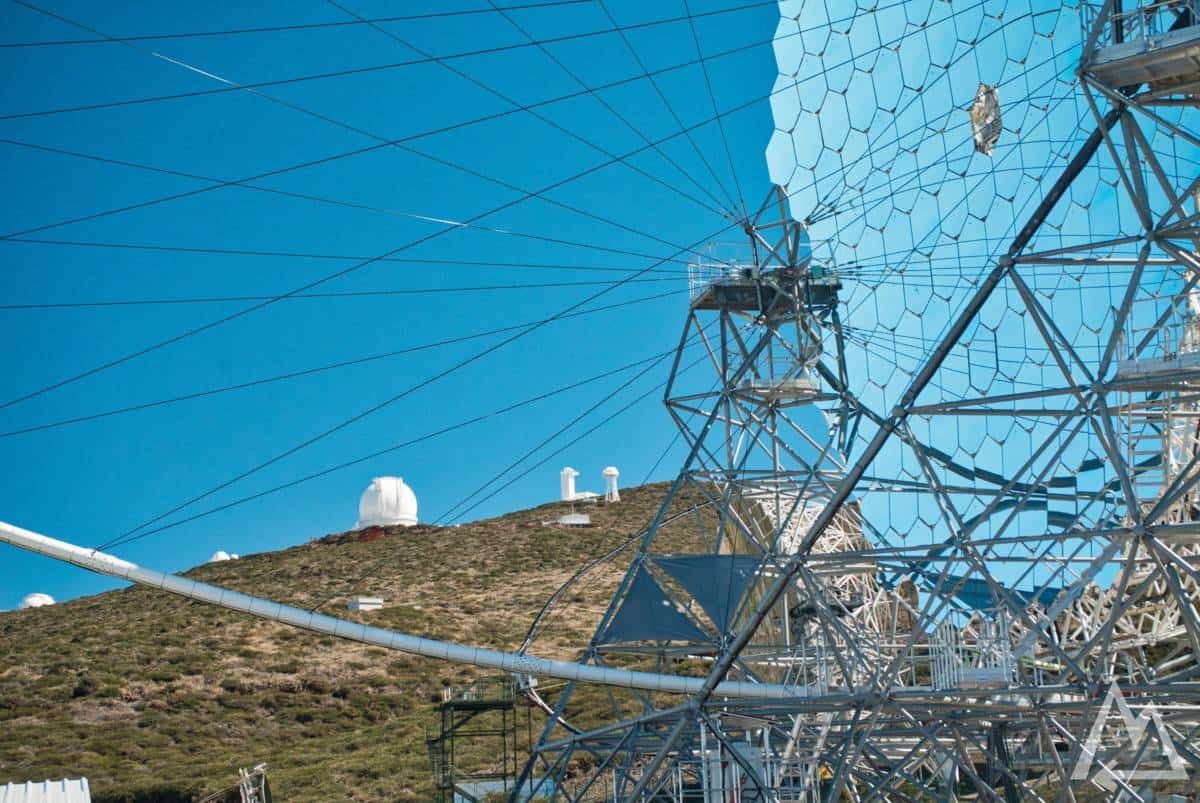
MAGIC Telescopes (Major Atmospheric Gamma-Ray Imaging Cherenkov)
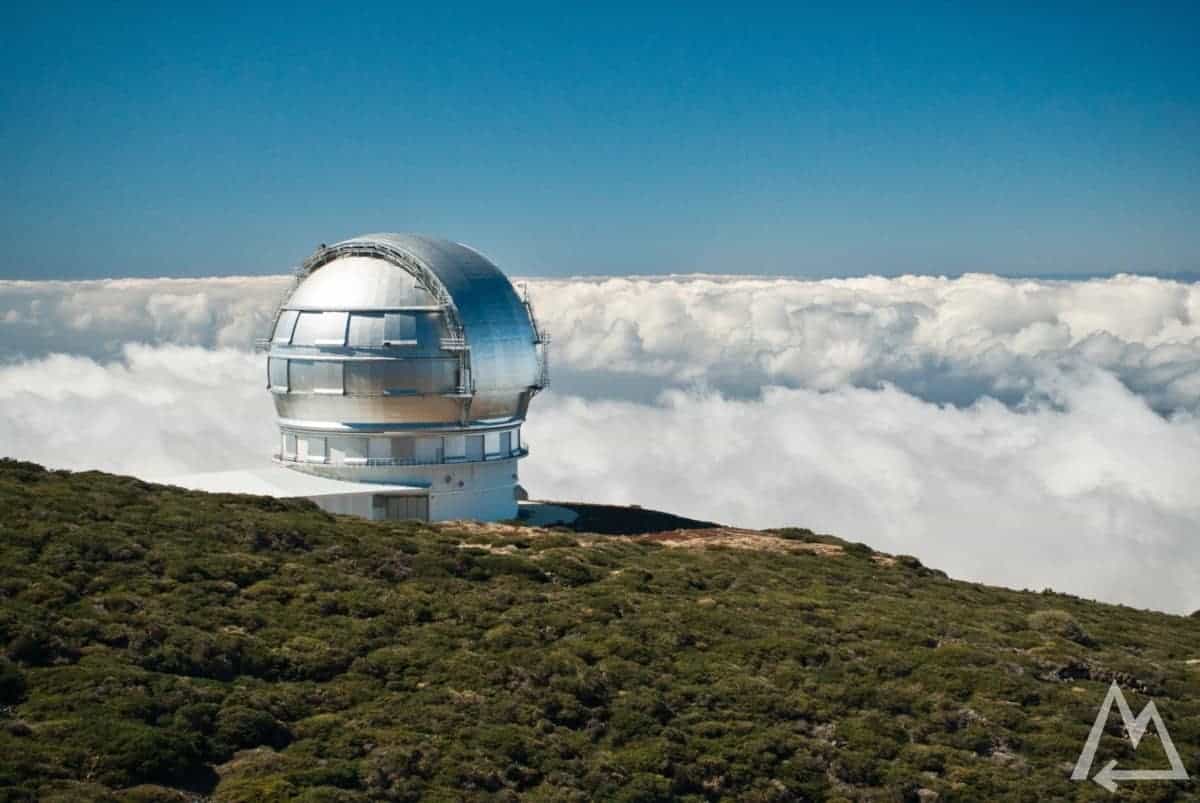
Gran Telescopio Canarias
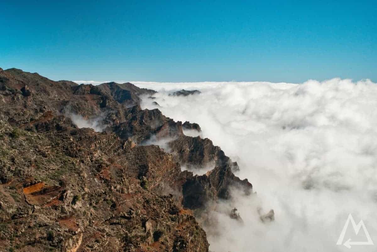
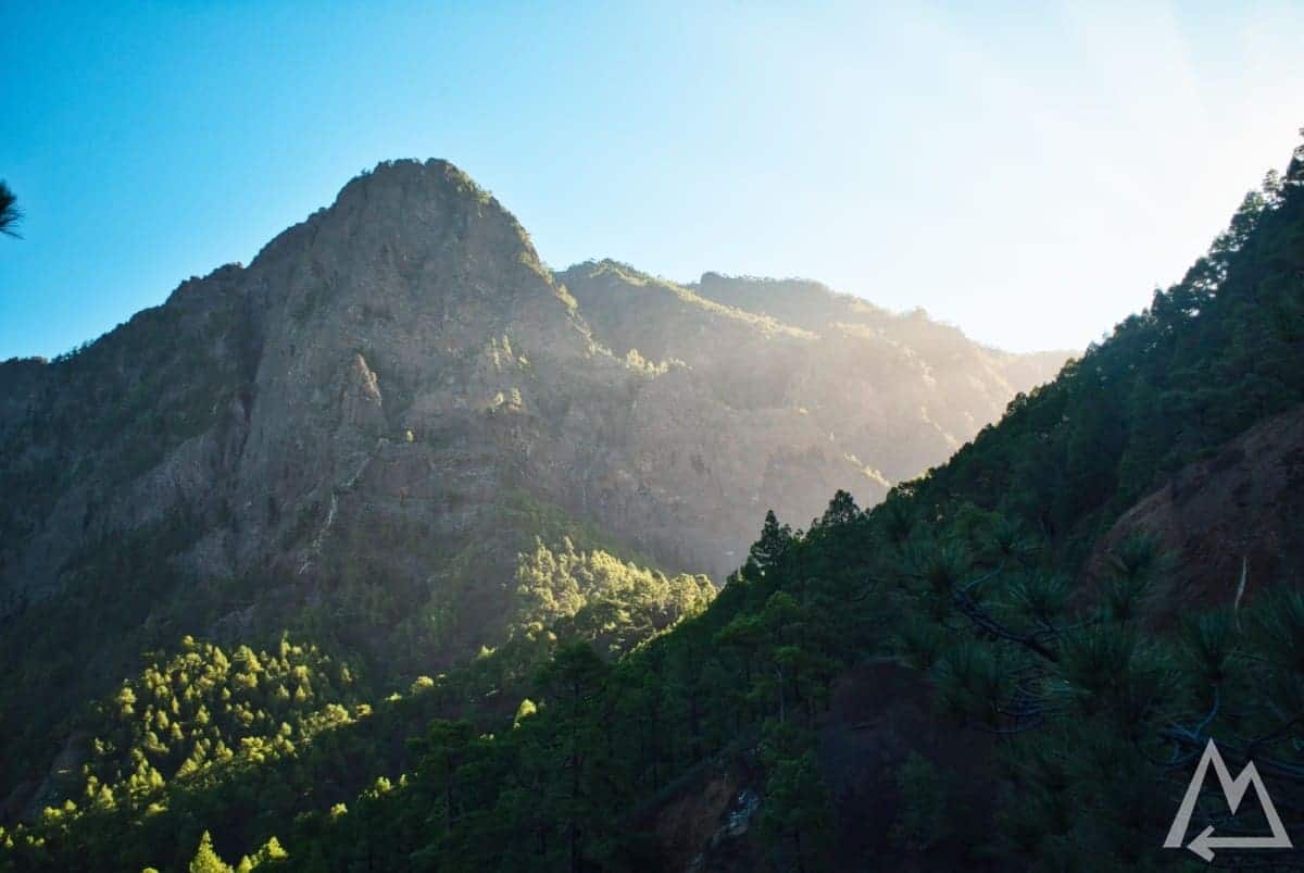
Continuing the road up to the highest point of the island with 2500 m ASL called Roque de los Muchachos you’ll get this view. If you are up there on a day without clouds you can see the big crater of the Caldera de Taburiente National Park.
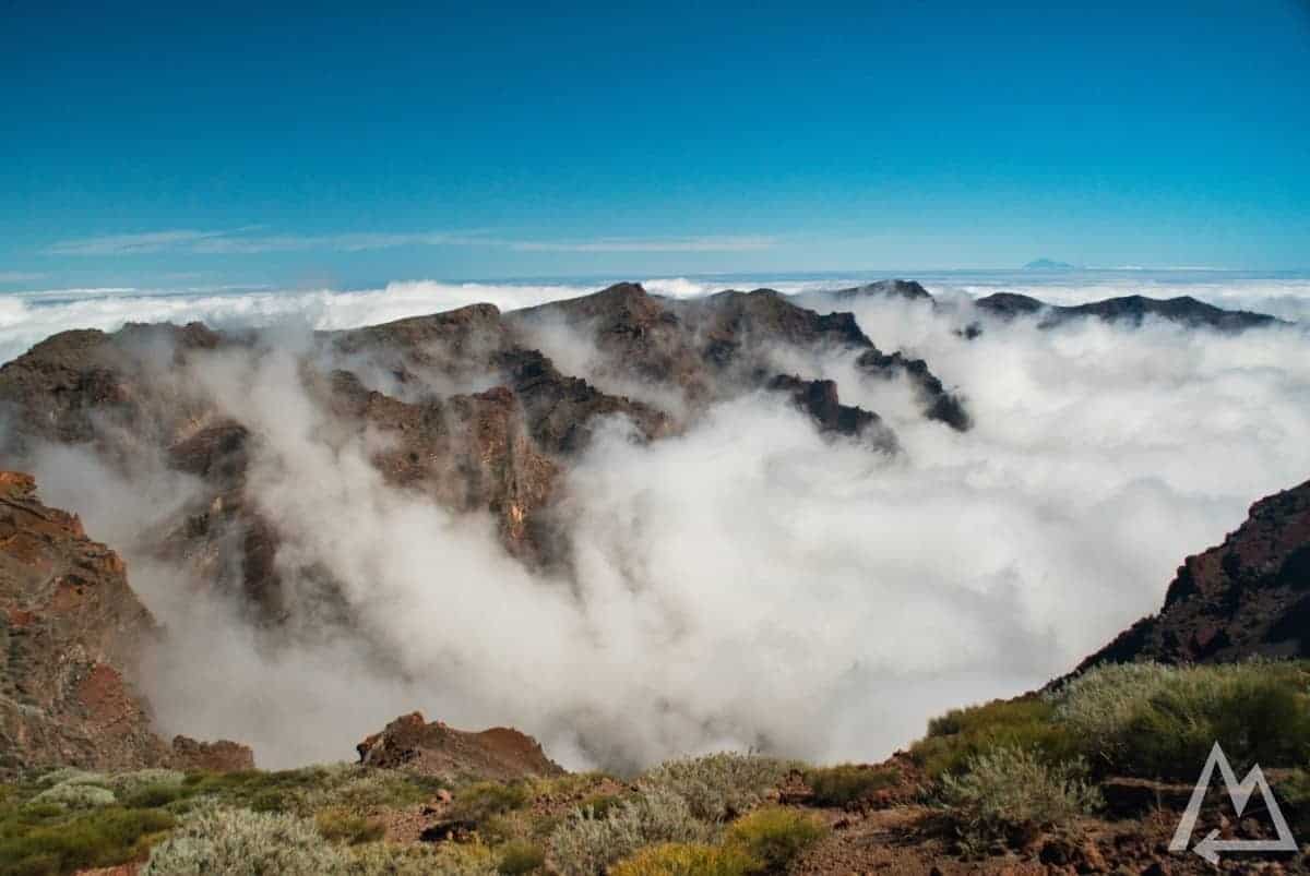
Roque de los Muchachos
Next on the list is Mirador de El Time. A very well situated restaurant with great view on the valley and the city Los Llanos where we stayed. We went during the winter months so it’s usually better to stay in the western part of the island as the weather is by far better than in the eastern part like Santa Cruz de La Palma.
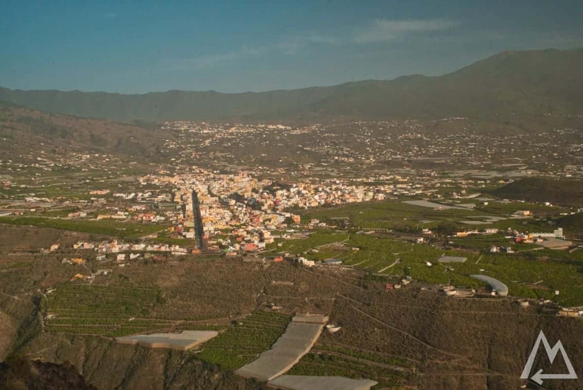
Mirador de El Time
Day 3 (center):
Next place to visit is called Mirador de la Cumbrecita. Make sure to get a reservation for the entry of the park a few days before you go there as the parking space is extremely limited and packed with all the tourists. You’ll get the reservation done either online under this link or at the Visitors Center Caldera de Taburiente. The most famous and easiest hike there goes to Mirador Lomo de las Chozas & Mirador de los Roques.
Mirador de la Cumbrecita
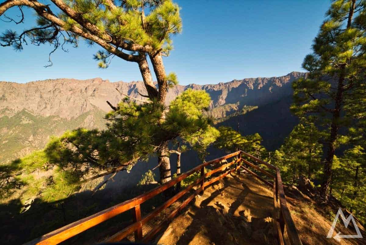
Mirador Lomo de las Chozas
Mirador Lomo de las Chozas
Mirador Lomo de las Chozas
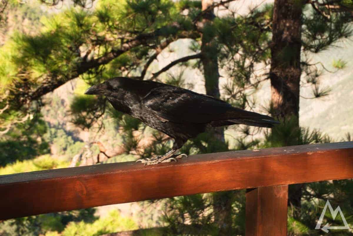
At one of the Miradors we encountered a friendly raven that traded a 1 Euro coin for some crumbles of a chocolate cookie.
Mirador Lomo de las Chozas
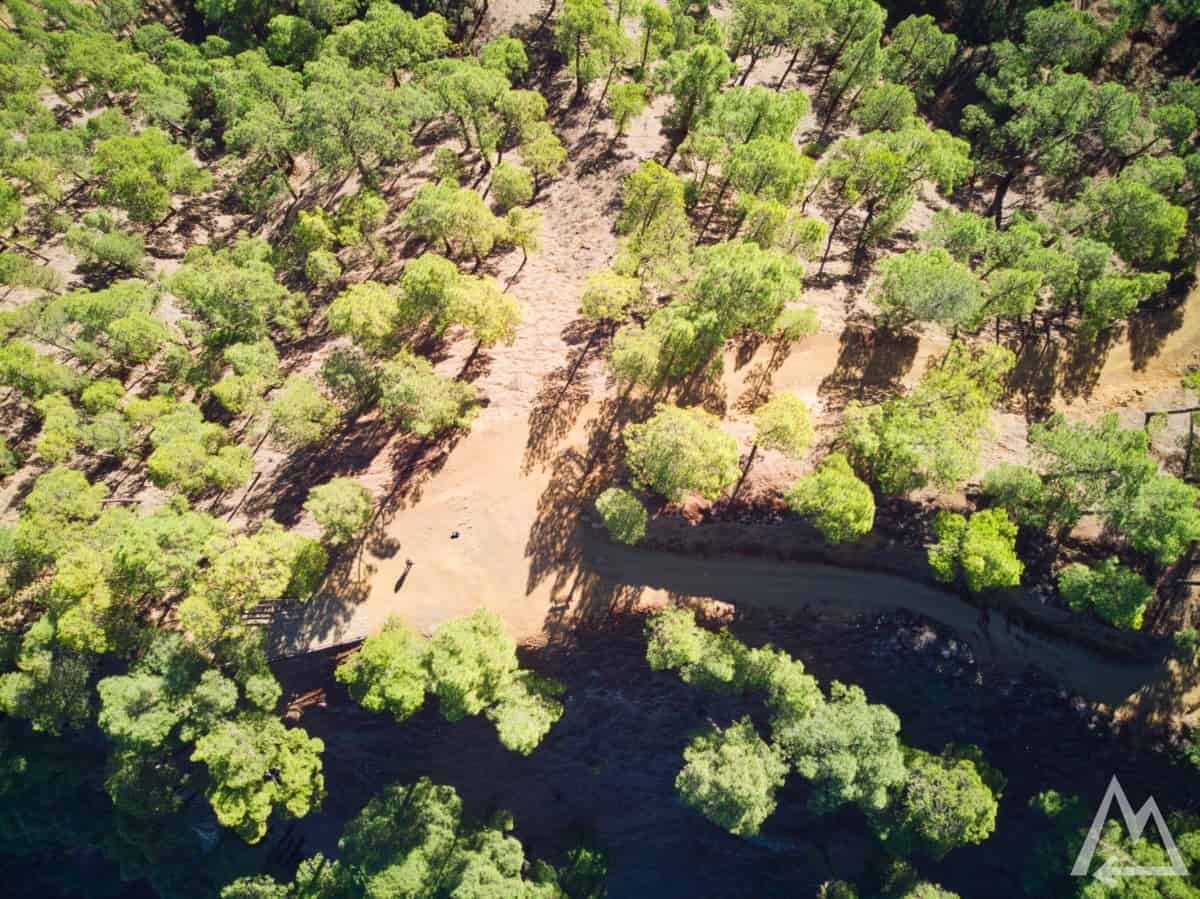
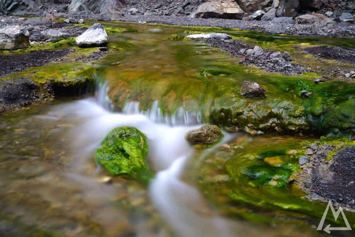
Next place to visit is Mirador de Los Brecitos. The parking places up there are even more limited, therefore park the car down in the valley at the big parking lot where you walk along the river Barranco de las Angustias, called Estacionamiento de la Caldera de Taburiente. If you want to visit the colourful waterfall Cascada de los Colores as shown below you can either share a cab that brings you up the mountain to go for the big tour or just follow the riverbed up for about 2.5 hours or 5.5 km (roundtrip takes around 5-5.5h for 11 km).
Cascada de los Colores
The riverbed of Barranco de las Angustias and the valley you follow may be even more fascinating than the actual waterfall as they change color every kilometre.
Barranco de las Angustias on the way to Cascada de los Colores
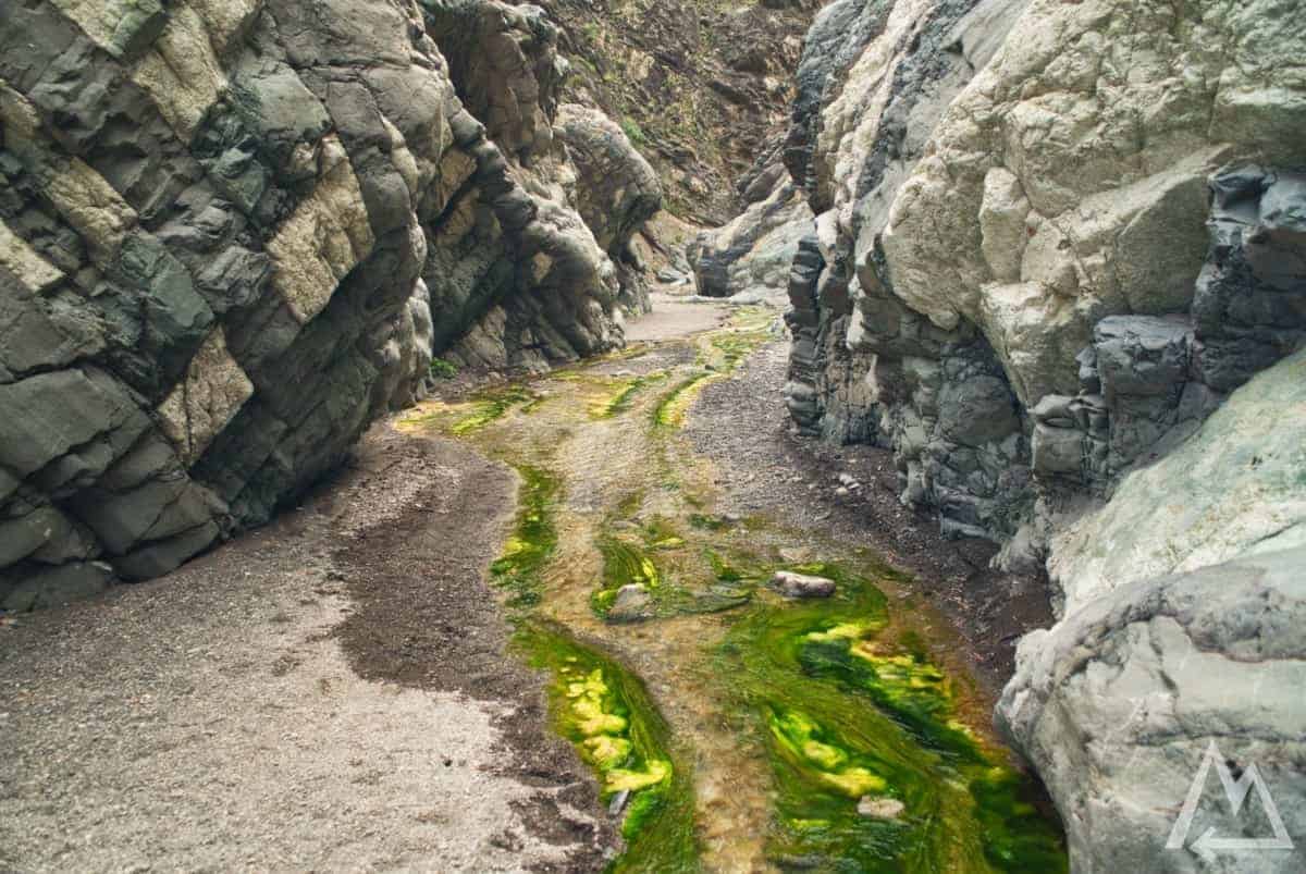
Barranco de las Angustias on the way to Cascada de los Colores
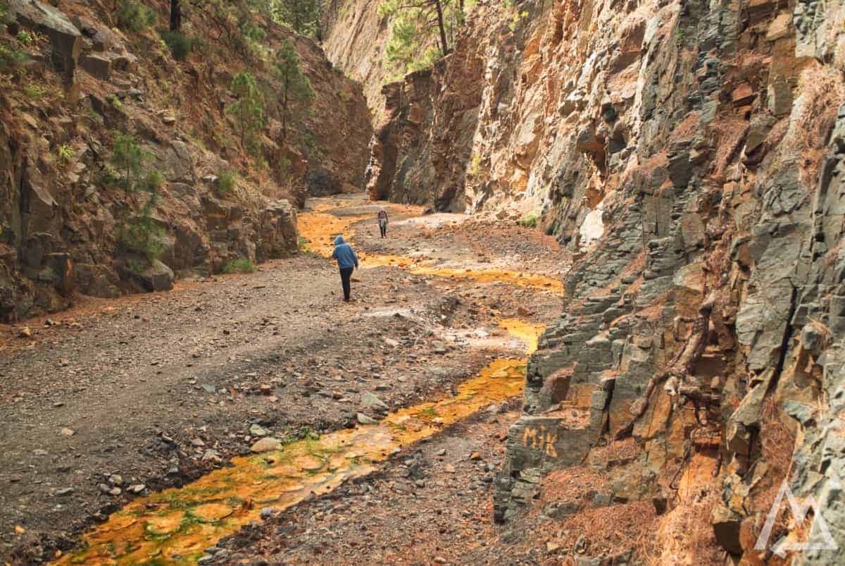
Barranco de las Angustias on the way to Cascada de los Colores
After this journey you need some traditional canary food like this.
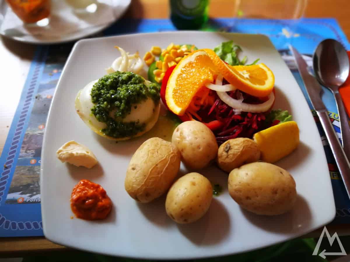
Traditional canary food (wrinkly potatoes with mojo sauce and sea food)
Day 4 (south):
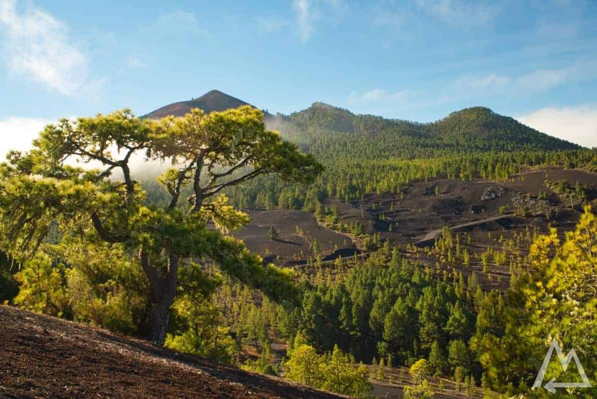
Start the day with some really good volcano scenery at the place called Mirador Astronómico del Llano del Jable. Make sure to explore the area by car and foot. In certain conditions, the clouds flow over the crater ridge down into the valley and create this stunning picture.
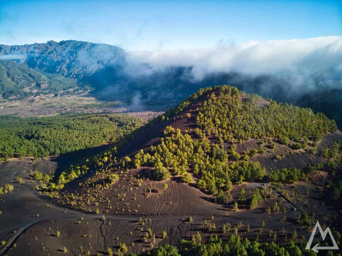
Llano del Jable
Llano del Jable
Llano del Jable
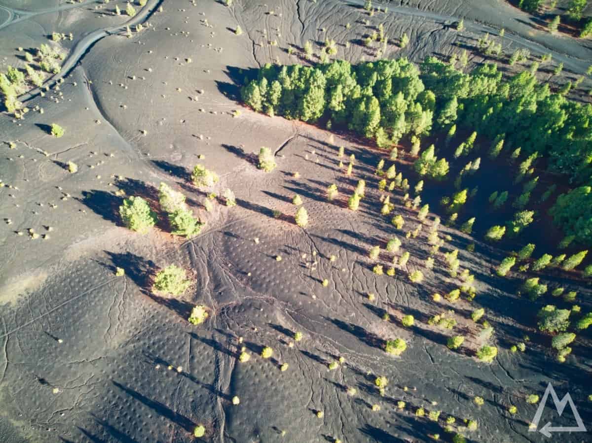
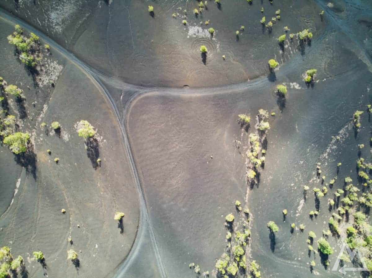
We walked up the hill in the first picture and had this breathtaking view on the mountain side.
Llano del Jable
Llano del Jable
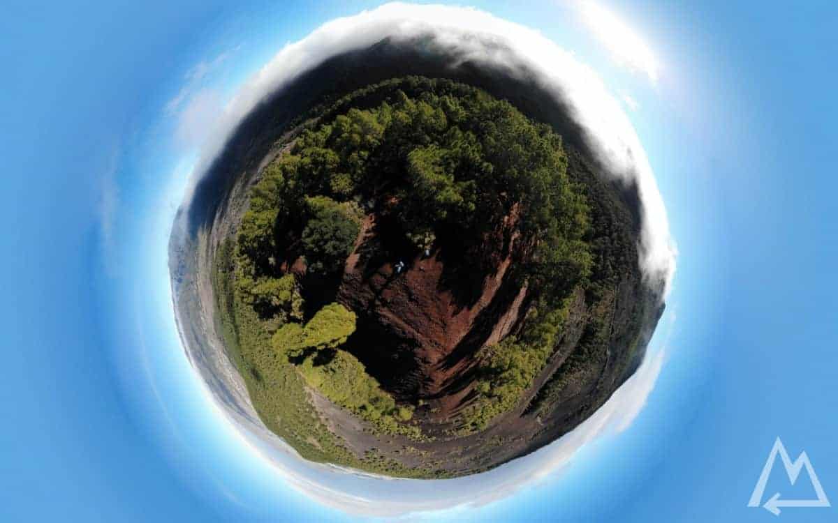
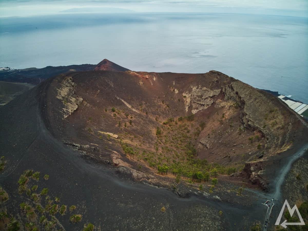
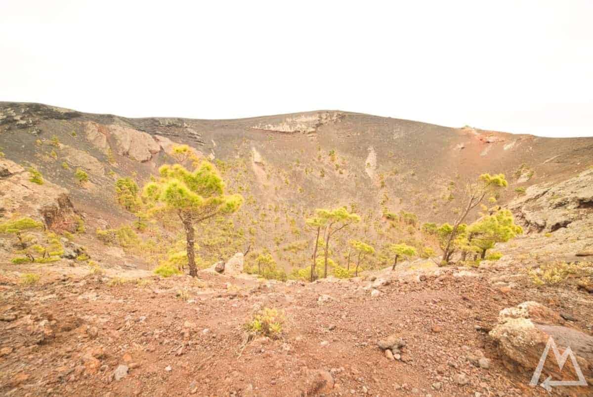
Further south you find the spot Mirador Volcán de San Antonio. For 5 Euros they let you walk on a pretty darn fresh volcano crater ridge. The last eruption was in 1971 and the surface temperature at some places still reaches more than 200°C.
Mirador Volcán de San Antonio
Mirador Volcán de San Antonio
At the end of the path you’ll have a great view on another very well preserved and protected volcano.
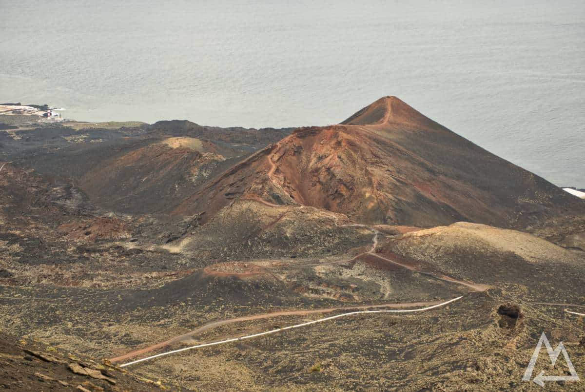
Mirador Volcán de San Antonio
On the southern most tip of the island the place Salinas de Fuencaliente is definitely worth a visit. Not only to learn more about how to make sea salt but also to take a bite in the restaurant there. The food and the beer are delicious.
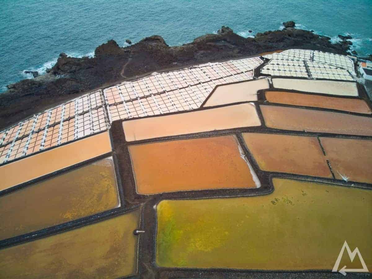
Saline de Fuencaliente
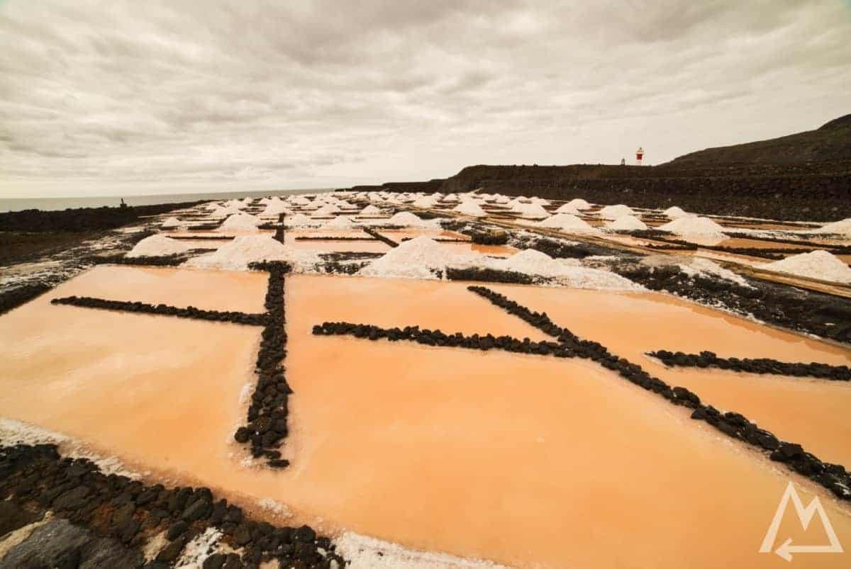
Saline de Fuencaliente
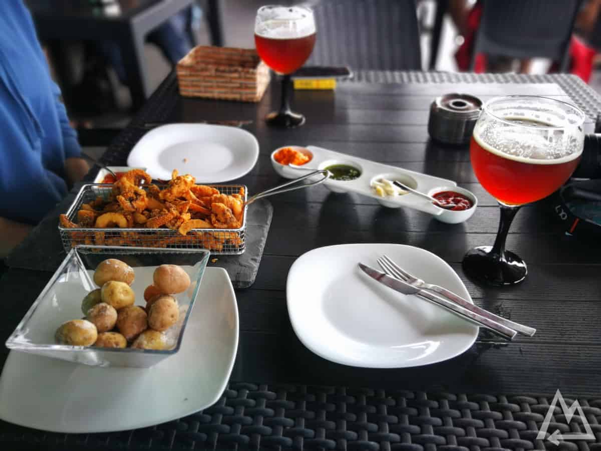
Saline de Fuencaliente (potatoes with mojo sauce and sea food)
Only a 5 min drive from Saline de Fuencaliente and you’ll reach Playa Echentive. When you walk down to the beach and follow the rock to the right you’ll want to take a swim in this breathtaking natural pool, the colours are just unbelievable.
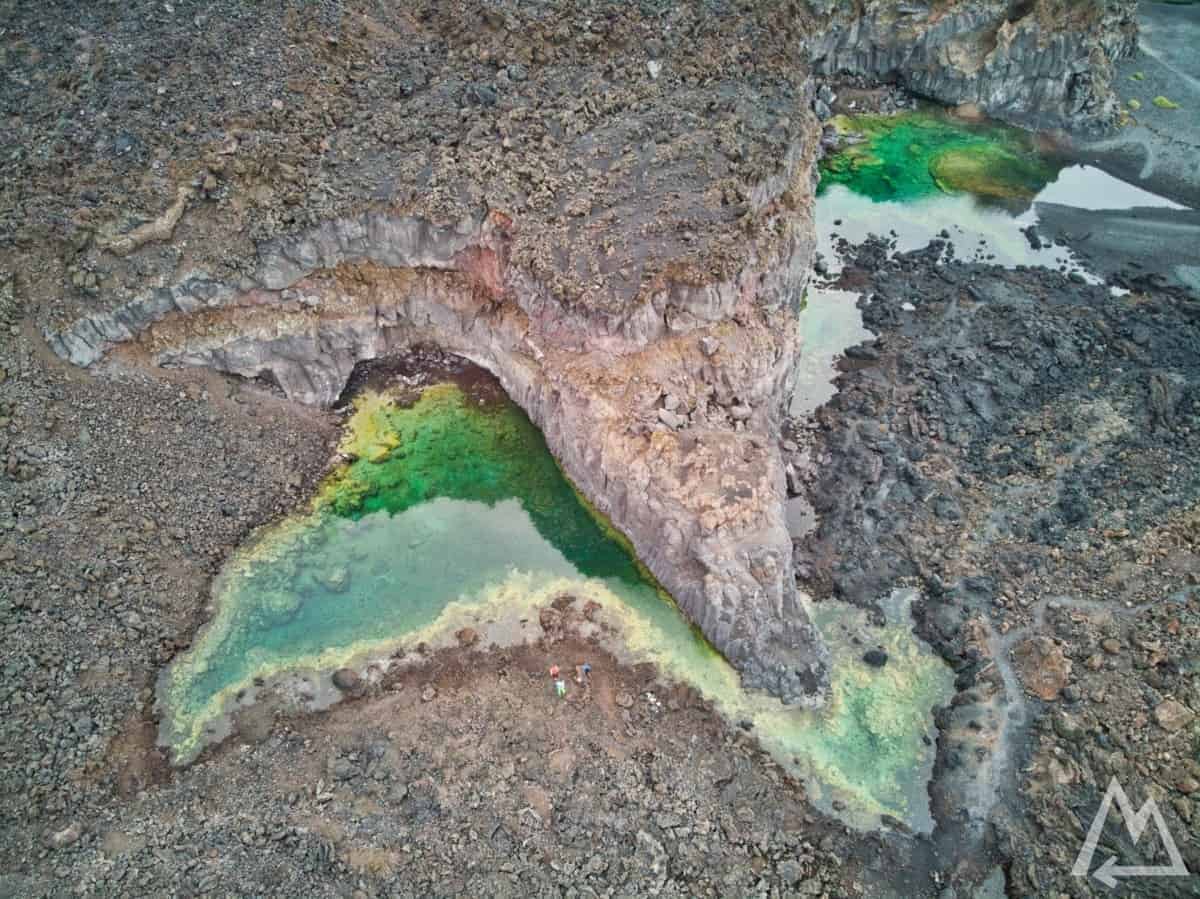
Playa Echentive
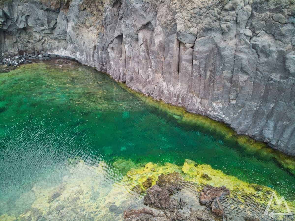
Playa Echentive
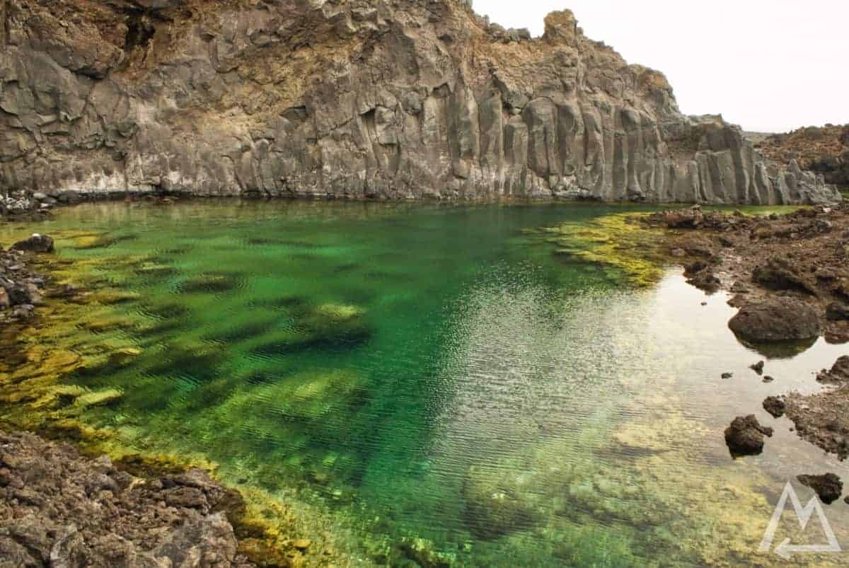
Playa Echentive
Day 5:
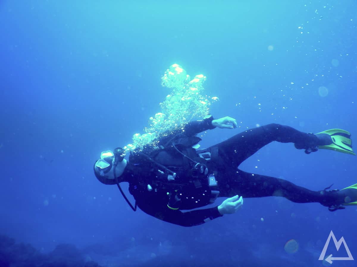
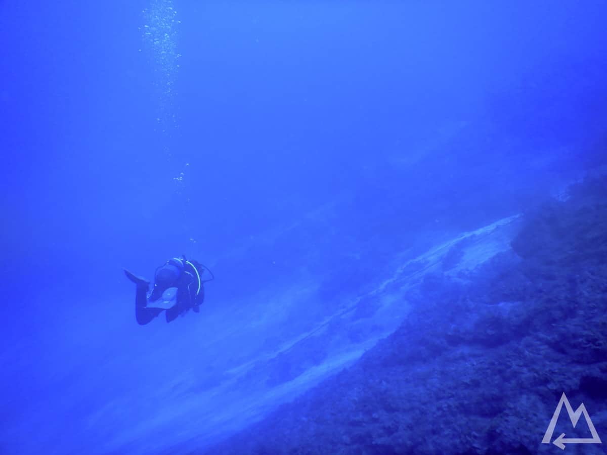
Depending on your preferences and traveling speed this is a buffer day. We spent the day diving in the area of La Bombilla to see where all the lava ended up after flowing into the ocean.
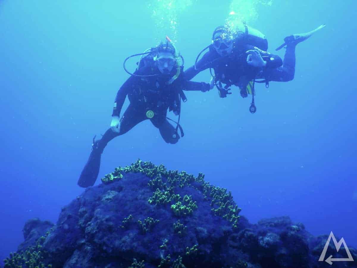
Diving in La Bombilla
Diving in La Bombilla
Diving in La Bombilla
We saw lots of spider crabs, …
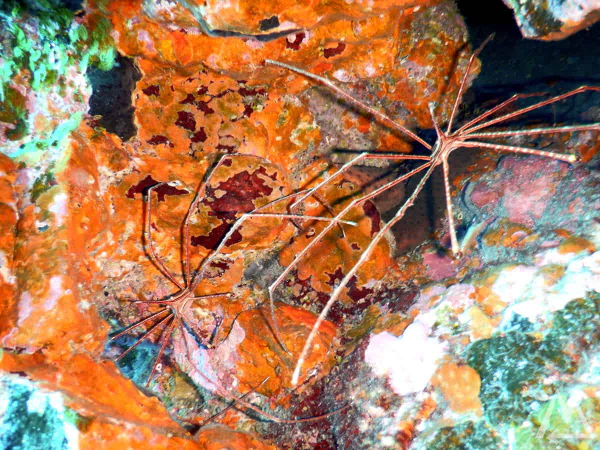
Spider crabs in La Bombilla
…different types of corals, …
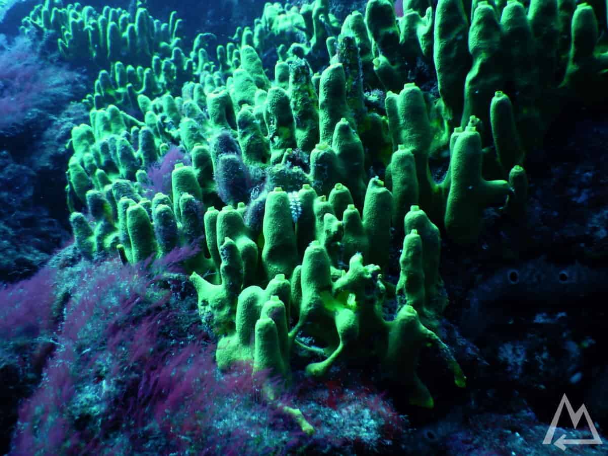
Corals in La Bombilla
…some very strange micro organisms, …
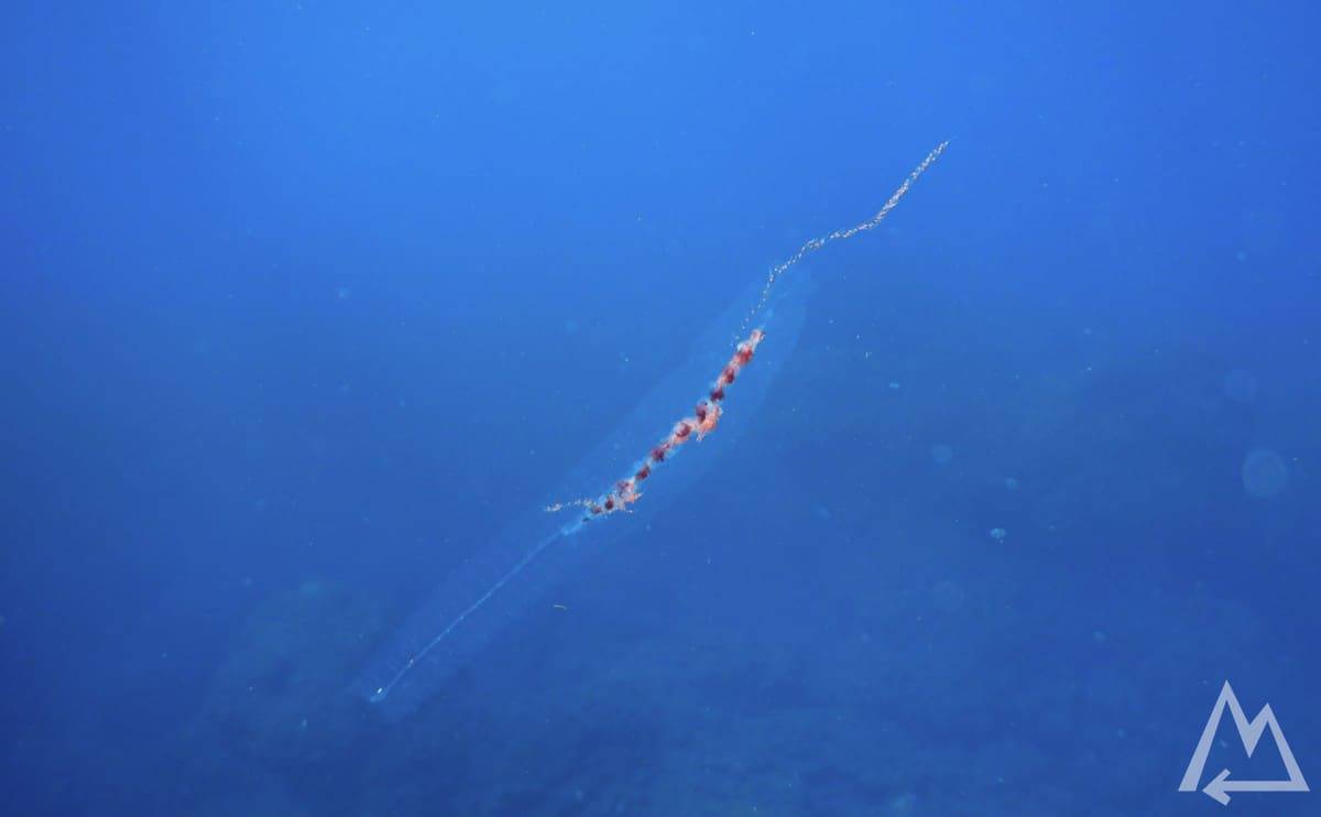
Microorganisms in La Bombilla
…and even spotted an eagle ray.
Day 6 (Day trip to La Gomera):
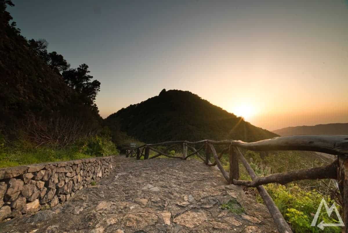
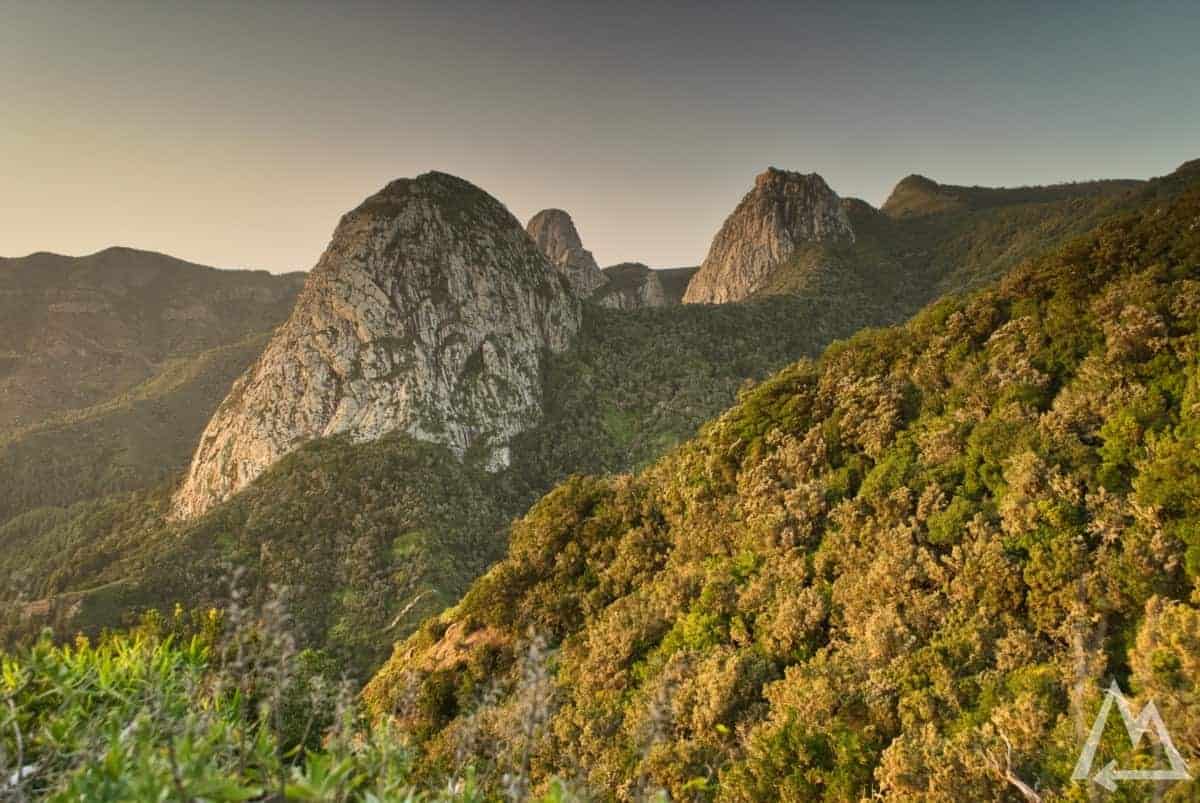
The ferry to La Gomera departed at 4:00 AM from Port of Santa Cruz de La Palma. The ferry ride takes around 2.5 hours, so you’ll arrive on time for some decent sunrise shots. The first and probably the best spot on La Gomera is Roque de Agando.
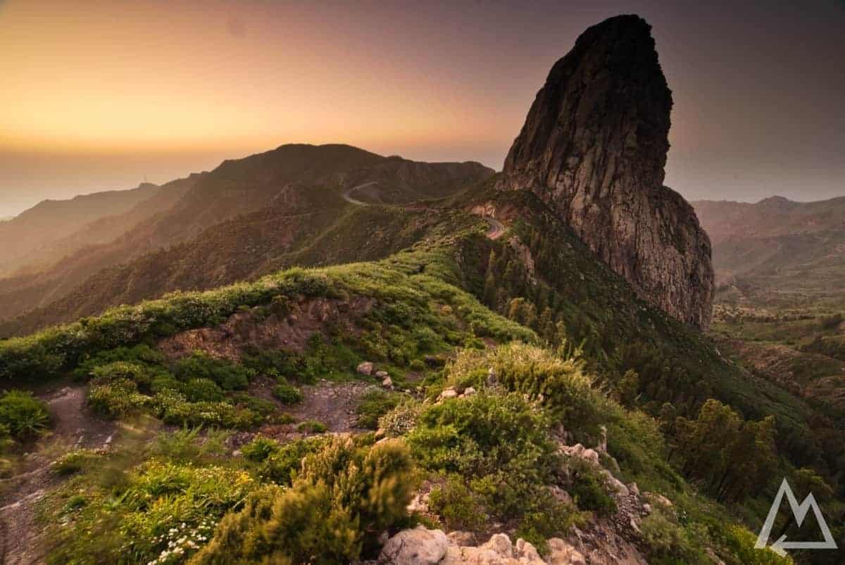
Roque de Agando
Continuing the road further up the hill, you find the parking for Mirador Morro de Agando. After a few hundred meters you’ll pass a wooden bridge and arrive at another great outlook.
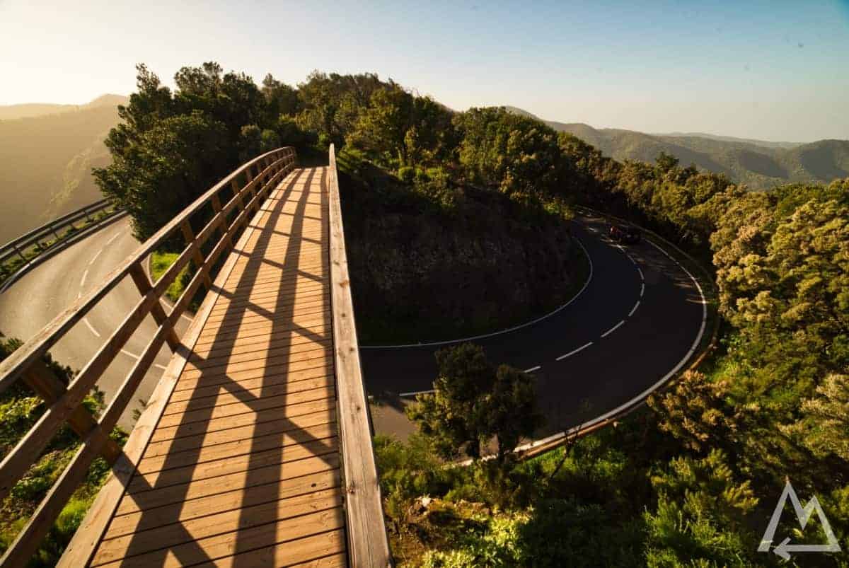
Mirador Morro de Agando
Mirador Morro de Agando
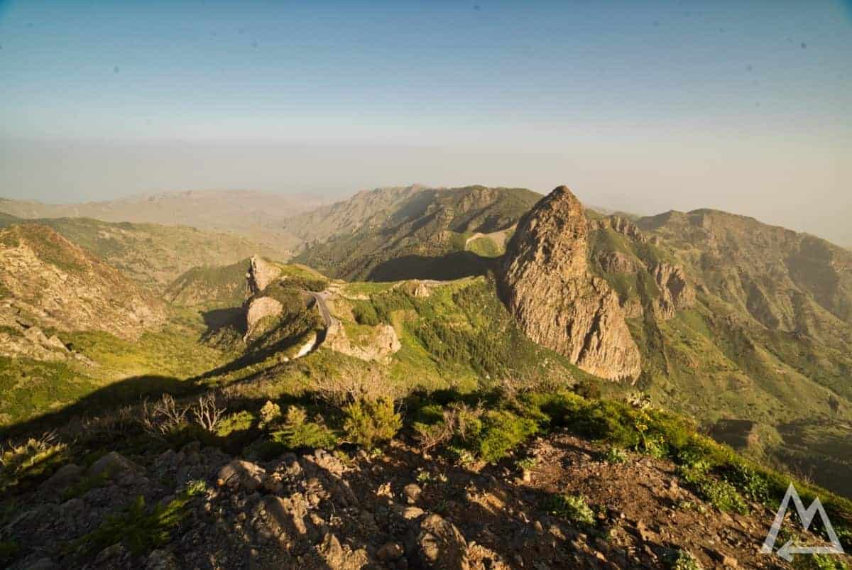
Close to this viewpoint is another great spot to go, called Mirador del Bailadero.
Mirador del Bailadero
Mirador del Bailadero
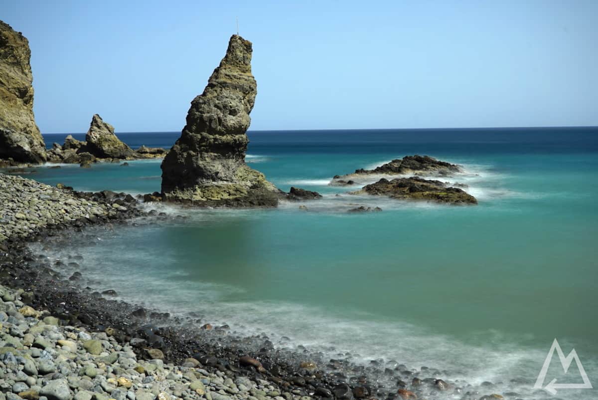
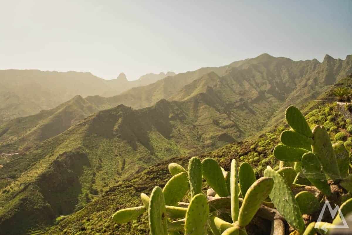
After this comes Valle Gran Rey. From here you can take a whale watching tour or depending on the day you can visit Los Organos, an awesome place with unique hexagonally shaped basalt formation rising up from the ocean, by boat. Heading back up and over the hill down to Vallehermoso.
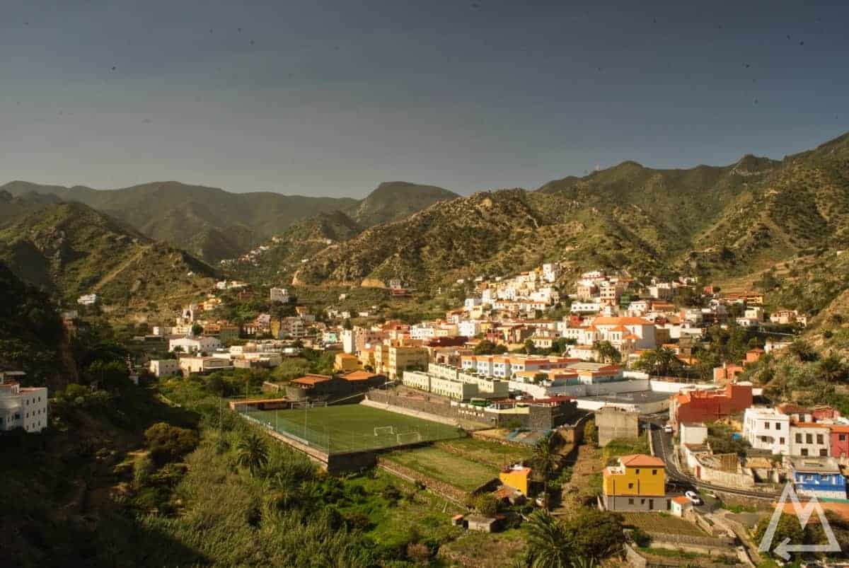
Vallehermoso
You’ll encounter some really cool viewpoints on the way there.
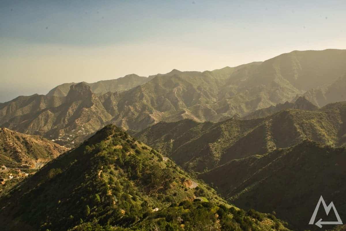
On the way to Vallehermoso
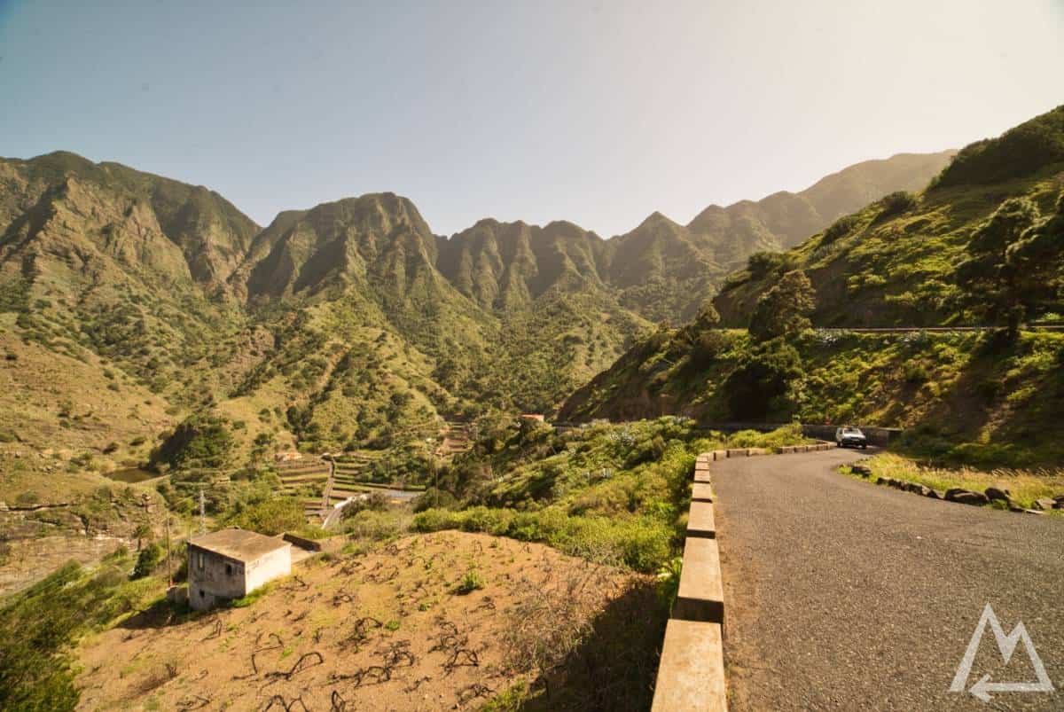
On the way to Agulo the street meanders around the eroded cliffs.
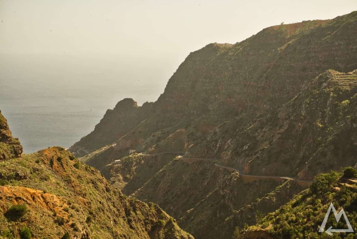
On the way to Agulo
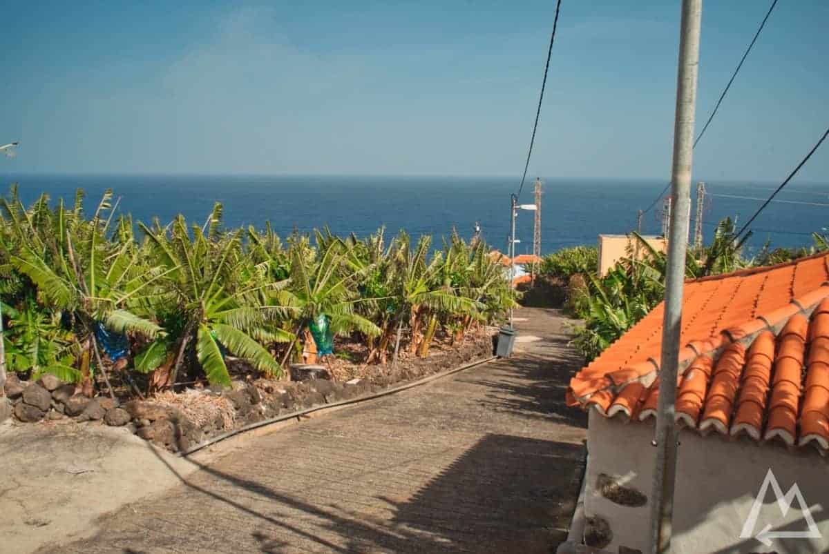
Continuing the road to Mirador de La Punta, a nice outlook on the abundance of banana fields of the island.
Mirador de La Punta

Mirador de la Punta
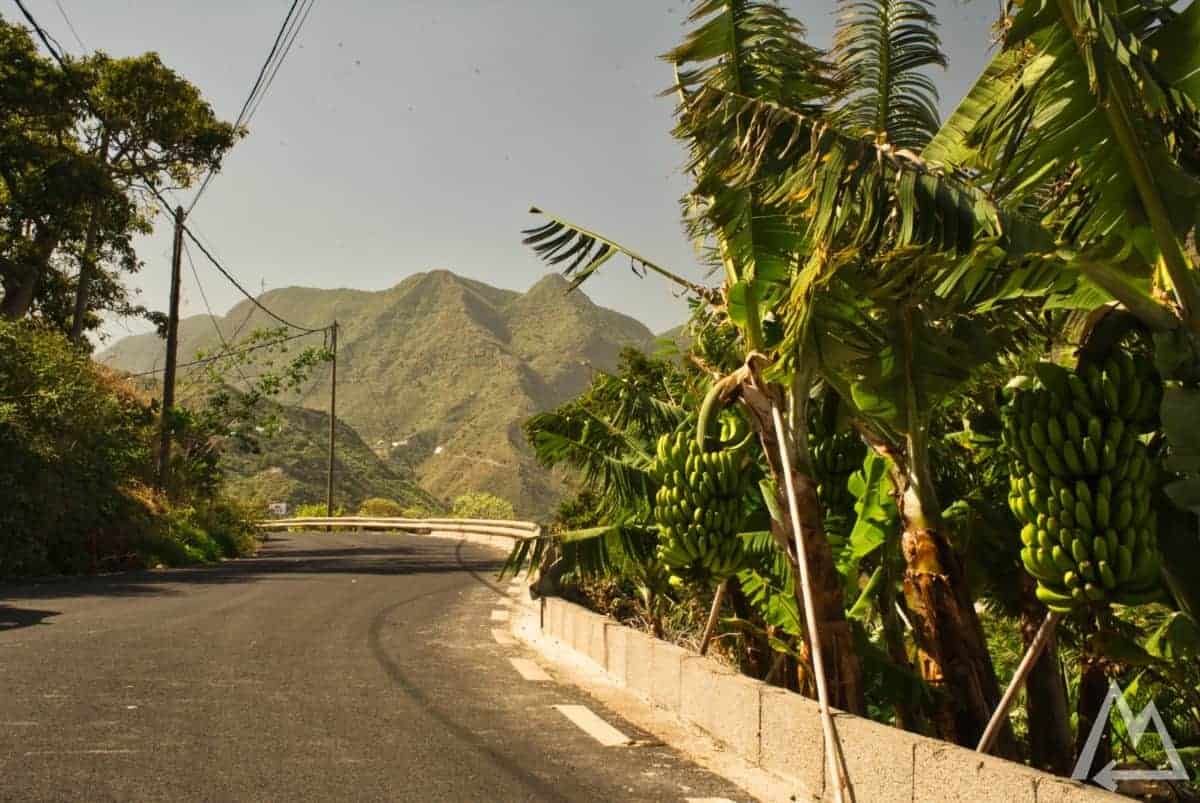
Mirador de La Punta driving north
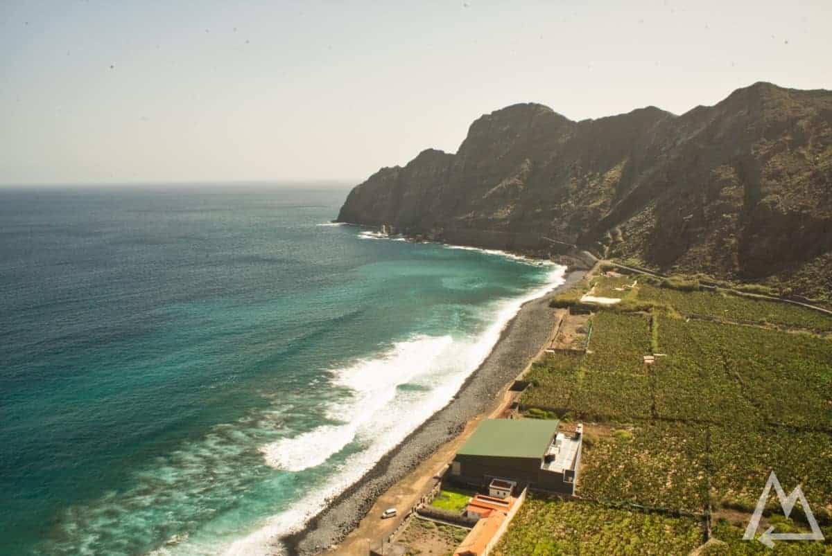
Next place to visit is Playa de la Caleta.
Playa de La Caleta
Continuing driving further up the mountain the scenery gets better and better.
Playa de La Caleta going north
Stop at the place called El Parque Etnográfico de La Gomera and check out the outstanding view on the hill with the two rocks standing out.
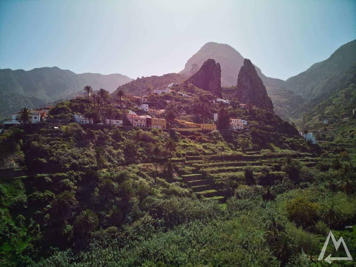
El Parque Etnográfico de La Gomera
Next place to make a stop is Mirador de Manaderos.
Mirador de Manaderos
Last place on La Gomera to visit is Bosque el Cedro. The laurel forest is best visited by foot. We went with the car half way down a stoned road and hiked from there some distance into the forest to Senora de Lourdes, a little chapel with a dwell in a tree.
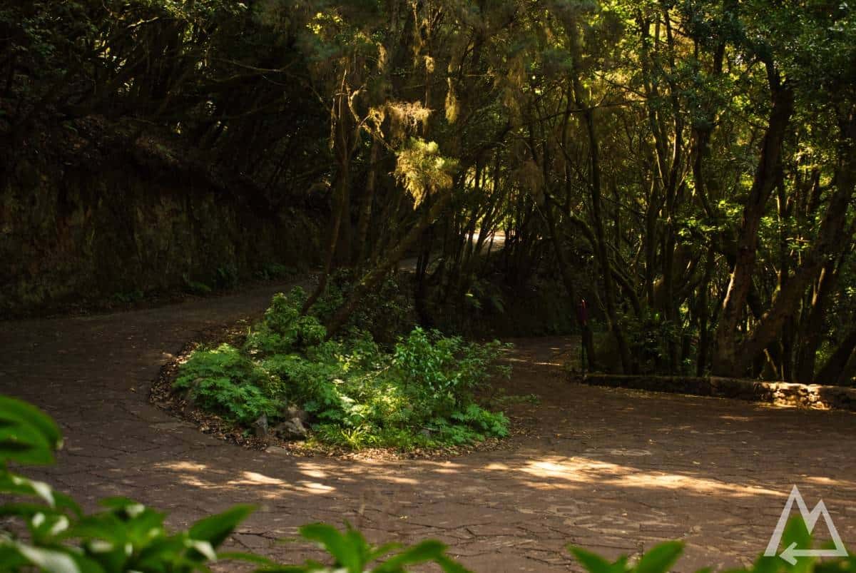
Bosque el Cedro
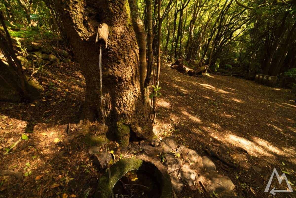
Bosque el Cedro
If there is time left you can head down to Playa de Santiago to play golf or take a swim at one of the beaches.
Day 7:
Another buffer day. We went climbing this time. There is well prepared climbing garden along the riverbed of Barranco del Agua with over 140 routes and walls up to 40 metres.
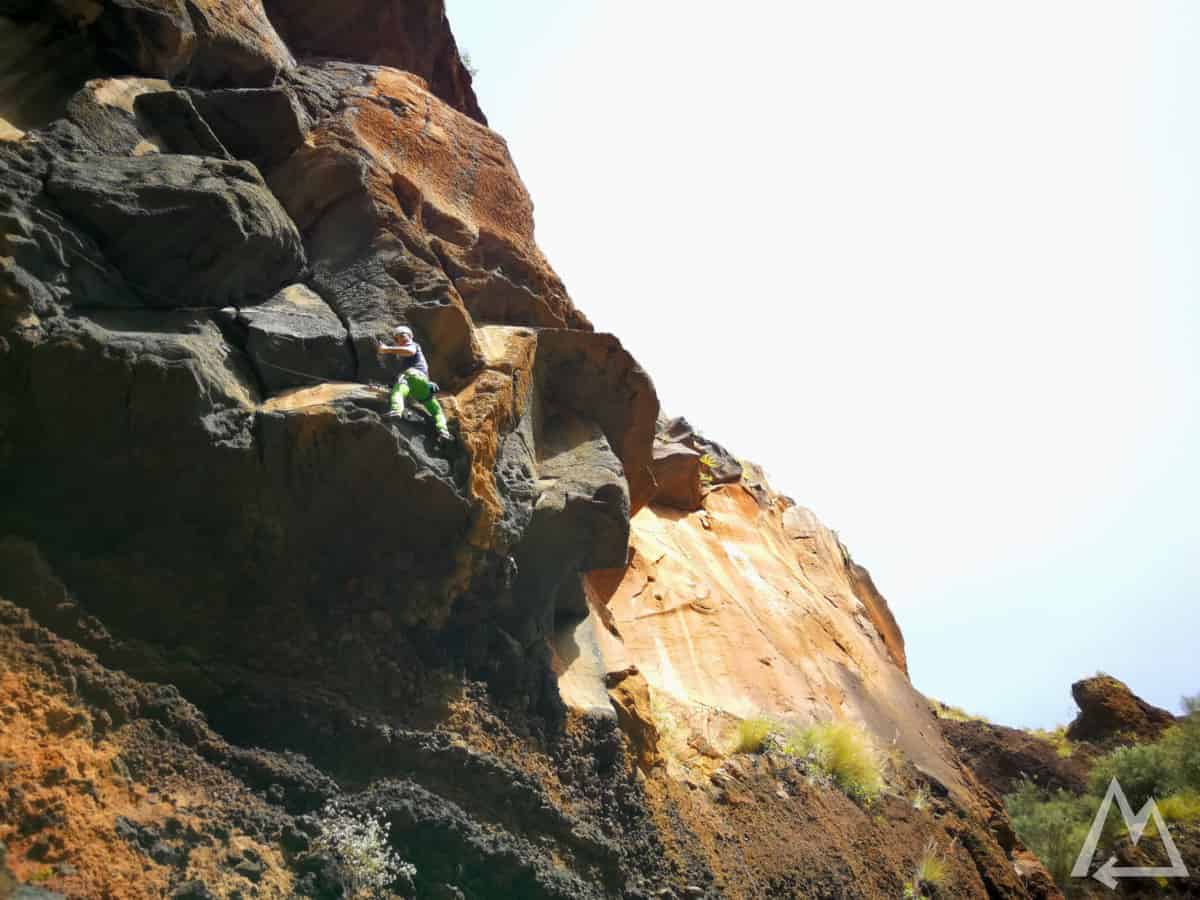
Climbing garden in Barranco del Agua
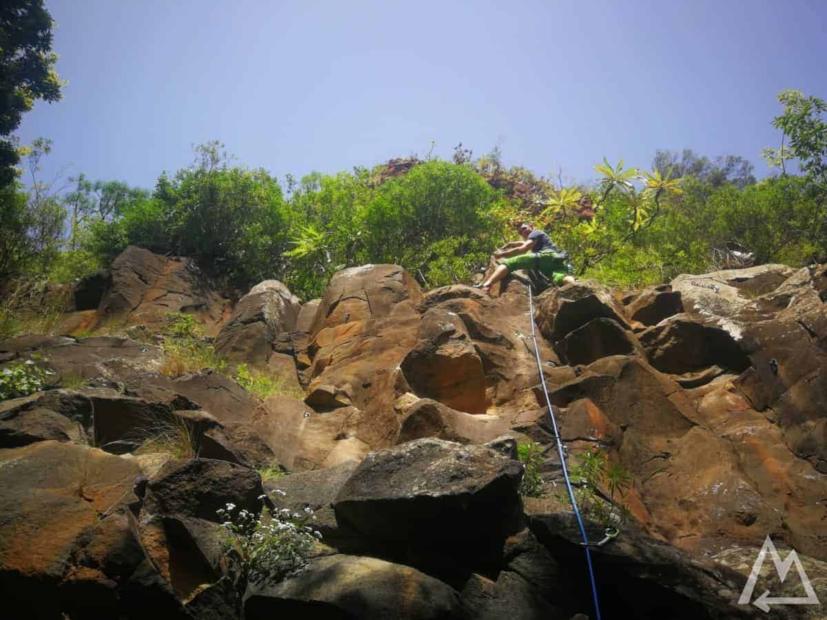
Climbing garden in Barranco del Agua
Click here and sign up to get our new eBook for free.

We hope this post is helpful and inspiring.
Please let us know if anything is missing or misleading.